Estero de San Antonio facts for kids
Quick facts for kids Estero de San Antonio |
|
|---|---|

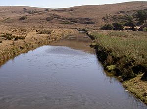
Estero de San Antonio in 2008
|
|
|
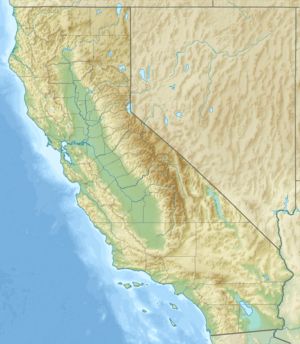
Location of the mouth of Estero de San Antonio in California
|
|
| Other name(s) | San Antonio Creek |
| Country | United States |
| State | California |
| Region | Marin and Sonoma counties |
| Physical characteristics | |
| Main source | 1.5 mi (2.4 km) southwest of Bloomfield, California 400 ft (120 m) 38°18′11″N 122°52′37″W / 38.30306°N 122.87694°W |
| River mouth | Bodega Bay 0 ft (0 m) 38°16′12″N 122°58′46″W / 38.27000°N 122.97944°W |
| Length | 9.5 mi (15.3 km) |
| Basin features | |
| Basin size | 50 sq mi (130 km2) |
| Tributaries |
|
The Estero de San Antonio is a cool stream in northern California. It flows through Marin and Sonoma counties. Finally, it empties into the beautiful Bodega Bay.
Contents
Journey of the Estero de San Antonio
The Estero de San Antonio starts from a spring just north of the border between Marin and Sonoma counties. This spot is on a hill that looks over Bloomfield, California. From there, the stream flows south along Gericke Road and into Marin County.
Just before Fallon-Two Rock Road, the stream turns west. It goes under this road, just east of State Route 1. The Estero then flows south next to the highway for about 0.25 mi (0.4 km).
Meeting Stemple Creek
The Estero then crosses under the highway again. It continues west until it meets Stemple Creek. This meeting point is about 0.3 mi (0.5 km) southeast of Fallon, California. Stemple Creek is the Estero's main branch.
From there, the Estero de San Antonio twists and turns westward. It passes under Middle Road and Valley Ford Franklin School Road. Finally, it flows into Bodega Bay. This is about 1.5 mi (2.4 km) north of Dillon Beach, California.
Nature and Wildlife in the Estero
The Estero de San Antonio is home to many different types of natural areas. These include freshwater ponds, muddy flats, and areas with special grasses like eelgrass and saltgrass. There are also wooded ravines, which are like small, narrow valleys with trees.
It's believed that the Estero has about 923 acres (374 ha) of wetlands connected to it. Wetlands are important areas where land and water meet. They are vital for many plants and animals.
The Sandbar at the Mouth
Sometimes, in the summer or early fall, a sandbar forms at the mouth of the Estero. This sandbar acts like a natural dam, blocking the stream. The water stays blocked until the winter rains arrive and break through the sand. In the past, people living nearby would sometimes break the sandbar on purpose. They did this to help reduce the amount of salt in the Estero's water.
Different Names for the Stream
The Estero de San Antonio has been called by many different names over time. The United States Geological Survey (USGS) lists ten other names for this stream.
Some of these names include:
- Stemple Creek: This is the name of its main branch.
- Estero De Americano: This name is very similar to another stream, Americano Creek, which is about 2 mi (3 km) north.
- Arroyo de San Antonio: This name has also been used for Walker Creek, another stream about 5 mi (8 km) south.
- San Antonio Creek: This is the name of a different creek located further east along the county line.
Because of its main branch, the area around the Estero is often called the Stemple Creek watershed. The stream is also sometimes known as Fallon Creek.
Bridges Crossing the Estero
Several bridges cross over the Estero de San Antonio, helping people travel across the stream.
- The Valley Ford Franklin School Road bridge was built in 1964 and is 242 ft (74 m) long. It is made of concrete.
- The Middle Road bridge was built in 1958 and is 196 ft (60 m) long. It is also made of concrete.
- The State Route 1 bridge is the newest, built in 2001, and is 62 ft (19 m) long. It is also a concrete bridge.
- There is also a concrete tee beam bridge at Fallon-Two Rock Road. This bridge was built in 1932 and is 22 ft (7 m) long.
 | Precious Adams |
 | Lauren Anderson |
 | Janet Collins |


