Stemple Creek facts for kids
Quick facts for kids Stemple Creek |
|
|---|---|

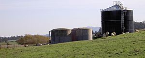
Cattle in a pasture near the headwaters of Stemple Creek
|
|
|
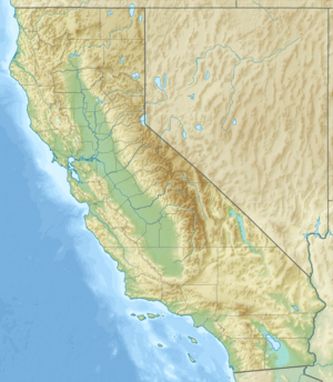
Location of the mouth of Stemple Creek in California
|
|
| Country | United States |
| State | California |
| Region | Sonoma and Marin counties |
| City | Fallon, California |
| Physical characteristics | |
| Main source | 2 mi (3 km) southwest of Cotati, California 38°18′38″N 122°43′51″W / 38.31056°N 122.73083°W |
| River mouth | Estero de San Antonio 13 ft (4.0 m) 38°16′20″N 122°54′7″W / 38.27222°N 122.90194°W |
| Length | 16 mi (26 km) |
Stemple Creek is a 16 mi (26 km) long stream that flows west through parts of Sonoma and Marin counties in California. It eventually joins the Estero de San Antonio, and its water finally reaches Bodega Bay. Bodega Bay is part of the Gulf of the Farallones National Marine Sanctuary in the Pacific Ocean.
Contents
Exploring Stemple Creek's Journey
Stemple Creek begins in the low coastal hills about 2 mi (3 km) southwest of Cotati. It flows under Stony Point Road and travels about 1 mi (1.6 km) southeast before turning to the west. The creek then passes south of Two Rock, California.
Where Does Stemple Creek Flow?
After passing Two Rock, the creek crosses into Marin County, just west of Training Center Petaluma. Stemple Creek winds its way through northern West Marin. Along its path, you can find bridges at Alexander Road, Twin Bridge Road, and State Route 1. The creek meets the Estero de San Antonio just west of State Route 1.
Understanding Water Quality in Stemple Creek
In 1994, California's water quality report said that Stemple Creek was an "impaired" stream. This means its water quality was not as good as it should be. The main reason for this was runoff from nearby pasture lands and feedlots.
What Pollutants Affect Stemple Creek?
Scientists found that certain substances were at unsafe levels in the creek. These included copper, ammonia, and zinc. Efforts are made to keep the water clean and healthy for the environment.
Bridges Crossing Stemple Creek
Many bridges allow people to cross Stemple Creek. You can find bridges at Route One, Pepper Road, Twin Bridge Road, Alexander Road, Tomales Road, Valley Ford Road, and Mecham Road.
Oldest and Newest Bridges
The newest and longest bridge over Stemple Creek was built in 1982. It is a 210 ft (64 m) long concrete slab bridge on State Route 1. The oldest bridge was built in 1915. It is a 39 ft (11.9 m) concrete tee beam bridge that carries Valley Ford Road. This older bridge is about 7.5 mi (12.1 km) from State Route 1.
 | Kyle Baker |
 | Joseph Yoakum |
 | Laura Wheeler Waring |
 | Henry Ossawa Tanner |


