
Bodega Bay facts for kids
|
Bodega Bay
|
|

Location of Bodega Bay and Bodega Harbor
|
|
| Lua error in Module:Location_map at line 420: attempt to index field 'wikibase' (a nil value). | |
| Nearest city | Bodega Bay, California |
|---|---|
| Area | 3,170 acres (1,280 ha) |
| Built | 1811 |
| NRHP reference No. | 73000461 |
Quick facts for kids Significant dates |
|
| Added to NRHP | December 18, 1973 |


Bodega Bay is a shallow, rocky bay on the coast of northern California, USA. It's about 5 miles (8 km) wide. It's located about 40 miles (64 km) northwest of San Francisco. It's also about 20 miles (32 km) west of Santa Rosa. The bay sits between Sonoma County (north) and Marin County (south).
Bodega Bay is a special place for ocean life. People use it for boating, swimming, and surfing, especially near Dillon Beach. It's also important for fishing, both for fun and for business.
At its north end, Bodega Head protects the bay from the big waves of the Pacific Ocean. This headland creates a smaller, calmer area called Bodega Harbor. The famous San Andreas Fault runs through Bodega Head. The town of Bodega Bay is on the east side of Bodega Harbor. To the south, Bodega Bay connects to Tomales Bay.
Some streams flow into Bodega Bay, like the Estero de San Antonio and the Americano Creek. You can visit beaches like Doran Regional Park and Pinnacle Gulch. Most of Bodega Bay is part of the Greater Farallones National Marine Sanctuary. This means it's a protected area for marine animals and plants.
Contents
Exploring Bodega Bay's Past
Coast Miwok Native Americans lived along the shores of Bodega Bay long ago. We know some of their village names, like Helapattai and Tokau. Some people think that Sir Francis Drake might have landed here in the 1500s.
Who First Charted Bodega Bay?
The first person to map this area was a Spanish explorer named Juan Francisco de la Bodega y Quadra in 1775. He named a bay after himself, but it was actually Tomales Bay, not the Bodega Bay we know today. He planned to come back but never did. Later, others tried to set up a colony here, but it didn't work out.
When Did Russians Arrive?
The first Russians came to Bodega Bay in 1807. They were hunting sea otters. In 1809, a Russian explorer named Ivan Kuskov visited. He buried special signs to show that Russia wanted to claim this land. He returned to Alaska with over 2,000 otter furs!
Kuskov came back in 1812. He found fewer otters because many American and English hunters were also in the area. He named the harbor Zaliv Rumyantsev (Rumyantsev Bay) after a Russian minister. This name appeared on early Russian maps.
The Russians decided to build a permanent settlement about 15 miles (24 km) north. This place was called Metini by the native Kashaya Pomo people. This settlement became Fort Ross.
By 1817, there were almost no sea otters left because of too much hunting. Bodega Bay continued to be an important port for the Russian colony until 1842. The first European buildings here were a wharf, warehouse, and barracks built by the Russian-American Company.
What Happened After the Russians Left?
Bodega Bay stayed busy as a port for shipping lumber until the 1870s. Then, a railroad was built inland, so ships were not needed as much.
In the 1950s, a company wanted to build a nuclear power plant here. Many local people were against it. By 1964, the plans for the plant were stopped.
Bodega Bay was also the setting for the famous 1963 Alfred Hitchcock movie The Birds.
In October 2017, Bodega Bay became a safe place for people escaping big wildfires in northern California. Many people from Santa Rosa came here for safety and supplies.
Protected Ocean Areas Near Bodega Bay
Like underwater parks, these special marine protected areas help keep ocean wildlife and ecosystems safe.
- Russian River State Marine Reserve and Russian River State Marine Conservation Area
- Bodega Head State Marine Reserve & Bodega Head State Marine Conservation Area
- Estero Americano State Marine Recreational Management Area
- Estero de San Antonio State Marine Recreational Management Area
Images for kids
-
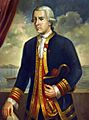
Bodega Bay is named after Juan Francisco de la Bodega y Quadra, who explored the area in 1775.

See also
 In Spanish: Bahía Bodega para niños
