Americano Creek facts for kids
Quick facts for kids Americano Creek |
|
|---|---|

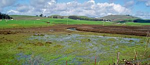
Upper reach of Americano Creek
|
|
|
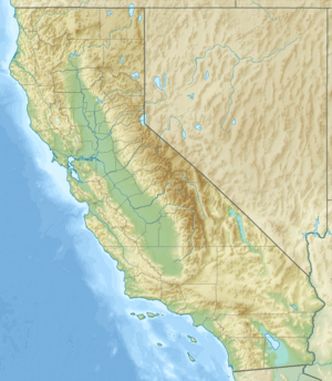
Location of the mouth of Americano Creek in California
|
|
| Other name(s) | Avacha River, Estero Americano |
| Country | United States |
| State | California |
| Region | Sonoma County |
| City | Bloomfield, California |
| Physical characteristics | |
| Main source | 4 mi (6 km) west of Cotati, California 265 ft (81 m) 38°19′18″N 122°46′58″W / 38.32167°N 122.78278°W |
| River mouth | Estero Americano (below) 1 mi (1.6 km) east of Valley Ford, California 20 ft (6.1 m) 38°19′0″N 122°54′0″W / 38.31667°N 122.90000°W |
| Length | 7.5 mi (12.1 km) |
| Estero Americano | |
|---|---|
| Country | United States |
| State | California |
| Region | Sonoma and Marin counties |
| City | Valley Ford, California |
| Physical characteristics | |
| Main source | Americano Creek (above) 1 mi (1.6 km) east of Valley Ford, California 20 ft (6.1 m) 38°19′0″N 122°53′56″W / 38.31667°N 122.89889°W |
| River mouth | Bodega Bay 3 mi (5 km) southeast of Bodega Bay, California 0 ft (0 m) 38°17′44″N 123°0′9″W / 38.29556°N 123.00250°W |
| Length | 9.2 mi (14.8 km) |
| Basin features | |
| Basin size | 49 sq mi (130 km2) |
| Tributaries |
|
Americano Creek is a stream about 7.5 miles (12.1 km) long in Sonoma and Marin counties, California. It flows into the Estero Americano, which is a 9.2-mile (14.8 km) long estuary. An estuary is a place where a river meets the sea. From there, the water flows into the Pacific Ocean. This article tells you about both of these water bodies.
Contents
The Journey of Americano Creek and Estero Americano
Americano Creek starts in low hills about 4 miles (6.4 km) west of Cotati. It flows west, following Roblar Road. Along its path, it goes past a closed landfill and crosses Valley Ford Road.
At Valley Ford Road, the creek gets deeper. In winter, when there's more water, you can even go kayaking there! People can get their kayaks into the water from a dirt road near Marsh Road.
Further west, the creek flows past the town of Bloomfield. It then goes under State Route 1, also called "Highway 1." At this point, the creek forms the border between Sonoma and Marin counties.
Just after Highway 1, the creek's name changes to Estero Americano. It winds its way past the town of Valley Ford. The last bridge over the estero is at Valley Ford-Franklin School Road. Soon after, Ebabias Creek joins it from the north.
The last 6 miles (9.7 km) of the estero are hard to reach by road. You can't really see them from public roads. The estero continues to mark the county line until it reaches the coast. It empties into Bodega Bay, about 4 miles (6.4 km) southeast of the town of Bodega Bay. Its mouth is near the northern part of the Gulf of the Farallones National Marine Sanctuary. This sanctuary is a special protected area in the ocean.
What Affects the Environment?
In 1994, California said that Americano Creek and most of Estero Americano were "impaired." This means their water quality wasn't very good. This was because of runoff from farms, especially from areas where animals like cattle are kept.
For example, in 1987, a single gully near Americano Creek released a lot of dirt and mud. This caused flooding in nearby towns. It also made the creek too shallow for boats. Harmful things found in the creek have included bacteria from animal waste, copper, ammonia, and zinc.
The area where Americano Creek starts is a historic home for some very rare and endangered species. These include plants like Sebastopol meadowfoam and Pitkin Marsh lily. There's also a closed landfill in this area.
Americano Creek often dries up for 4 to 6 months each year. For its first 8 miles (12.9 km), the stream flows through a wide valley. This valley is mostly used for farming, especially for raising cattle. The ground in the valley is flat and wide. Because of all the dirt and mud in the water, you can barely see any rocks in the streambed.
Cattle often walk right in the streambed, which puts harmful things directly into the water. During the rainy season (November to April), parts of this area become a big marsh. Sadly, most of the natural wetland plants have been destroyed by the constant grazing.
The lower part of Americano Creek is also surrounded by farms. However, the creek channel is better separated from the grazing areas here. The estero itself is a special protected area.
The amount of water flowing in the creek changes a lot with the seasons. The most water flows during the rainy winter months. Tests of Americano Creek and Estero usually show pH (acidity) levels that are healthy for the water.
Sometimes, a sand bar forms at the mouth of the estero. This can block the ocean tides from coming in. Other times, the tides can reach up to 4 miles (6.4 km) upstream. High levels of salt have been found in the estero's water.
The Estero Americano is protected by the Estero Americano State Marine Recreational Management Area. This area is like an underwater park. It helps protect ocean animals and their homes.
A Look Back in History
Long ago, two permanent Coast Miwok villages were located on the Estero Americano. One was called Uli-yomi at the start of the estero. The other was named Awachi at its mouth.
The earliest Spanish maps show the creek and its estuary as Estero Americano. When the Russians had a colony at Fort Ross, Americano Creek was known as the Avacha River. To challenge the Russian settlement, General Vallejo sent three "Americanos" to settle near Bodega Bay. These men were Edward McIntosh, James Black, and James Dawson. They came to California as sailors. Black settled on land now called Rancho Cañada de Jonive. Dawson and McIntosh settled on Rancho Estero Americano.
Ebabias Creek, which flows into the estero, was shown on a map from 1844.
Bridges Crossing the Water
Several Bridges cross Americano Creek and Estero Americano.
Americano Creek has bridges at Gericke Road, Roblar Road, and Valley Ford Road. The bridge at Valley Ford Road was built in 1985 and is 73 feet (22.3 m) long. The Roblar Road bridge, built in 1964, is a 27-foot (8.2 m) long concrete pipe. The Gericke Road bridge, built in 1972, is 107 feet (32.6 m) long.
The Estero Americano is crossed by bridges at Valley Ford-Franklin School Road, Highway One, and Slaughter House Road. All these bridges are made of concrete. The State Route 1 bridge was built in 1925 and is 144 feet (43.9 m) long. The Valley Ford-Franklin School bridge, built in 1961, is 198 feet (60.4 m) long. The Slaughter House Road bridge, built in 1990, is 75 feet (22.9 m) long.
 | Emma Amos |
 | Edward Mitchell Bannister |
 | Larry D. Alexander |
 | Ernie Barnes |


