Farallon de Medinilla facts for kids

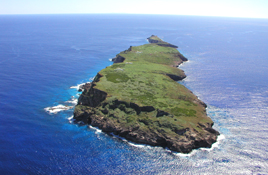
NOAA photo of Farallon de Medinilla
|
|
 |
|
| Geography | |
|---|---|
| Location | Pacific Ocean |
| Coordinates | 16°1′2″N 146°3′31″E / 16.01722°N 146.05861°E |
| Archipelago | Northern Mariana Islands |
| Area | 0.35 sq mi (0.91 km2) |
| Length | 2.8 km (1.74 mi) |
| Width | 0.5 km (0.31 mi) |
| Highest elevation | 81 m (266 ft) |
| Administration | |
|
United States
|
|
| Commonwealth | Northern Mariana Islands |
| Demographics | |
| Population | - uninhabited - (2010) |
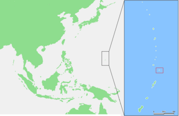
Farallon de Medinilla is a small, empty island in the Northern Mariana Islands. These islands are located in the huge Pacific Ocean.
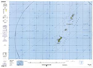
This island is about 45 nautical miles (83 km) north of Saipan. It is the smallest island in the Northern Mariana Islands chain. Farallon de Medinilla is part of the Northern Islands Municipality.
Contents
Island History
Farallon de Medinilla was first found by Europeans in October 1543. A Spanish explorer named Bernardo de la Torre discovered it. He was on a ship called San Juan de Letrán.
Even though no one lived there when he found it, old pottery and blackened caves show that Chamorro people lived there a long time ago.
In 1819, a person named Louis de Freycinet visited the island. He named it after Don Jose de Medinilla y Pifieda. This person was the Spanish Governor of the Marianas from 1812 to 1822.
Changing Control of the Island
In 1899, Spain sold the Northern Marianas to the German Empire. Farallon de Medinilla then became part of German New Guinea.
During World War I, Japan took control of the island. It was then managed as part of the South Seas Mandate.
After World War II, the United States took over the island. It was part of the Trust Territory of the Pacific Islands. Since 1978, the island has been part of the Northern Mariana Islands. It is now a commonwealth of the United States.
Military Use and Wildlife Protection
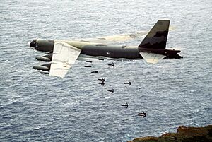
For many years, the United States Navy used Farallon de Medinilla for military training. This included bombing exercises.
In 2002, a group called the Center for Biological Diversity sued the Navy. They said the military exercises were harming the island's wildlife.
A court then ordered the United States Department of Defense to stop bombing. They had to follow rules to protect migratory birds. This rule is called the Migratory Bird Treaty Act.
Military activities have caused problems for animals and plants. This includes land animals and sea creatures. Some affected animals are Micronesian megapodes and many types of migratory birds. These birds include boobies, terns, and frigatebirds. Sea animals like humpback whales and false killer whales were also impacted.
Island Geography
Farallon de Medinilla looks a bit like a wedge. It is about 2.8 kilometers (1.7 miles) long.
The island is narrow at the south, about 150 meters (490 feet) wide. It gets wider in the north, reaching about 530 meters (1,740 feet). The total area is about 0.845 square kilometers (0.326 sq mi). At its narrowest point, the island is only 20 meters (66 feet) wide.
The highest point on the island is 81 meters (266 feet) tall.
The edges of the island have cliffs with caves. The flat top part of the island has some bushes and savanna grass.
If you look at satellite pictures (like on Google Earth), you can see some strange shapes. There are three X-shapes and one Y-shape in the northern part of the island. These shapes are made from metal shipping containers. The U.S. Navy left them there to practice hitting targets with bombs.
See also
 In Spanish: Farallón de Medinilla para niños
 | William Lucy |
 | Charles Hayes |
 | Cleveland Robinson |


