Farleigh, Surrey facts for kids
Quick facts for kids Farleigh |
|
|---|---|
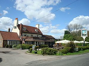 The Harrow Inn, Old Farleigh Road |
|
| OS grid reference | TQ372602 |
| Civil parish |
|
| District |
|
| Shire county | |
| Region | |
| Country | England |
| Sovereign state | United Kingdom |
| Post town | WARLINGHAM |
| Postcode district | CR6 |
| Dialling code | 01883 |
| Police | Surrey |
| Fire | Surrey |
| Ambulance | South East Coast |
| EU Parliament | South East England |
| UK Parliament |
|
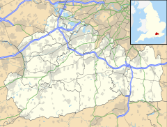
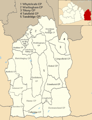
Farleigh is a small village in Surrey, England. It's part of the Chelsham and Farleigh parish, located in the Tandridge area. Farleigh is special because it sits within the beautiful North Downs Area of Outstanding Natural Beauty (AONB) and the Metropolitan Green Belt. This means it's a protected area with lovely countryside.
The village is about 4.5 miles (7.2 km) south-east of Croydon and 13.4 miles (21.6 km) south of London. It's also about 25 miles (40 km) west-north-east of Guildford, which is Surrey's main town.
Contents
Farleigh's Past: A Look Back in Time
Early Days of Farleigh
Farleigh has a long history, dating back to Anglo-Saxon times. It was part of an old land division called Tandridge hundred.
The village is even mentioned in the famous Domesday Book from 1086. Back then, it was known as Ferlega. It was a small manor, meaning a large estate with a lord and workers. The Domesday Book tells us it had a small amount of land for farming and was worth £3 a year to its owners.
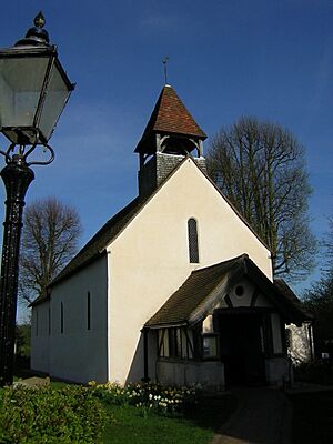
The first stone church in Farleigh, St Mary's Church, was likely built around the late 1000s. You can still see parts of this old style in its western doorway. The church today is made from local flints and has its original rough plaster on the outside.
In the 1200s, a man named Walter de Merton owned the manor. He later founded Merton College, Oxford, a famous university college. He gave his Farleigh property to the college.
Farleigh After the Industrial Revolution
By 1848, Farleigh covered about 1,060 acres (4.3 sq km). Most of this land was used for growing crops (arable land) or was covered in trees (woodland). There was also some pasture for animals. These land uses haven't changed much even today.
Merton College, Oxford continued to own the manor of Farleigh well into the 1900s, showing its long connection to the village.
In 1965, Farleigh stopped being its own separate parish. For a few years, it became part of the London Borough of Croydon.
Farleigh's Location and Landscape
Farleigh is the northern part of the Chelsham and Farleigh civil parish. Both villages are located on the North Downs, which is a beautiful area. As mentioned, it's an AONB and part of the Green Belt. This means the area is protected to keep its natural beauty and open spaces.
The combined population of Chelsham and Farleigh was 356 people in 2001.
Hills, Soil, and Views
Farleigh is located on high ground. This means it offers amazing views that stretch for a long distance, even over parts of London. The area has many trees, and the soil is best for grazing animals.
The land in Farleigh is quite hilly. The highest points are around 191 meters (627 feet) above sea level. The lowest points are in deep valleys, around 126 meters (413 feet) high. The highest point of the entire North Downs is Botley Hill, which is just a short distance south of Farleigh.
Nearby Areas
Fickleshole Hamlet
About 1 mile (1.6 km) east of Farleigh is a small hamlet called Fickleshole. A hamlet is a very small settlement, even smaller than a village.
Fickleshole is mostly used for farming. It has stables that are home to many horses. This hamlet has been around since the early 1500s. The roads leading to Fickleshole are very narrow, just like the old paths used by horses and carts. They are not really suitable for large trucks. A well-known spot in Fickleshole is The White Bear public house, which has a cool white bear sculpture outside.
Important Places in Farleigh
St Mary's Church
St Mary's Church is a very old and important building in Farleigh. It's so important that it's listed as a Grade I building, meaning it has special historical or architectural interest. Its history goes back to the 11th century, as mentioned earlier.
Farleigh Rovers F.C.
If you like football, you might be interested to know about Farleigh Rovers F.C.. This football club was started in 1922. They play their home games at Parsonage Field in Warlingham, which is nearby. In the 2021/22 season, their main team played in the Surrey Premier County Football League.
 | Percy Lavon Julian |
 | Katherine Johnson |
 | George Washington Carver |
 | Annie Easley |


