
Ferryville, Wisconsin facts for kids
Quick facts for kids
Ferryville, Wisconsin
|
|
|---|---|
|
Village
|
|

Between the Driftless Area bluffs and the Upper Mississippi
|
|

Location of Ferryville in Crawford County, Wisconsin.
|
|
| Country | |
| State | |
| County | Crawford |
| Area | |
| • Total | 1.99 sq mi (5.15 km2) |
| • Land | 1.97 sq mi (5.10 km2) |
| • Water | 0.02 sq mi (0.05 km2) |
| Elevation | 646 ft (197 m) |
| Population
(2020)
|
|
| • Total | 191 |
| • Density | 96.0/sq mi (37.09/km2) |
| Time zone | UTC-6 (Central (CST)) |
| • Summer (DST) | UTC-5 (CDT) |
| Area code(s) | 608 |
| FIPS code | 55-25725 |
| GNIS feature ID | 1564924 |
Ferryville is a small village located in Crawford County, Wisconsin, in the United States. It sits right along the beautiful Upper Mississippi River and is part of the scenic Great River Road. In 2020, about 191 people called Ferryville home. It's known for its location between the tall bluffs of the Driftless Area and the wide river.
Contents
Geography of Ferryville
Ferryville is located at coordinates 43.341550 degrees North and -91.083882 degrees West.
The village covers a total area of about 5.15 square kilometers (1.99 square miles). Most of this area is land, about 5.10 square kilometers (1.97 square miles). A very small part, about 0.05 square kilometers (0.02 square miles), is water. The village is nestled in a unique part of Wisconsin, known as the Driftless Area. This means the land was not flattened by glaciers during the last Ice Age, resulting in many hills and valleys called coulees.
Population and People
| Historical population | |||
|---|---|---|---|
| Census | Pop. | %± | |
| 1920 | 203 | — | |
| 1930 | 266 | 31.0% | |
| 1940 | 306 | 15.0% | |
| 1950 | 216 | −29.4% | |
| 1960 | 194 | −10.2% | |
| 1970 | 183 | −5.7% | |
| 1980 | 227 | 24.0% | |
| 1990 | 154 | −32.2% | |
| 2000 | 174 | 13.0% | |
| 2010 | 176 | 1.1% | |
| 2020 | 191 | 8.5% | |
| U.S. Decennial Census | |||
The population of Ferryville has changed over the years, as shown in the table above.
2010 Census Information
According to the census from 2010, there were 176 people living in Ferryville. These people lived in 94 households, and 59 of these were families. The village had about 89.3 people per square mile. There were also 165 housing units, which are places where people can live.
Most of the people in the village (98.3%) were White. A small number (0.6%) were from other races, and 1.1% were from two or more races. About 2.3% of the population identified as Hispanic or Latino.
In terms of households, 16% had children under 18 living there. Nearly half (48.9%) were married couples living together. About 33% of all households were made up of individuals living alone. Many residents were older, with 16% of households having someone 65 years or older living by themselves. The average household had 1.87 people, and the average family had 2.32 people.
The average age of people in Ferryville in 2010 was 60.5 years. About 13.6% of residents were under 18. A large portion, 36.9%, were 65 years old or older. The village had slightly more females (52.8%) than males (47.2%).
Education in Ferryville
Students in Ferryville attend schools that are part of the De Soto Area Schools district.
Transportation Options
Bus service is available in Ferryville. You can take a bus towards La Crosse or Prairie du Chien. This service is provided three times a day in each direction by Scenic Mississippi Regional Transit.
Famous People from Ferryville
- John A. Haggerty: He was a legislator (someone who makes laws) and a businessman in Wisconsin. He lived in Ferryville.
- Patrick Lucey: He served as the Governor of Wisconsin. Before that, he was a justice of the peace in Ferryville, which means he helped with local legal matters.
Images for kids
-
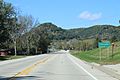
Population sign
-
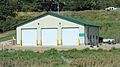
Public Works building


See also
 In Spanish: Ferryville (Wisconsin) para niños
