
Fine, New York facts for kids
Quick facts for kids
Fine, New York
|
|
|---|---|

SUNY-ESF Ranger School at Wanakena
|
|

Map highlighting Fine's location within St. Lawrence County.
|
|

Fine, New York
Location in New York Adirondack Park
|
|
| Country | United States |
| State | New York |
| County | St. Lawrence |
| Area | |
| • Total | 169.42 sq mi (438.79 km2) |
| • Land | 166.65 sq mi (431.61 km2) |
| • Water | 2.77 sq mi (7.18 km2) |
| Elevation | 1,549 ft (472 m) |
| Population
(2020)
|
|
| • Total | 1,304 |
| • Density | 8.83/sq mi (3.41/km2) |
| Time zone | UTC-5 (Eastern (EST)) |
| • Summer (DST) | UTC-4 (EDT) |
| FIPS code | 36-25791 |
| GNIS feature ID | 0978957 |
Fine is a small town located in St. Lawrence County, New York, in the United States. In 2020, about 1,304 people lived there. The town is named after Judge John Fine, a businessman who helped settle the area.
The Town of Fine is in the southern part of St. Lawrence County, south of Canton. You can find the SUNY-ESF Ranger School and the Griffin Memorial Forest in the eastern part of Fine.
Contents
History of Fine
The first attempts to settle Fine began in 1823. A man named Elias Teall tried to bring settlers and built a mill, but his plan didn't work out.
Later, in 1828, James C. Haile made another attempt. He built a sawmill and a small grist mill on the Oswegatchie River. He also encouraged more people to move there. However, he left the town in 1833.
In 1834, Arnasa I. Brown took over. He moved his family to Fine, even though his closest neighbors were ten miles away! A few other families joined him. By 1843, there were enough people to have about 43 or 44 voters.
The small community of Fine is located on the east branch of the Oswegatchie River. It was once known as "Smithville" after an early resident named William P. Smith.
The Town of Fine was officially formed in 1849. It was created from parts of the nearby Towns of Pierrepont and Russell. The Fine Town Hall is an important building. It was added to the National Register of Historic Places in 1996.
Geography and Nature
Fine is a large town, covering about 169.4 square miles (438.79 square kilometers). Most of this area is land, with a small part being water.
The town is located inside the beautiful Adirondack Park. This park is a huge protected area known for its forests, mountains, and lakes.
The southern border of Fine touches Lewis and Herkimer counties.
Two main roads cross through the town: New York State Route 3 runs east to west, and New York State Route 58 meets NY-3 near the village of Fine.
The east branch of the Oswegatchie River flows through Fine. It starts at Cranberry Lake and moves northwest.
Population Facts
| Historical population | |||
|---|---|---|---|
| Census | Pop. | %± | |
| 1850 | 293 | — | |
| 1860 | 519 | 77.1% | |
| 1870 | 603 | 16.2% | |
| 1880 | 893 | 48.1% | |
| 1890 | 1,207 | 35.2% | |
| 1900 | 1,694 | 40.3% | |
| 1910 | 2,234 | 31.9% | |
| 1920 | 1,459 | −34.7% | |
| 1930 | 1,053 | −27.8% | |
| 1940 | 1,208 | 14.7% | |
| 1950 | 1,875 | 55.2% | |
| 1960 | 2,391 | 27.5% | |
| 1970 | 2,302 | −3.7% | |
| 1980 | 2,243 | −2.6% | |
| 1990 | 1,813 | −19.2% | |
| 2000 | 1,622 | −10.5% | |
| 2010 | 1,512 | −6.8% | |
| 2020 | 1,304 | −13.8% | |
In 2000, there were 1,622 people living in Fine. These people made up 667 households and 452 families. The average household had about 2.36 people, and the average family had about 2.83 people.
The population was spread out in terms of age:
- About 21.1% were under 18 years old.
- About 8.2% were between 18 and 24.
- About 26.0% were between 25 and 44.
- About 27.7% were between 45 and 64.
- About 17.0% were 65 years or older.
The median age in the town was 42 years old. This means half the people were younger than 42, and half were older.
Communities and Places in Fine
Here are some of the smaller communities and important locations you can find in the Town of Fine:
- Aldrich – A small community located south of Coffin Mills.
- Briggs – Another small community found near the western edge of the town.
- Coffins Mills – A community southwest of Oswegatchie village.
- Fine – This is the main community, also called a hamlet, in the northern part of the town. It's by the east branch of the Oswegatchie River. It was once known by other names like "Smithville" and "Andersonville."
- Flat Rock Reservoir – A reservoir (a large artificial lake) located north of Lower Oswegatchie.
- Inlet – A specific location found west of Wanakena.
- Jayville – A community at the western town line, west of Briggs.
- Long Lake – A lake located on the southern border of the town. It's east of Round Lake.
- Lower Oswegatchie – A community on NY-3, in the eastern part of the town. It's north of Oswegatchie village.
- Oswegatchie – A community on NY-3, also in the eastern part of the town. This area became important because of the railroad.
- Otter Pond – A lake located southeast of Star Lake.
- Round Lake – A lake located near the southern town line.
- Star Lake – A lake in the eastern part of the town.
- Star Lake – A community located on the eastern town line, east of Star Lake (the lake) on NY-3. Most of this community is actually in the Town of Clifton. The Clifton-Fine Central School District is also located here.
- Streeter Lake – A small lake located southeast of Star Lake.
- Sucker Lake – A lake located east of Coffins Mills.
- Wanakena – A community located on County Road 61. It's on an arm of Cranberry Lake in the southeastern part of the town. This is where the SUNY-ESF Ranger School is located.
Images for kids
-
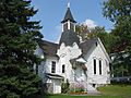
Western Adirondack Presbyterian Church in Wanakena

See also
 In Spanish: Fine (Nueva York) para niños
