Fishing River facts for kids
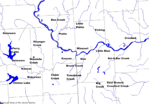
The Fishing River is a river in western Missouri, United States. It is about 39 miles (63 km) long. This river flows into the much larger Missouri River. It starts near Kansas City in Clay County. Then it flows east and southeast through Clay and Ray counties. It passes by the town of Mosby. Finally, it joins the Missouri River near Orrick.
A smaller river, called the East Fork Fishing River, flows into the Fishing River. This fork starts near Lawson. It flows south for about 20.6 miles (33 km). It passes through places like Crystal Lake and Excelsior Springs.
The river got its name because it used to have lots of fish! People could easily catch fish there.
In 1808, a famous explorer named William Clark built Fort Osage. Clark was part of the Lewis and Clark Expedition. This fort was built near where the Fishing River meets the Missouri River. Fort Osage became an important place. It was a trading center for European settlers and Native American tribes.
Where is the Fishing River Located?
The Fishing River is found in western Missouri. It flows through Clay County and Ray County.
Where Does the Fishing River Start?
The Fishing River begins in Clay County, Missouri. This is its source.
- Source: Clay County, Missouri: 39°18′53″N 94°29′45″W / 39.31472°N 94.49579°W
Where Does the Fishing River End?
The Fishing River ends when it joins the Missouri River. This meeting point is called its mouth. It is located in Ray County, Missouri.
- Mouth: Confluence with the Missouri River in Ray County, Missouri: 39°10′31″N 94°08′27″W / 39.17528°N 94.14078°W
 | Tommie Smith |
 | Simone Manuel |
 | Shani Davis |
 | Simone Biles |
 | Alice Coachman |


