Flinders Bay facts for kids
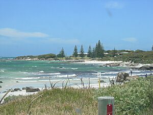
Flinders Bay is a beautiful bay located right next to the town of Augusta in Western Australia. It's also very close to where the Blackwood River meets the ocean.
This bay is found northeast of Cape Leeuwin, which is the most south-westerly point of mainland Australia. It's a significant spot with a rich history and interesting features.
Contents
Discovering Flinders Bay
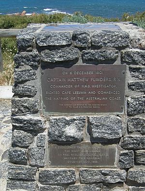
A famous explorer named Matthew Flinders first mapped this area between 1801 and 1803. On his maps, he originally called it Dangerous Bight.
Flinders Bay stretches for about 8 kilometers (5 miles). It runs from Point Matthew, which is near Cape Leeuwin, all the way east to Ledge Point. Matthew Flinders himself visited the bay on December 7, 1801. Later, in 1829 or 1830, it was officially named Flinders Bay by either James Stirling or Septimus Roe.
Flinders Bay: A Hub for Trade
The Flinders Bay area was once a small settlement. It was a busy place for whaling and fishing. It also became the end point for the Busselton to Flinders Bay Branch Railway line, which operated from the 1920s until 1957.
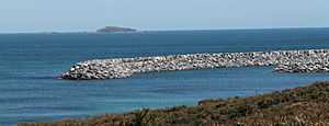
The area is also known for its jetties, sometimes called the Barrack Point Jetties. In the 1800s, this port was even known as Port Augusta, Flinders Bay.
Flinders Bay Settlement
In the past, the settlement of Flinders Bay was seen as a separate place from Augusta. However, today it's mostly considered the southern part of the larger Augusta community. This small area used to have its own Post Office, a general store, and the railway station.
Augusta Boat Harbour
Over the years, there was a growing need for a safe place for boats. This included boats used by whale watchers and local fishermen. In 2004, a plan for a marina was suggested near the old Flinders Bay settlement.
However, a new plan in 2005 moved the marina to a different bay closer to Cape Leeuwin. This new boat harbor, located at Flat Rock, is now complete. It is officially called the "Augusta Boat Harbour" by the Department of Transport.
Whaling History
The landing area next to the old railway station was historically known as "The Whaling." This was the main spot where boats operated for whaling in the 1800s and early 1900s. Sheds and ramps from these operations were still visible until the early 1970s.
More recently, in the late 20th century, this area was used for whale rescue operations. Today, businesses that offer whale watching tours also use the bay.
Islands and Reefs
The St Alouarn Islands are a group of islands that stretch out south of Point Matthew, on the way to Cape Leeuwin. These islands, along with various reefs, act as natural barriers. They protect the outer parts of Flinders Bay to the south.
Climate in Flinders Bay
Flinders Bay has a cool-summer Mediterranean climate. This means it has mild to warm summers and mild, wet winters. This type of climate is common in many coastal areas of southwestern Western Australia.
Abalone Sea Ranch
After successful tests in 2012, a special "sea ranch" was started in Flinders Bay in 2016. This ranch is the first of its kind in the world. Its purpose is to raise abalone, which are a type of sea snail.
The ranch uses an artificial reef made of 5,000 concrete units. These units are called abitats, short for abalone habitats. Each habitat weighs about 900 kilograms (nearly 2,000 pounds) and can hold 400 abalone. Young abalone from an onshore hatchery are placed onto this reef.
The abalone eat seaweed that grows naturally on the habitats. This unique setup also helps the bay's ecosystem. It has led to more dhufish, pink snapper, wrasse, samson fish, and other marine species. The company running the ranch emphasizes that their abalone are very similar to wild abalone. They explain, "We're not aquaculture, we're ranching, because once they're in the water they look after themselves."
See also
 In Spanish: Bahía Flinders para niños
 | Emma Amos |
 | Edward Mitchell Bannister |
 | Larry D. Alexander |
 | Ernie Barnes |


