Fort Adams, Mississippi facts for kids
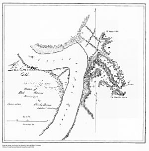
Fort Adams is a small town located by a river in Wilkinson County, Mississippi. It's about 40 miles (64 km) south of Natchez. This place was once very important because it was the main entry point into the U.S. along the Mississippi River. This was before the U.S. gained control of New Orleans. It was also the site of an early fort named Fort Adams.
The town was first called Wilkinburg and officially became a town in 1798. Before that, it was known as Loftus Heights. Even earlier, it was a Jesuit religious mission called the Rock of Davion, started around 1689–1700.
Fort Adams is also where the Choctaw Treaty of Fort Adams was signed in 1801.
Contents
History of Fort Adams
Around the year 1700, a French priest named Father Albert Davion started a mission here. It was on the bluffs overlooking the Mississippi River. The mission's goal was to teach local Native Americans about Christianity.
This mission became an important landmark. It was a popular stopping place for people traveling on the river. It was also a stop for those using the land trails between Natchez and New Orleans. Father Davion left the mission by 1720. However, the spot continued to be called Roche Davion (Davion's Rock) for many years.
Loftus Heights and the British
In 1764, the site got a new name: Loftus Heights. This happened after a British group, led by Major Arthur Loftus, was attacked by Native Americans here. The attack stopped their journey.
Fort Adams is Built
The site became Fort Adams after the United States and Spain settled a disagreement over their border. This border was in what is now southern Mississippi. The Treaty of San Lorenzo, also known as Pinckney's Treaty, was signed in 1795. It set the border at 31 degrees North latitude.
U.S. General James Wilkinson chose Loftus Heights for a military base in 1798. He took the advice of Captain Isaac Guion. The spot was on a bluff overlooking the Mississippi River. It was about six miles (9.7 km) upriver from the new international border. It was a good place to watch and stop military movements on the river. General Wilkinson called it the "most southerly tenable position within our limits." The new fort was named after the U.S. President at the time, John Adams.
Treaty of Fort Adams
In December 1801, Fort Adams was the site of an important meeting. A treaty was negotiated and signed between the Choctaw people and the United States government. This agreement was called the Treaty of Fort Adams.
This treaty was the first in a series of agreements. These treaties gave Choctaw land to the U.S. government. Eventually, these treaties led to the Choctaw Nation moving away from their lands east of the Mississippi River. In return for about 2,641,920 acres (10,691 km2) of land, the Choctaws received goods worth about $2,000. They also received three sets of tools for blacksmithery.
Later Years
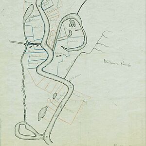
Over the years, the river channel changed its path. This left Fort Adams far from the main Mississippi River. By 1993, Fort Adams was a small community. It was a place where businesses provided supplies for hunting and fishing camps in the area.
 | May Edward Chinn |
 | Rebecca Cole |
 | Alexa Canady |
 | Dorothy Lavinia Brown |


