Wilkinson County, Mississippi facts for kids
Quick facts for kids
Wilkinson County
|
|
|---|---|
|
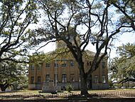
Left to right: Clark Creek and Wilkinson County Courthouse
|
|

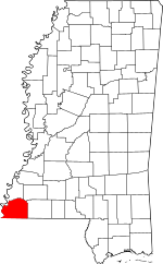
Location within the U.S. state of Mississippi
|
|
 Mississippi's location within the U.S. |
|
| Country | |
| State | |
| Founded | 1802 |
| Named for | James Wilkinson |
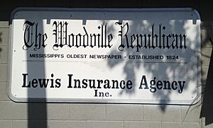
| Seat | Woodville |
| Largest town | Centreville |
| Area | |
| • Total | 688 sq mi (1,780 km2) |
| • Land | 678 sq mi (1,760 km2) |
| • Water | 9.7 sq mi (25 km2) 1.4% |
| Population
(2020)
|
|
| • Total | 8,587 |
| • Density | 12.481/sq mi (4.819/km2) |
| Time zone | UTC−6 (Central) |
| • Summer (DST) | UTC−5 (CDT) |
| Congressional district | 2nd |
Wilkinson County is a county located in the southwest part of the U.S. state of Mississippi. In 2020, about 8,587 people lived there. Its main town, called the county seat, is Woodville. The Mississippi River is on its west side. The county is named after James Wilkinson. He was a military leader during the American Revolutionary War and the first governor of the Louisiana Territory after the U.S. bought it in 1803.
Contents
History of Wilkinson County

In the 1800s, European-American settlers built large plantations in this county. These farms grew cotton along the Mississippi River. Many areas further inland were not developed until after the American Civil War.
Growing cotton needed a lot of workers. Many enslaved African Americans were brought here from other parts of the U.S. This was a huge forced migration. Because of this, most people in the county quickly became Black.
The West Feliciana Railroad was built to help move the cotton to markets. Some plantation owners became very rich before the Civil War. They built beautiful mansions in Woodville. After the Civil War, formerly enslaved people, called freedmen, and plantation owners worked out new ways to farm. Sharecropping, where farmers gave a share of their crops to the landowner, became common.
The economy faced hard times due to a long period of low farm prices. The county's population was highest in 1900. After that, many Black people moved away during the Great Migration. They went to the North and Midwest to escape unfair laws and practices in Mississippi. These included racial segregation and not being allowed to vote, which started after the state's new constitution in 1890 and later Jim Crow laws.
In the early 1900s, tiny insects called boll weevils destroyed much of the cotton. Also, new machines meant fewer farm jobs. People started harvesting and processing timber as a new product. The number of people living in the county has continued to go down. Towns are now trying to attract visitors by promoting their history, which is called heritage tourism.
Geography of the County
The U.S. Census Bureau says the county covers about 688 square miles. About 678 square miles is land, and 9.7 square miles (1.4%) is water.
Main Roads
Neighboring Counties
- Adams County (north)
- Franklin County (northeast)
- Amite County (east)
- East Feliciana Parish, Louisiana (southeast)
- West Feliciana Parish, Louisiana (south)
- Concordia Parish, Louisiana (west)
Protected Natural Areas
- Homochitto National Forest (part of it is in Wilkinson County)
People of Wilkinson County
| Historical population | |||
|---|---|---|---|
| Census | Pop. | %± | |
| 1810 | 5,068 | — | |
| 1820 | 9,718 | 91.8% | |
| 1830 | 11,686 | 20.3% | |
| 1840 | 14,193 | 21.5% | |
| 1850 | 16,914 | 19.2% | |
| 1860 | 15,933 | −5.8% | |
| 1870 | 12,705 | −20.3% | |
| 1880 | 17,815 | 40.2% | |
| 1890 | 17,592 | −1.3% | |
| 1900 | 21,453 | 21.9% | |
| 1910 | 18,075 | −15.7% | |
| 1920 | 15,319 | −15.2% | |
| 1930 | 13,957 | −8.9% | |
| 1940 | 15,955 | 14.3% | |
| 1950 | 14,116 | −11.5% | |
| 1960 | 13,235 | −6.2% | |
| 1970 | 11,099 | −16.1% | |
| 1980 | 10,021 | −9.7% | |
| 1990 | 9,678 | −3.4% | |
| 2000 | 10,312 | 6.6% | |
| 2010 | 9,878 | −4.2% | |
| 2020 | 8,587 | −13.1% | |
| 2023 (est.) | 8,058 | −18.4% | |
| U.S. Decennial Census 1790-1960 1900-1990 1990-2000 2010-2013 |
|||
Population and Diversity
In 2020, Wilkinson County had 8,587 people. There were 3,170 households and 1,843 families.
| Race/ethnicity | Num. | Perc. |
|---|---|---|
| White | 2,525 | 29.4% |
| Black or African American | 5,764 | 67.12% |
| Native American | 16 | 0.19% |
| Asian | 8 | 0.09% |
| Other/Mixed | 204 | 2.38% |
| Hispanic or Latino | 70 | 0.82% |
The U.S. Census Bureau reported that in 2020, most people in Wilkinson County were Black or African American. Specifically, 67.12% were Black or African American. About 29.4% were white (not Hispanic). Other groups included Native American, Asian, and people of mixed backgrounds. About 0.82% were Hispanic or Latin American.
Household Income
In 2010, the average household income in the county was about $28,066 per year. By 2020, this had increased to $30,760. The average monthly cost for housing was $419. For families with married couples, the average income was $50,227. Households without families had an average income of $27,468.
Education in Wilkinson County
The Wilkinson County School District serves the students in the county. Before 1970, schools were separate for Black and white students. A federal court order then required schools to be integrated.
When schools finally combined, almost all white students chose to attend private schools. Many went to Wilkinson County Christian Academy, which started in 1969. This school was created to avoid integration. The superintendent of the public school system even sent his own child to the private academy.
Wilkinson County is also part of the Southwest Mississippi Community College district.
Communities in the County
Wilkinson County has several towns and smaller communities.
Towns
- Centreville (partly in Amite County)
- Crosby (partly in Amite County)
- Woodville (the main town or county seat)
Unincorporated Communities
These are smaller places that are not officially towns.
Ghost Towns
These are places where people used to live, but now they are empty or abandoned.
Famous People from Wilkinson County
- Regina Barrow (born 1966), a state senator in Louisiana. She was born in Wilkinson County.
- Jefferson Davis, who grew up near Woodville. He later became the President of the Confederate States of America.
- Anne Moody (1940-2015), a civil rights activist and writer.
- William Grant Still, an African-American classical composer. He was born in Woodville in 1895 and is in the Mississippi Musicians Hall of Fame.
See also
 In Spanish: Condado de Wilkinson (Misisipi) para niños
 | Ernest Everett Just |
 | Mary Jackson |
 | Emmett Chappelle |
 | Marie Maynard Daly |


