Fortville, Indiana facts for kids
Quick facts for kids
Fortville, Indiana
|
|
|---|---|
| Town of Fortville | |
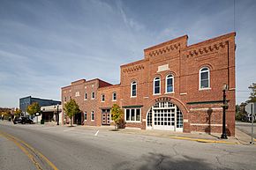
View of Main St at Pearl St
|
|
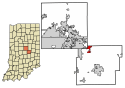
Location of Fortville in Hancock County, Indiana.
|
|
| Country | United States |
| State | Indiana |
| County | Hancock |
| Township | Vernon |
| Area | |
| • Total | 3.46 sq mi (8.96 km2) |
| • Land | 3.45 sq mi (8.94 km2) |
| • Water | 0.01 sq mi (0.02 km2) |
| Elevation | 853 ft (260 m) |
| Population
(2020)
|
|
| • Total | 4,784 |
| • Density | 1,386.67/sq mi (535.39/km2) |
| Time zone | UTC-5 (EST) |
| • Summer (DST) | UTC-4 (EDT) |
| ZIP code |
46040
|
| Area code(s) | 317 |
| FIPS code | 18-24286 |
| GNIS feature ID | 2396943 |
Fortville is a small town in Indiana, United States. It is located in Hancock County. In 2020, about 4,784 people lived there.
Contents
Where is Fortville?
Fortville is in the northwest part of Hancock County, Indiana. It is right next to Hamilton County and Madison County. The town is about 25 miles (40 km) northeast of downtown Indianapolis, Indiana. It is part of the larger Indianapolis area.
In 2010, Fortville covered about 2.91 square miles (7.54 square kilometers). Most of this area, about 2.90 square miles (7.51 square kilometers), is land. Only a tiny part, 0.01 square miles (0.03 square kilometers), is water.
Fortville's History
When the first settlers arrived in this area, the Miami people lived here. The Shawnee people might have lived here too. An important early settler was Francis Kincade. He owned many plots of land where two main roads met. These roads were well-known as early as 1826.
The settlement that became Fortville was first called Phoebe Fort. Later, its name was changed to Walpole, after a politician named Thomas D. Walpole. The town was officially planned out in 1849. It was named after Cephas Fort, who originally owned the land where the town was built. Fortville officially became a town in 1865.
A historic building called the Browne-Rafert House was added to the National Register of Historic Places in 2015. This means it is an important historical site.
How Many People Live in Fortville?
| Historical population | |||
|---|---|---|---|
| Census | Pop. | %± | |
| 1870 | 387 | — | |
| 1880 | 634 | 63.8% | |
| 1890 | 685 | 8.0% | |
| 1900 | 1,006 | 46.9% | |
| 1910 | 1,174 | 16.7% | |
| 1920 | 1,213 | 3.3% | |
| 1930 | 1,289 | 6.3% | |
| 1940 | 1,463 | 13.5% | |
| 1950 | 1,786 | 22.1% | |
| 1960 | 2,209 | 23.7% | |
| 1970 | 2,460 | 11.4% | |
| 1980 | 2,787 | 13.3% | |
| 1990 | 2,690 | −3.5% | |
| 2000 | 3,444 | 28.0% | |
| 2010 | 3,929 | 14.1% | |
| 2020 | 4,784 | 21.8% | |
| U.S. Decennial Census | |||
Fortville's Population in 2010
In 2010, there were 3,929 people living in Fortville. These people lived in 1,553 households. A household is a group of people living in the same home. About 1,060 of these households were families.
The town had about 1,318 people per square mile (509 people per square kilometer). There were 1,705 homes in total. Most of the people living in Fortville were White (96.2%). A smaller number were Black (1.3%), Native American (0.3%), or Asian (0.1%). Some people were from other races (0.9%) or from two or more races (1.3%). About 2.3% of the population was Hispanic or Latino.
In 2010, about 37.7% of households had children under 18 living with them. Almost half of the households (47.6%) were married couples. The average household had 2.53 people. The average family had 3.03 people.
The average age of people in Fortville was 35.7 years old. About 28.3% of residents were under 18. About 11.6% were 65 years old or older. Slightly more than half of the residents (51.4%) were female.
Parks in Fortville
Fortville has a few parks where people can relax and play.
- Landmark Park is located at Staat Street and Veteran's Court. It is just east of Main Street.
- Memorial Park has its entrance just west of Church and McCarty streets.
Education in Fortville
Fortville is home to schools that are part of the Mt. Vernon Community Schools Corporation. This school district has three elementary schools, one middle school, and one high school. The schools often get high ratings from the State of Indiana.
The town also has a public library called the Vernon Township Public Library. It is a place where people can borrow books and other materials.
Fortville's Economy
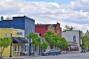
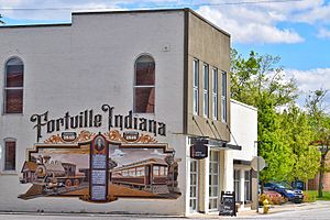
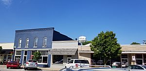
Fortville's historic downtown area is a lively place. It has many local shops, restaurants, and businesses that provide services. The downtown area is also known for its arts and culture scene.
See also
 In Spanish: Fortville (Indiana) para niños
 | Charles R. Drew |
 | Benjamin Banneker |
 | Jane C. Wright |
 | Roger Arliner Young |


