
Fresno, Texas facts for kids
Quick facts for kids
Fresno, Texas
|
|
|---|---|

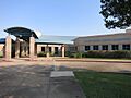
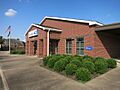
US Post Office, Fresno, Texas
|
|

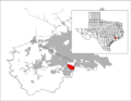
Location of Fresno, Texas
|
|
| Country | United States |
| State | Texas |
| County | Fort Bend |
| Named for | Fresno, CA |
| Area | |
| • Total | 9.3 sq mi (24.1 km2) |
| • Land | 9.2 sq mi (23.8 km2) |
| • Water | 0.1 sq mi (0.3 km2) |
| Elevation | 72 ft (22 m) |
| Population
(2020)
|
|
| • Total | 24,486 |
| • Density | 2,630/sq mi (1,016/km2) |
| Time zone | UTC-6 (Central (CST)) |
| • Summer (DST) | UTC-5 (CDT) |
| ZIP code |
77545
|
| Area code(s) | 281 |
| FIPS code | 48-27540 |
| GNIS feature ID | 1336203 |
Fresno is a community in Fort Bend County, Texas, United States. It's called a "census-designated place" (CDP) because it's a community that the government counts for population, even though it's not officially a city.
In 2020, about 24,486 people lived in Fresno. This was a big jump from 19,069 people in 2010, and even more from 6,603 people in 2000.
Fresno is located near Houston, which is one of the biggest cities in the United States. It's also close to other towns like Missouri City, Arcola, and Pearland.
Contents
Geography

Fresno is in the eastern part of Fort Bend County. The eastern edge of Fresno is also the border of Brazoria County.
It's about 17 miles (27 km) north of downtown Houston. Missouri City is about 11 miles (18 km) to the northwest, and Pearland is about 11 miles (18 km) to the east.
The United States Census Bureau says that Fresno covers a total area of about 9.3 square miles (24.1 square kilometers). Most of this area is land, with a small part being water.
History
Fresno got its name from a settler who came from Fresno, California. The town was built on land that was once used for cotton farms back in the 1880s.
Fresno got its own post office in 1910. By 1914, it had a telephone, a general store, a hardware store, and about 32 people living there. However, by 1933, the population dropped to just ten people and only one business.
In 1936, Fresno had a few rows of houses along a paved road (now called FM 521) and was served by a railroad. The population slowly grew, reaching 100 people by 1946. It stayed around that number through the 1960s. By 1970, it was 120, and two years later, it was 161. During the 1970s and 1980s, Fresno started growing much faster as Houston expanded.
Growing Communities in Fresno
Because of its good location near major roads, many new neighborhoods have been built in Fresno. These areas, once forests and grazing lands, are now home to many families. These new communities are often called "bedroom communities" because many people who live there commute to work in nearby cities like Houston.
The types of people living in Fresno have changed a lot since 2000, as more homes were built.
The area tends to vote for the Democratic Party. Because more people moved to Fresno, its local government district changed in 2003.
Some of the largest neighborhoods in Fresno are part of the Fort Bend MUD #23 area. A MUD, or Municipal Utility District, is a special local government that provides services like water, sewer, and drainage to a community.
- Teal Run was one of the first neighborhoods, started in the 1980s. After a period when the oil industry in Houston struggled, construction started again in 1992.
- The Estates of Teal Run began in 1999.
- Teal Run North (which includes Villages of Teal Run and Teal Run Meadows) started in 2001. By 2006, there were over 3,100 homes in the Fort Bend MUD #23 area.
Other large communities include:
- NewPoint Estates, which has larger properties for homes, stables, and expensive houses.
- Winfield Lakes, started in 2004.
- Andover Farms, also started in 2004.
- Cambridge Falls, which began adding roads and utilities in 2005.
The new Fort Bend Tollway has made it easier for people in eastern Fort Bend County to travel into Houston. This tollway helps reduce travel time, making commutes much faster than using older roads during busy hours.
Demographics
| Historical population | |||
|---|---|---|---|
| Census | Pop. | %± | |
| 2000 | 6,603 | — | |
| 2010 | 19,069 | 188.8% | |
| 2020 | 24,486 | 28.4% | |
| U.S. Decennial Census 1850–1900 1910 1920 1930 1940 1950 1960 1970 1980 1990 2000 2010 |
|||
| Race / Ethnicity (NH = Non-Hispanic) | Pop 2000 | Pop 2010 | Pop 2020 | %2000 | %2010 | %2020 |
|---|---|---|---|---|---|---|
| White (NH) | 1,428 | 1,011 | 898 | 21.63% | 5.30% | 3.67% |
| Black or African American (NH) | 1,739 | 11,225 | 13,690 | 26.34% | 58.87% | 55.91% |
| Native American or Alaska Native (NH) | 7 | 15 | 30 | 0.11% | 0.08% | 0.12% |
| Asian (NH) | 65 | 181 | 289 | 0.98% | 0.95% | 1.18% |
| Pacific Islander (NH) | 0 | 2 | 11 | 0.00% | 0.01% | 0.04% |
| Some Other Race (NH) | 8 | 43 | 87 | 0.12% | 0.23% | 0.36% |
| Mixed race or Multi-Racial (NH) | 62 | 274 | 524 | 0.94% | 1.44% | 2.14% |
| Hispanic or Latino | 3,294 | 6,318 | 8,957 | 49.89% | 33.13% | 36.58% |
| Total | 6,603 | 19,069 | 24,486 | 100.00% | 100.00% | 100.00% |
The United States Census is a count of the population that happens every ten years. In 2020, the census showed that 24,486 people lived in Fresno. These people lived in 7,247 "households" (which means a house or apartment where people live) and 5,789 "families" (groups of related people living together).
In 2000, there were 6,603 people in Fresno. About 54.1% of the households had children under 18. Most households (68.6%) were married couples. The average household had about 3.51 people.
The median age in Fresno in 2000 was 28 years old. This means half the people were younger than 28, and half were older.
The average income for a household in 2000 was about $46,290. The average income for a family was $48,824. About 15.3% of the population lived below the poverty line, which means they had a very low income.
The Fort Bend County Sheriff's Office helps keep the Fresno area safe. The Fresno Volunteer Fire Department provides fire protection, and Fort Bend EMS provides emergency medical services.
Education
Children in Fresno attend schools that are part of the Fort Bend Independent School District.
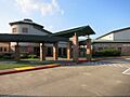
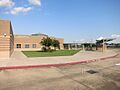
There are three elementary schools located in Fresno: Lula Belle Goodman Elementary School, Burton Elementary School, and Rosa Parks Elementary School. A small part of Fresno is also zoned to Heritage Road Elementary School, which is outside of Fresno.
For middle school, some students go to Lake Olympia Middle School in Missouri City, while others attend Billy Baines Middle School.
Most high school students from Fresno go to Hightower High School in Missouri City. Some students are zoned to Willowridge High School in Houston. In the past, students also attended Elkins High School and Ridge Point High School.
Fresno is also part of the Houston Community College (HCC) district. This means that residents can attend HCC for higher education.
-
Walter Moses Burton Elementary School
-
Lula Belle Goodman Elementary School
-
Rosa Parks Elementary School


Parks and Recreation
Fort Bend County has a place called the Mustang Community Center in Fresno. This center is about 5 acres (20,000 square meters) in size. It has a baseball field, benches, a meeting room, two covered areas (pavilions), a play area, tables, and a walking trail for people to enjoy.
Images for kids
-
US Post Office, Fresno, Texas
-
Location of Fresno, Texas
See also
 In Spanish: Fresno (Texas) para niños
