Frontenac, Missouri facts for kids
Quick facts for kids
Frontenac, Missouri
|
|
|---|---|

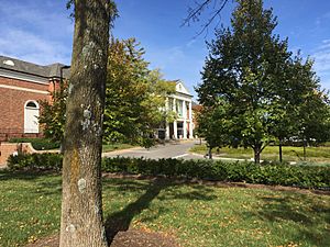
Plaza Frontenac, October 2017
|
|

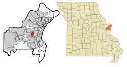
Location of Frontenac, Missouri
|
|

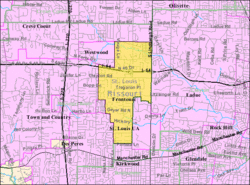
U.S. Census reference map.
|
|
| Country | United States |
| State | Missouri |
| County | St. Louis |
| Area | |
| • Total | 2.88 sq mi (7.46 km2) |
| • Land | 2.88 sq mi (7.46 km2) |
| • Water | 0.00 sq mi (0.00 km2) |
| Elevation | 640 ft (200 m) |
| Population
(2020)
|
|
| • Total | 3,612 |
| • Density | 1,253.73/sq mi (484.02/km2) |
| Time zone | UTC-6 (Central (CST)) |
| • Summer (DST) | UTC-5 (CDT) |
| ZIP code |
63131
|
| Area code(s) | 314 |
| FIPS code | 29-26110 |
| GNIS feature ID | 2394829 |
| Website | Frontenac, Missouri |
Frontenac is a city in St. Louis County, Missouri, United States. In 2020, about 3,612 people lived there.
The city's name comes from Louis de Buade de Frontenac. He was a governor of New France, which was a French area in North America. Benjamin and Lora Wood often visited Quebec, a city in Canada. They named the first part of the community, Frontenac Estates, after him. This area had 26 large homes, each on two acres of land.
Frontenac became an official city in 1947. It started as about 217 acres. In 1948, it grew much bigger, adding another 967 acres. Today, most homes in Frontenac are still on large, one-acre lots. The city encourages houses to be built in a French architectural style.
Contents
Frontenac's Geography
Frontenac covers a total area of about 2.88 square miles (7.46 square kilometers). All of this area is land; there is no water within the city limits.
Frontenac's Population
| Historical population | |||
|---|---|---|---|
| Census | Pop. | %± | |
| 1950 | 1,099 | — | |
| 1960 | 3,089 | 181.1% | |
| 1970 | 3,920 | 26.9% | |
| 1980 | 3,654 | −6.8% | |
| 1990 | 3,374 | −7.7% | |
| 2000 | 3,483 | 3.2% | |
| 2010 | 3,482 | 0.0% | |
| 2020 | 3,612 | 3.7% | |
| U.S. Decennial Census | |||
People in 2020
In 2020, there were 3,612 people living in Frontenac. There were also 1,305 households. Most residents, about 82.6%, were White. About 2.3% were African American, and 9.3% were Asian. A small number of people were from other backgrounds. About 2.6% of the population was Hispanic or Latino.
People in 2010
According to the census in 2010, Frontenac had 3,482 people. There were 1,267 households, and 1,036 of these were families. The city had about 1,209 people per square mile.
Most people were White (90.1%). About 2.6% were African American, and 5.6% were Asian. About 1.5% of the population was Hispanic or Latino.
About 34.6% of households had children under 18. Most households (73.3%) were married couples. About 16.1% of households were individuals living alone. The average household had 2.70 people.
The average age in Frontenac was 49.2 years. About 24.9% of residents were under 18. About 21.3% were 65 or older. The city had slightly more females (52.4%) than males (47.6%).
Schools in Frontenac
Frontenac has several schools and is served by different school districts:
- Ladue School District: This is a public school district that serves parts of Frontenac.
- St. Joseph's Academy: This is a private high school just for girls.
- Chaminade College Preparatory School: This is a private middle and high school just for boys.
- Villa Duchesne and Oak Hill School: This is a Sacred Heart School. It has classes for boys and girls from junior kindergarten to 6th grade. It also has classes for young women from 7th to 12th grade.
- Kirkwood School District: This public school district serves some parts of South Frontenac.
See also

- In Spanish: Frontenac (Misuri) para niños
 | William Lucy |
 | Charles Hayes |
 | Cleveland Robinson |

