
Fryingpan-Arkansas Project facts for kids
The Fryingpan-Arkansas Project, also known as "Fry-Ark," is a huge system that moves, stores, and delivers water in southeastern Colorado. This important project was approved in 1962 by President Kennedy. Its main goals are to provide water for cities and businesses, generate electricity, and create opportunities for recreation, fishing, and wildlife.

Construction of the Fry-Ark Project started in 1964 and finished in 1981. It includes five dams and reservoirs, one government-run hydroelectric power plant (and two private ones), and 22 tunnels and pipes that stretch for about 87 miles (140 km). The Bureau of Reclamation, which is part of the United States Department of the Interior, built and now manages this entire project.
Like another big water project called the Colorado-Big Thompson Project, the Fry-Ark moves water from Colorado's West Slope to the drier and more populated East Slope. This extra water helps over 720,000 people and 280,600 acres (1,136 km²) of farmland in cities like Colorado Springs, Pueblo, La Junta, and Lamar every year.

Contents
How the Project Works
The Fryingpan-Arkansas Project moves a lot of water each year. On average, it diverts about 52,000 acre-feet (64,000,000 m³) of water annually. An acre-foot is the amount of water needed to cover one acre of land with water one foot deep.
The amount of water moved can change a lot depending on the weather. For example, in 2011, when Colorado had a lot of snow, the project brought in about 98,000 acre-feet (121,000,000 m³) of water. This was one of the highest amounts in the project's history. But the very next year, 2012, there wasn't much snow, and the state faced a drought. Because of this, the project could only bring in about 14,000 acre-feet (17,000,000 m³) of water.
Water's Journey from West to East
Before the Fry-Ark Project could be built, people from the East and West Slopes of Colorado had to agree on how the water would be shared. One important part of this agreement was building Ruedi Reservoir. This reservoir is located about 15 miles (24 km) upstream on the Fryingpan River. Ruedi Reservoir provides water to the West Slope. This helps make up for the water that is moved to the East Slope.
The journey of the water starts in the Fryingpan River basin on the West Slope. A network of 16 small dams and tunnels, all located high up (above 10,000 feet or 3,048 meters), collect snowmelt. This water then flows by gravity into the Charles H. Boustead Tunnel.
Crossing the Continental Divide
The Boustead Tunnel carries the water for about 5.5 miles (8.9 km) right underneath the Continental Divide. This is a mountain ridge that separates rivers flowing to the Pacific Ocean from those flowing to the Atlantic Ocean. After passing through the tunnel, the water flows into Turquoise Lake, which is near Leadville.
From Turquoise Lake, the water travels through the Mt. Elbert Conduit for nearly 11 miles (18 km) to the Mt. Elbert Forebay. A "forebay" is a small reservoir that holds water just before it enters a power plant. Water is stored here to build up "head," which means it gains energy from its height. This energy is then used to generate electricity. The water then drops over 0.5 miles (0.8 km) in elevation to the hydroelectric Mt. Elbert Powerplant.
Generating Electricity
The Mt. Elbert Powerplant is named after Mount Elbert, Colorado's tallest mountain, and sits at its base. This power plant is the largest hydroelectric power plant in Colorado. It can produce 200 megawatts of electricity.
This plant uses a special "pump-back" system. At night, when electricity is cheaper, the plant pumps water from Twin Lakes back up to the forebay. This means the same water can be used again to generate more electricity when it flows down. The Western Area Power Administration sells the electricity made at this plant.
Water for Cities and Farms
After leaving the Mt. Elbert Power Plant, the water helps fill Twin Lakes Reservoir. This was a natural lake that was made bigger by the Twin Lakes Dam between 1978 and 1980. The reservoir is on Lake Creek, which flows down from Independence Pass.
Water from Twin Lakes Reservoir continues down Lake Creek and eventually reaches the Arkansas River. The Arkansas River is the main pathway for delivering water from the Fry-Ark project to its users.
Pueblo Reservoir, which is the main part of Lake Pueblo State Park, is the last major reservoir in the project. It's located on the Arkansas River, just west of Pueblo. Most of the water for cities and farms is taken out of Pueblo Reservoir. The remaining water then continues east towards Kansas via the Arkansas River.
Images for kids
-
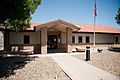
The Pueblo Field Office of the Bureau of Reclamation
-

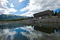
Late afternoon at Lake Pueblo
-
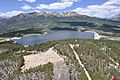
Mt. Elbert Power Plant on Twin Lakes
-
Mt. Elbert Forebay with Mt. Elbert in the background


