Colorado Western Slope facts for kids
Quick facts for kids Colorado Western Slope |
|
|---|---|
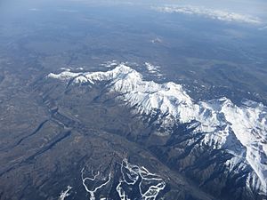
San Juan Mountains North of Telluride, Colorado in the Western Slope
|
|
| Location | West of the Continental Divide in Colorado |
| Coordinates | 38°28′41.16″N 107°52′33.96″W / 38.4781000°N 107.8761000°W |
| Range | Rocky Mountains |
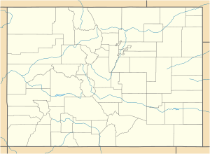
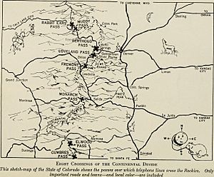
The Western Slope is a special part of Colorado. It's the area of the state that lies west of the Continental Divide. Imagine a big imaginary line running through the Rocky Mountains. Water on the west side of this line flows towards the Pacific Ocean. Water on the east side flows towards the Atlantic Ocean.
The Western Slope covers about one-third of Colorado. However, only about 10% of the state's people live there. The eastern part of Colorado, including cities like Denver, has many more residents.
Contents
Where is the Colorado Western Slope?
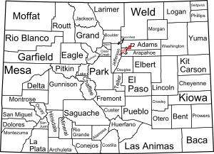
The Western Slope includes many counties in Colorado. Some of these are Moffat, Routt, La Plata, Mesa, and Gunnison counties. It also covers parts of other counties like Saguache.
This region holds about 70% of Colorado's water. The mighty Colorado River and its smaller rivers flow through this area. They divide the region into northern and southern parts near Grand Junction, Colorado. The climate here is similar to the Great Basin, which is a large dry area in the western United States.
A Look Back: History of the Western Slope
Who Lived Here First?
Long, long ago, about 12,000 B.C., early people called Paleo-Indians lived on the Western Slope. They were nomads, meaning they moved around a lot. These hunter-gatherers followed large animals for food.
Later, between 6500 B.C. and A.D. 200, the Ancestral Puebloans lived in the river valleys. From about 350 B.C. to A.D. 1300, they built homes in places like Mesa Verde National Park. The Puebloans were the first to farm and water their crops here. They also continued to hunt and gather food. They left the area in the late 1200s because of a long period of dry weather.
Around A.D. 1300, the Ute people arrived from the Great Basin. They hunted animals like deer, elk, and buffalo. They also gathered berries, roots, and nuts. The Utes often visited the natural hot springs in areas like Pagosa Springs and Glenwood Springs. Many of the paths they created became the routes for today's roads and highways.
European Explorers and Settlers
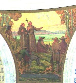
In the 1700s, Spanish explorers visited the Western Slope. Juan de Rivera explored in 1765. Then, in 1776, the Domínguez–Escalante expedition came through.
Later, in the 1800s, European fur trappers, also known as mountain men, came to catch beavers. They set up trading posts like Fort Uncompahgre to trade furs for supplies. Famous trappers and explorers included Kit Carson and Jim Bridger. They helped guide other explorers like John C. Frémont through the Western Slope. When the demand for beaver furs dropped, the fur trade slowed down.
In 1858, the Gold Rush brought many miners to Colorado. They found gold in rivers and later mined for other valuable materials underground. Mining towns like Breckenridge popped up. Maps made by Ferdinand Vandeveer Hayden in the 1870s helped more people move into western Colorado.
Over time, agreements were made to define land for Native Americans. The Utes gave up land east of the Continental Divide in 1868. However, they kept most of their land on the Western Slope. After gold was found in the San Juan Mountains, the Utes were pushed out of more land. After an event called the Meeker Massacre in 1879, many Utes were moved to a reservation in Utah. However, the Southern Ute and Ute Mountain Ute tribes still have land in southern Colorado today.
The Western Slope has a strong history of farming and ranching. These activities are still very important. The region is also known for its energy resources like coal, oil, and natural gas.
Who Lives on the Western Slope Today?
The Western Slope is not very crowded. It has 38% of Colorado's land but only about 10.7% of its people. In 2013, about 563,138 people lived there.
The most populated areas are the Tri-County area, which includes Grand Junction, Montrose, and Delta. Another busy area is the Intermountain area, with towns like Glenwood Springs and Aspen. Grand Junction is the largest city in the region, with over 61,000 people in 2016.
Experts believe the population of the Western Slope will grow a lot by 2050. Mesa County is expected to have the most growth.
What Drives the Economy?
The economy of the Western Slope has always relied on ranching, mining, and tourism. Fruit farming is also big, especially along the Colorado and Gunnison rivers. The town of Palisade is famous for its peaches and many wineries.
Today, energy production (oil, natural gas, coal) and tourism are still very important. However, in the Grand Junction area, healthcare is the biggest industry. Grand Junction is a major healthcare center for many counties in Colorado, Utah, and Wyoming.
Fun Things to Do: Tourism on the Western Slope
The Western Slope has many different types of landscapes. You can find deserts, mountains, lakes, and river valleys. This means there are tons of outdoor activities to enjoy! You can go rock climbing, hiking, skiing, or horseback riding.
- Skiing: Popular ski resorts include Crested Butte, Aspen, Telluride, and Vail.
- National Forests: You can explore vast forests like White River National Forest and San Juan National Forest. The amazing Black Canyon is part of the Gunnison National Park.
- Hot Springs and Caves: Glenwood Springs has the world's largest hot springs pool and cool fairy caves. You can also go whitewater rafting there.
- Culture and Food: Aspen hosts events like the Aspen Music Festival. You can visit vineyards and wineries in Palisade and Grand Junction.
- Ancient History: Mesa Verde National Park is home to incredible cliff-dwellings built by the Ancient Puebloans.
- Natural Wonders: Don't miss Dinosaur National Monument and Colorado National Monument.
- Rivers: The Colorado River and Crystal River are just two of the many beautiful rivers in the area.
 | Ernest Everett Just |
 | Mary Jackson |
 | Emmett Chappelle |
 | Marie Maynard Daly |


