Gabbs, Nevada facts for kids
Quick facts for kids
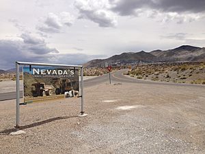
Gabbs, Nevada
|
|
|---|---|

Central Gabbs
|
|
| Nickname(s):
The Little-Big Northwest
|
|
| Motto(s):
High up we go, the town of Gabbs show
|
|

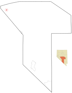
Location of Gabbs, Nevada
|
|
| Country | United States |
| State | Nevada |
| County | Nye |
| Area | |
| • Total | 1.50 sq mi (3.89 km2) |
| • Land | 1.50 sq mi (3.88 km2) |
| • Water | 0.00 sq mi (0.01 km2) |
| Population
(2020)
|
|
| • Total | 186 |
| • Density | 124.17/sq mi (47.94/km2) |
| Time zone | UTC-8 (Pacific (PST)) |
| • Summer (DST) | UTC-7 (PDT) |
| ZIP code |
89409
|
| Area code(s) | 775 |
| FIPS code | 32-25900 |
Gabbs is a small, unincorporated town in Nye County, Nevada, United States. An unincorporated town means it's not officially governed by its own city government. In 2020, about 186 people lived there. Gabbs is located far from Las Vegas, but it is still considered part of the larger Las Vegas area.
Contents
History of Gabbs
Gabbs was started around December 1941. It began as a "company town" for a business called Basic Magnesium, Inc. (BMI). A company town is a place where a company builds homes and services for its workers. The company had a plant that made magnesium. Magnesium is a light metal used in many things, like airplanes.
The town grew from an older mining camp called Brucite. It was named after the surrounding Gabbs Valley. The valley itself was named after William Gabb, a scientist who studied old fossils from the area.
Gabbs During World War II
During World War II, there was a high demand for magnesium. This caused the plant in Gabbs to grow a lot. The government helped manage this growth. In 1942, Gabbs got its own police, a jail, and a school district. By June 1943, Gabbs became a township with 426 people.
The town had different areas like North Gabbs, South Gabbs, and Tent City. They had a library, a city hall, parks, and tennis courts. Local newspapers also served the community. Gabbs officially became a city on March 29, 1955.
Changes in the Mining Industry
In September 1944, the original magnesium plant closed. It had made enough magnesium for the war's needs. The number of people living in Gabbs went down at first. However, the town grew again in 1955. A new plant opened, run by Basic Refractories, Inc. This plant made magnesium for other companies. By 1960, the town's population grew to 796 people.
In 1982, the plant laid off many workers. This caused the town's population to shrink again. For a short time in the 1980s and 1990s, more people moved to Gabbs. This was because of a gold mine nearby at Paradise Peak. But this gold mine also closed in 1994. In 2001, Gabbs lost its official city status. Today, the town still has a high school, stores, and homes.
Geography
Gabbs is located at 38°51′59″N 117°55′32″W / 38.86639°N 117.92556°W. It covers an area of about 3.89 square kilometers (1.50 square miles). Almost all of this area is land.
Population Information
| Historical population | |||
|---|---|---|---|
| Census | Pop. | %± | |
| 1960 | 770 | — | |
| 1970 | 874 | 13.5% | |
| 1980 | 811 | −7.2% | |
| 1990 | 667 | −17.8% | |
| 2000 | 318 | −52.3% | |
| 2010 | 269 | −15.4% | |
| 2020 | 186 | −30.9% | |
| U.S. Decennial Census | |||
A census is an official count of a population. The 2010 census showed that 269 people lived in Gabbs. There were 121 households, which are groups of people living in one home. Most people were White (87.4%). Some were Native American (5.6%) or Asian (1.1%). About 4.5% of the population was Hispanic or Latino.
In terms of age, about 20.8% of the people were under 18 years old. Another 20.8% were 65 years or older. The average age in Gabbs was about 50.1 years old.
See also
 In Spanish: Gabbs (Nevada) para niños


