Gascoyne, North Dakota facts for kids
Quick facts for kids
Gascoyne
|
|
|---|---|

Gascoyne
|
|

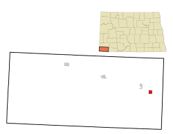
Location of Gascoyne, North Dakota
|
|
| Country | United States |
| State | North Dakota |
| County | Bowman |
| Founded | 1907 |
| Area | |
| • Total | 1.00 sq mi (2.59 km2) |
| • Land | 1.00 sq mi (2.59 km2) |
| • Water | 0.00 sq mi (0.00 km2) |
| Elevation | 2,763 ft (842 m) |
| Population
(2020)
|
|
| • Total | 21 |
| • Estimate
(2022)
|
21 |
| • Density | 21.02/sq mi (8.12/km2) |
| Time zone | UTC–7 (Mountain (MST)) |
| • Summer (DST) | UTC–6 (MDT) |
| ZIP code |
58653
|
| Area code(s) | 701 |
| FIPS code | 38-29540 |
| GNIS feature ID | 1036053 |
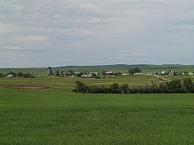
Gascoyne is a small city located in Bowman County, North Dakota, United States. In 2020, about 21 people lived there. It is a quiet place with a history tied to railroads and coal mining.
Contents
History of Gascoyne
Gascoyne was founded in 1907. It was first called Fischbein. The name was changed to Gascoyne on March 25, 1908.
How Gascoyne Got Its Name
One idea for the new name came from a construction foreman. He worked on the Milwaukee Road railway. This railway was a transcontinental rail line, meaning it crossed the entire continent. Another idea is that the name comes from the large amounts of natural gas found in the area.
Coal Mining in Gascoyne
The area around Gascoyne also has reserves of lignite coal. Lignite is a type of soft coal. Gascoyne was home to a coal mine for most of the 1900s.
The mine was busiest between 1975 and 1995. During this time, it produced about 2.5 million tons of lignite each year. This coal was mainly used for the Big Stone Power Plant in South Dakota. The mine started closing down in 1995 and was fully shut by 1997.
In 2001, a company called Westmoreland Coal Company bought the mine. They wanted to start mining again. They also planned to build a large power plant. However, these plans were stopped in 2008. This was due to worries about the environment.
Geography of Gascoyne
Gascoyne is a small city in terms of size. According to the United States Census Bureau, the city covers a total area of 1.00 square mile (2.59 km2). All of this area is land, with no water.
Population and People
| Historical population | |||
|---|---|---|---|
| Census | Pop. | %± | |
| 1920 | 60 | — | |
| 1930 | 97 | 61.7% | |
| 1940 | 48 | −50.5% | |
| 1950 | 76 | 58.3% | |
| 1960 | 50 | −34.2% | |
| 1970 | 34 | −32.0% | |
| 1980 | 23 | −32.4% | |
| 1990 | 22 | −4.3% | |
| 2000 | 23 | 4.5% | |
| 2010 | 16 | −30.4% | |
| 2020 | 21 | 31.3% | |
| 2022 (est.) | 21 | 31.3% | |
| U.S. Decennial Census 2020 Census |
|||
The population of Gascoyne has changed over the years. It was once larger, but now it is quite small.
Gascoyne in 2010
In 2010, there were 16 people living in Gascoyne. These people lived in 9 different homes. About 5 of these homes were families. The city had 10 housing units in total.
Most of the people living in Gascoyne in 2010 were White. About 11% of the homes had children under 18. More than half of the homes were married couples living together. The average age of people in Gascoyne was 63.5 years old. About 44% of the residents were 65 or older.
See also
 In Spanish: Gascoyne (Dakota del Norte) para niños
 | Georgia Louise Harris Brown |
 | Julian Abele |
 | Norma Merrick Sklarek |
 | William Sidney Pittman |

