Gaywood River facts for kids
Quick facts for kids Gaywood |
|
|---|---|
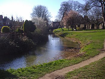
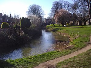
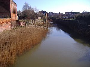
Gaywood River at Kettlewell mill
|
|
|
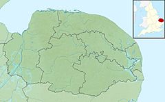
Location of the river mouth within Norfolk
|
|
| Country | England |
| County | Norfolk |
| Region | East of England |
| District | North West Norfolk |
| Physical characteristics | |
| Main source | In Derby Fen, North west of the village of Gayton, Norfolk |
| River mouth | At King’s Lynn in to the River Great Ouse 52°45′0″N 0°23′38″E / 52.75000°N 0.39389°E |
| Length | 6.7 mi (10.8 km) |
The Gaywood River is also known as the River Gay or Fisher Fleet in King's Lynn. It's a smaller river that flows into the River Great Ouse in Norfolk, England.
The river starts in a place called Derby Fen, near the village of Gayton. It's about 11 meters (36 feet) above sea level there. The Gaywood River flows for about 6.7 miles (10.8 km) (around 11 kilometers) before it joins the River Great Ouse in the town of King's Lynn.
Contents
The River's Journey and Wildlife
Derby Fen is a special natural area. It used to be a much larger "valley fen" system. This area has different types of habitats, from dry grassy areas to damp, acidic grasslands. All these habitats depend on the river for water.
From Derby Fen, the river flows under Leziate Drove. It then runs along the south side of Sugar Fen before reaching open countryside.
River Restoration and Animals
In recent years, people have worked to make the river flow in its natural curvy path again. These improvements have helped wildlife. Now, you can see water voles and even otters along the river.
The river also has a small population of trout. However, only the parts of the river closer to the sea are good for coarse fishing (catching fish like carp or roach).
Through the Countryside to King's Lynn
North of the village of Bawsey, the river goes under an old railway track. It then flows west, passing north of the old St. James’ church ruins. The church stands on a small hill south of the river.
Next, the river goes under the A149 road, which connects King's Lynn to Hunstanton. As the river gets closer to King's Lynn, it enters the town's outer areas. Here, a lot of work has been done to protect the banks from floods.
The river then goes along the south side of South Wootton. It passes under the A148 and turns south. For a short distance, it flows next to a street called Riverside. Then, it runs along the edge of sports fields near the King’s Lynn Leisure Centre.
Now in the Gaywood district of King's Lynn, the river flows beside River Lane. It then makes a sharp turn west towards the town center along Swan Lane. From Swan Lane, it goes through some open land and allotments. Finally, it turns south again by Kettlewell Lane.
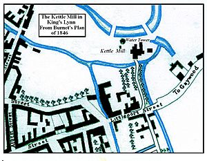
Kettle Watermill: A Historic Site
A very old mill once stood on the bend at the top of Kettlewell Lane. It was known as King's Lynn Kettle Watermill. The first records show that the building was once a place for people with leprosy.
Even though it was called a mill, Kettle Mill was probably never used for making things. But at one time, the water from the Gaywood River definitely powered it.
Water Supply for King's Lynn
The mill was called "Kettle Mill" because it originally used horses to power it. This was in the early 1400s. Its job was to pull water from the river using "kettle-like" containers. This water then supplied the town's fresh water pipes.
One of the first water pipes ran from Kettlemill down Damgate to Gresemarket. It also connected south to the Saturday marketplace. A Dutchman named Peter Morrys is said to have invented this system. His system was used in King's Lynn, Hull, and even London.
Old Water Pipes
Many old wooden pipes from this system were found near Marble Arch in London. Elm wood was preferred because it could handle the water and pressure better than other woods.
However, this system was later found to be wasteful and unhealthy. The pipes and water pits were often too close to cesspools and drains. Some of these old tree pipes, dating from the early 1800s, have been found in New Conduit Street.
Later, Kettlemill was used as a power plant that burned coal to make electricity. Eventually, it was torn down to make space for the offices of the local Drainage Board.
The River's Final Stretch
At the south end of Kettlewell Lane, the river goes under the A148, Littleport Street. Then, it flows through a culvert (an underground pipe) under the main railway lines that lead to King's Lynn station.
The "Walks" and Other Mills
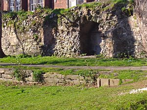
After the railway culvert, the river winds through the gardens and parkland known as the “Walks.” In this park, you can still see parts of the old town wall.
It's also believed that another watermill for grinding corn, called the Oyle Mil, was located here. The river then heads west again and reaches London Road. Another watermill, called Town Mill, is thought to have stood here.
This mill was probably a single-story stone building with a two-story house for the miller next to it. It might have been on the same spot as an even older mill called Swagges Mill. The Town Mill was likely taken down in the 1800s to make way for London Road.
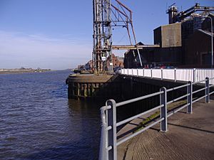
At this point, the river goes into another culvert. This culvert runs under Millfleet and then Stonegate Street. At the west end of Stonegate Street, the river comes out of the culvert. A short distance away, at the south end of the South Quay, the Gaywood River flows into the River Great Ouse.
 | Ernest Everett Just |
 | Mary Jackson |
 | Emmett Chappelle |
 | Marie Maynard Daly |


