Generals Highway facts for kids
Quick facts for kids Generals Highway |
|
|---|---|
|
Generals Highway highlighted in green
|
|
| Route information | |
| Length | 32.5 mi[1] (52.3 km) |
| Major junctions | |
| South end | |
| North end | |
| Location | |
| Counties: | Tulare |
The Generals Highway is a special road in California. It connects two important state routes, State Route 180 and State Route 198. This highway travels through beautiful Sequoia National Park, Giant Sequoia National Monument, and Kings Canyon National Park. These parks are located in the amazing Sierra Nevada mountains. Because the highway is inside national parks, the United States government takes care of it. It is not maintained by the state of California.
Exploring the Generals Highway
The Generals Highway gets its name from two of the world's largest trees. These are the famous General Sherman and General Grant trees. Both are giant sequoia trees.
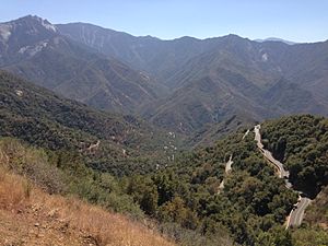
This highway is known for being very steep and narrow. It also has many winding turns. Driving can be difficult, especially in the southern part. This section goes from Hospital Rock to Giant Forest in Sequoia National Park. This part of the road has many sharp turns called switchbacks. Drivers must go very slowly here, with a speed limit of just 10 miles per hour.
There are rules about how long vehicles can be on this road. Vehicles should not be longer than 40 feet (about 12 meters). However, it is not recommended for vehicles longer than 22 feet (about 6.7 meters). This recommendation applies to the section between Potwisha Campground and the Giant Forest Museum.
Where the Highway Starts and Ends
The Generals Highway begins where SR 198 officially ends. This is at the southern edge of Sequoia National Park. The road then travels northeast, following the middle fork of the Kaweah River. It enters Sequoia National Park through the Indian Head Entrance.
Near the Hospital Rock turnout, the road turns north. It then goes through several turns before heading northeast again. This part of the highway passes close to the famous General Sherman Tree. At Lodgepole Bridge, the road turns west, then later turns north.
The Generals Highway leaves Sequoia National Park through the North Entrance. It then enters Sequoia National Forest. The road continues northwest through Giant Sequoia National Monument. Finally, it travels along the northern border of Kings Canyon National Park. It briefly enters this park before ending at SR 180.
History of the Road
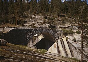
The Generals Highway has a rich history. Two of its beautiful stone bridges are very old. These bridges are so important that they are listed on the National Register of Historic Places. This means they are protected because of their historical value.
 | James B. Knighten |
 | Azellia White |
 | Willa Brown |


