Glassford Peak facts for kids
Quick facts for kids Glassford Peak |
|
|---|---|
| Highest point | |
| Elevation | 11,602 ft (3,536 m) |
| Prominence | 1,762 ft (537 m) |
| Listing | Mountain peaks of Idaho |
| Geography | |
| Location | Custer County, Idaho, U.S. |
| Parent range | Boulder Mountains |
| Topo map | USGS Ryan Peak |
| Climbing | |
| Easiest route | Simple scramble, class 2 |
Glassford Peak is a tall and impressive mountain located in Idaho, United States. It stands at 11,602 feet (about 3,536 meters) above sea level. This makes it the third highest peak in the Boulder Mountains and the 39th highest mountain in all of Idaho!
Location of Glassford Peak
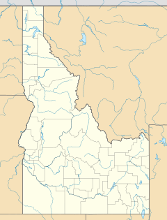
Glassford Peak is found in Custer County, Idaho, a beautiful part of central Idaho. It is part of the Hemingway–Boulders Wilderness. This wilderness area is a protected natural space. It is also within the Sawtooth National Recreation Area. This area is known for its stunning mountain views and outdoor activities. Glassford Peak is located very close to the border of Blaine County, Idaho. It is only about 0.55 miles (0.89 kilometers) north of the county line.
Visiting Glassford Peak
People who want to visit Glassford Peak usually start their journey from Idaho State Highway 75. This highway runs between the towns of Stanley and Challis. It is generally easier to reach the peak from the south side of this highway. However, you can also get to the peak from the north side of State Highway 75. This northern route is closer to the town of Ketchum. The easiest way to climb Glassford Peak is by a simple scramble. A scramble means climbing over rocks and uneven ground using both your hands and feet. It is not as difficult as rock climbing, but it still requires care.
 | Audre Lorde |
 | John Berry Meachum |
 | Ferdinand Lee Barnett |


