
Glen Lyon, Pennsylvania facts for kids
Quick facts for kids
Glen Lyon, Pennsylvania
|
|
|---|---|
.jpg)
Houses in Glen Lyon
|
|

Glen Lyon, Pennsylvania
Location in Pennsylvania

Glen Lyon, Pennsylvania
Location in the United States
|
|
| Country | United States |
| State | Pennsylvania |
| County | Luzerne |
| Township | Newport |
| Area | |
| • Total | 3.77 sq mi (9.78 km2) |
| • Land | 3.59 sq mi (9.31 km2) |
| • Water | 0.18 sq mi (0.47 km2) |
| Population
(2020)
|
|
| • Total | 1,877 |
| • Density | 522.26/sq mi (201.67/km2) |
| Time zone | UTC-5 (Eastern (EST)) |
| • Summer (DST) | UTC-4 (EDT) |
| ZIP code |
18617
|
| Area code(s) | 570 |
| FIPS code | 42-29680 |
Glen Lyon is a small community in Newport Township, Pennsylvania, in the United States. It's called a "census-designated place" (CDP), which means it's a special area defined by the government for counting people. In 2020, about 1,877 people lived there.
Contents
History of Glen Lyon
Glen Lyon started as a town around 1869. This was when people began mining anthracite coal in Newport Township. A company called Susquehanna Coal Company, owned by the Pennsylvania Railroad, ran the coal mine.
Early Names and Transport
The western part of the community was first known as Morgantown. The eastern part was called Williamstown. Later, a train station named Glen Lyon Rail Station was built. The whole town then took the name Glen Lyon. A section on the east side, separated by the railroad, even got the nickname "Canada."
Roads and a streetcar line connected Glen Lyon to nearby towns like Nanticoke and Wilkes-Barre. Over time, buses and cars replaced the streetcars as the main way to travel.
Coal Mining Operations
A hill divided the community into two parts. A coal mine shaft, called Sixth Shaft, was built on this hill. Coal from this mine was moved across a bridge to a breaker. A breaker is a large building where coal is cleaned and sorted. The Glen Lyon breaker was built in 1887.
Inside the breaker, gravity helped move the coal through different steps. The cleaned coal then came out the north end. From there, it was loaded onto train cars and trucks. Another coal mine, the Seventh Shaft colliery, operated west of Glen Lyon.
People and Community Life
The first miners in Glen Lyon were mostly Welsh and Protestant. Many of them belonged to the Methodist church. There was a small Methodist church on Market Street. Later, many immigrants came from Central Europe (like Poland) and Southern Europe.
Two Polish Catholic churches, Saint Adalbert's and Saint Michael's, were started in the late 1800s. These churches were built on the west side of the coal breaker. Other European miners and their families were part of Ukrainian or "Byzantine Rite" churches on the east side of town.
For a long time, a company-run store served the community, but it closed in the 1920s. Other shops and stores were built on Nanticoke Street (later Main Street). These stores provided food and supplies. Many small taverns also existed throughout the town. The miners in Glen Lyon were very active in forming unions, and they eventually joined the United Mine Workers.
Decline of Mining and Changes
After World War II, coal mining started to decline. The M. A. Hanna Company closed the Seventh Shaft mine. However, the Sixth Shaft and its breaker stayed open until the 1960s. The breaker finally closed in 1971 and later burned down in October 1974.
The end of deep mining in Northeastern Pennsylvania after a big mining accident in 1959, known as the Knox Mine Disaster, also hurt the town. Some strip mining (mining coal from the surface) continued for a few years. Small factories that made dresses provided jobs, mostly for women, when mining was slowing down. But these factories also closed later.
As mining declined, many businesses closed, and more houses became empty. Many older people who had retired made up a large part of the population. The Roman Catholic churches slowly combined, and St. Michael's church was taken down around 2004. St. Dennis, which was known as the "Irish" church, became owned by the Knights of Columbus.
Glen Lyon was even used as a setting in a movie! It was called "Coaltown" in the 1948 film The Miracle of the Bells, and some outdoor scenes were filmed there.
Geography
Glen Lyon is located at 41°10′32″N 76°4′28″W / 41.17556°N 76.07444°W.
The area of Glen Lyon is about 3.4 square miles (8.8 square kilometers). Most of this area, about 3.3 square miles (8.5 square kilometers), is land. The rest, about 0.1 square miles (0.26 square kilometers), is water.
Population Information
| Historical population | |||
|---|---|---|---|
| Census | Pop. | %± | |
| 2000 | 1,881 | — | |
| 2010 | 1,873 | −0.4% | |
| 2020 | 1,877 | 0.2% | |
| U.S. Decennial Census | |||
In 2000, there were 1,881 people living in Glen Lyon. This included 828 households and 494 families. The population density was about 563.5 people per square mile.
About 26.8% of households had children under 18 living with them. Around 38.9% were married couples. About 34.7% of all households were made up of single individuals. Also, 20.4% of households had someone living alone who was 65 years old or older. The average household had 2.27 people.
The population was spread out by age:
- 23.0% were under 18 years old.
- 9.1% were between 18 and 24.
- 28.6% were between 25 and 44.
- 20.5% were between 45 and 64.
- 18.8% were 65 years or older.
The median age in Glen Lyon was 37 years. For every 100 females, there were about 92.5 males.
Notable people
- Bob Duliba, a baseball player
- Tess Gardella, a Broadway entertainer
Gallery
-
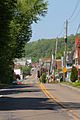
Glen Lyon from the east
-
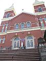
Church in Glen Lyon
-
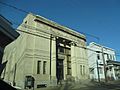
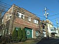
Bank in Glen Lyon
-
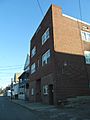
Glen Lyon
-
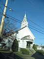
Church in Glen Lyon
-
Glen Lyon

.jpg)
.jpg)
.jpg)
.jpg)
.jpg)
See also
 In Spanish: Glen Lyon para niños
