Golden City, Missouri facts for kids
Quick facts for kids
Golden City, Missouri
|
|
|---|---|

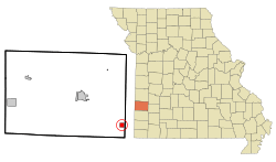
Location of Golden City, Missouri
|
|
| Country | United States |
| State | Missouri |
| County | Barton |
| Township | Golden City |
| Area | |
| • Total | 1.04 sq mi (2.68 km2) |
| • Land | 1.03 sq mi (2.68 km2) |
| • Water | 0.00 sq mi (0.00 km2) |
| Elevation | 1,060 ft (320 m) |
| Population
(2020)
|
|
| • Total | 656 |
| • Density | 633.82/sq mi (244.81/km2) |
| Time zone | UTC-6 (Central (CST)) |
| • Summer (DST) | UTC-5 (CDT) |
| ZIP code |
64748
|
| Area code(s) | 417 |
| FIPS code | 29-27676 |
| GNIS feature ID | 2394923 |
| Website | www.goldencitymo.com |
Golden City is a city located in Barton County, Missouri, in the United States. It is part of Golden City Township. In 2020, about 656 people lived there.
Contents
History of Golden City
Golden City was started in 1867. It was an important stop on the Butterfield Stagecoach Line, which was a route for horse-drawn carriages carrying mail and passengers across the country. The city got its name from a nearby area called Golden Grove.
Some people believe the name came from early settlers who thought old Native American flint mines were actually Spanish gold mines. The city's layout was officially mapped out again in 1870. A local newspaper, the Golden City Herald, served the community for many years, from 1881 until 1972.
2019 Tornado Event
On May 22, 2019, a very strong tornado, rated as an EF-3, hit Golden City around 9:30 PM. This severe storm caused a lot of damage to the city. Sadly, some people lost their lives, and many homes were completely destroyed. The community worked hard to recover from this tragic event.
Geography of Golden City
Golden City covers an area of about 1.03 square miles (2.68 square kilometers), and all of it is land. The city is located in the middle of Missouri's Tall Grass Prairie country. This means the area has wide-open spaces with tall grasses.
Several special preserved prairies are close to Golden City. These include the Golden Prairie, the Cook Meadow, and the Pennsylvania Prairie. They help protect the natural environment and wildlife of the region.
Population and People
| Historical population | |||
|---|---|---|---|
| Census | Pop. | %± | |
| 1880 | 139 | — | |
| 1890 | 773 | 456.1% | |
| 1900 | 875 | 13.2% | |
| 1910 | 882 | 0.8% | |
| 1920 | 899 | 1.9% | |
| 1930 | 828 | −7.9% | |
| 1940 | 867 | 4.7% | |
| 1950 | 839 | −3.2% | |
| 1960 | 714 | −14.9% | |
| 1970 | 810 | 13.4% | |
| 1980 | 900 | 11.1% | |
| 1990 | 794 | −11.8% | |
| 2000 | 884 | 11.3% | |
| 2010 | 765 | −13.5% | |
| 2020 | 656 | −14.2% | |
| U.S. Decennial Census | |||
Golden City in 2010
According to the census from 2010, there were 765 people living in Golden City. These people lived in 325 households, and 197 of these were families. The city had about 743 people per square mile.
About 30% of the households had children under 18 living there. Many households were married couples living together. The average household had about 2.34 people.
The average age of people in Golden City was 38.5 years. About 25% of the residents were under 18 years old. Around 18% of the people were 65 years or older. There were slightly more males (52.3%) than females (47.7%) in the city.
Education in Golden City
The public schools in Golden City are managed by the Golden City R-III School District. This district runs one elementary school and Golden City High School.
Golden City also has a public library. It is a part of the larger Barton County Library system.
See also
 In Spanish: Golden City (Misuri) para niños
 | Selma Burke |
 | Pauline Powell Burns |
 | Frederick J. Brown |
 | Robert Blackburn |

