Gorllwyn facts for kids
Quick facts for kids Gorllwyn |
|
|---|---|

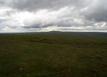
Drygarn Fawr from the Gorllwyn plateau
|
|
| Highest point | |
| Elevation | 613 m (2,011 ft) |
| Prominence | 88 m (289 ft) |
| Parent peak | Drygarn Fawr |
| Listing | Hewitt, Nuttall |
| Naming | |
| Language of name | Welsh |
| Geography | |
| Location | Powys, Wales |
| Parent range | Cambrian Mountains |
| OS grid | SN862584 |
| Topo map | OS Landranger 147 |
Gorllwyn is a mountain peak found in the heart of Wales. It is part of the Cambrian Mountains, a beautiful range of hills and mountains that stretch across much of central Wales. Gorllwyn is known as a "subsidiary summit," which means it's a smaller peak that is connected to a larger, main mountain, in this case, Drygarn Fawr.
This mountain sits on a wide, flat area called a plateau, which is often covered in moorland. It's a very remote and peaceful place, far from busy towns and roads.
Contents
Gorllwyn: A Mountain in Wales
Gorllwyn might not be the tallest mountain in Wales, standing at 613 metres (about 2,011 feet) above sea level. However, it's an important part of the landscape. It's listed as both a Hewitt and a Nuttall. These are special lists for hillwalkers and climbers who like to explore different peaks across the UK.
Where is Gorllwyn Located?
Gorllwyn is located in Powys, a large county in central Wales. It is part of the Cambrian Mountains, which are sometimes called the "backbone of Wales." This area is famous for its wild, open spaces and stunning natural beauty. The exact location of Gorllwyn can be found using a grid reference: SN862584.
What is a Mountain Plateau?
Gorllwyn's summit is on a plateau. A plateau is like a large, flat tableland that is much higher than the land around it. The plateau where Gorllwyn sits is a moorland area. Moorland is a type of habitat with low-growing plants like heather and grasses. It often has wet, spongy ground called peat bog. Peat bog forms over thousands of years from dead plants that don't fully decay due to the wet conditions.
What Can You Find on the Summit?
When you reach the top of Gorllwyn, you'll find a few interesting features. The summit itself is mostly grassy. There is a "shelter cairn," which is a pile of stones built to provide a little protection from the wind. It's a good spot to take a break and enjoy the views.
You will also see a "trig point." A trig point is a concrete pillar used by surveyors to help map the land accurately. They are found on many hilltops across the UK and are often a sign that you've reached the highest point.
Exploring the Area Around Gorllwyn
To the west of Gorllwyn, you can see its parent peak, Drygarn Fawr. Drygarn Fawr is easy to spot because it has very large piles of stones, also known as cairns, on its summit. These cairns make it stand out in the otherwise flat and open plateau.
A pass called Bwlch y Ddau Faen separates Gorllwyn from Drygarn Fawr. A pass is a lower area between two mountains, often used as a route for walking or travel. To the east, the plateau continues towards another area called Y Gamriw. Even further east, you can see the Radnor Forest, which is a large area of hills and woodlands.
 | Stephanie Wilson |
 | Charles Bolden |
 | Ronald McNair |
 | Frederick D. Gregory |

