Granby, Missouri facts for kids
Quick facts for kids
Granby, Missouri
|
|
|---|---|
 |
|

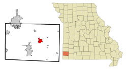
Location of Granby, Missouri
|
|
| Country | United States |
| State | Missouri |
| County | Newton |
| Area | |
| • Total | 4.43 sq mi (11.47 km2) |
| • Land | 4.42 sq mi (11.46 km2) |
| • Water | 0.01 sq mi (0.01 km2) |
| Elevation | 1,171 ft (357 m) |
| Population
(2020)
|
|
| • Total | 2,050 |
| • Density | 463.38/sq mi (178.92/km2) |
| Time zone | UTC-6 (Central (CST)) |
| • Summer (DST) | UTC-5 (CDT) |
| ZIP code |
64844
|
| Area code(s) | 417 |
| FIPS code | 29-28108 |
| GNIS feature ID | 2394948 |
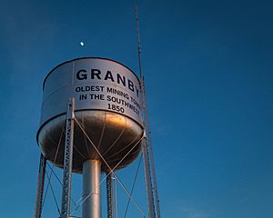
Granby is a city located in Newton County, Missouri, United States. In 2010, about 2,134 people lived there. It is part of the larger Joplin Metropolitan Area.
Contents
Discovering Granby's Past
A post office opened in Granby in 1856. The city got its name from a town called Granby, Massachusetts.
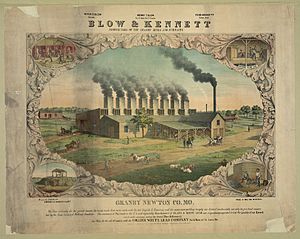
For many years, mining was the main activity in Granby. Around the year 1900, there was a large metal factory here. It was owned by a person named Henry Taylor Blow. This factory helped process the metals found in the area.
Exploring Granby's Geography
Granby is located at 36°55′04″N 94°15′39″W / 36.91778°N 94.26083°W.
The city covers a total area of about 4.43 square miles (11.47 square kilometers). Most of this area, about 4.42 square miles (11.46 square kilometers), is land. Only a very small part, about 0.01 square miles (0.01 square kilometers), is water.
In the early 1900s, Granby was a big center for mining lead and zinc. This was part of the Tri-State district, a large mining region. Today, you won't see many "chat piles" left. These were large hills of waste rock from the mining process.
Understanding Granby's Population
| Historical population | |||
|---|---|---|---|
| Census | Pop. | %± | |
| 1880 | 1,882 | — | |
| 1890 | 1,400 | −25.6% | |
| 1900 | 1,400 | 0.0% | |
| 1910 | 2,315 | 65.4% | |
| 1920 | 2,442 | 5.5% | |
| 1930 | 1,736 | −28.9% | |
| 1940 | 1,445 | −16.8% | |
| 1950 | 1,455 | 0.7% | |
| 1960 | 1,670 | 14.8% | |
| 1970 | 1,808 | 8.3% | |
| 1980 | 1,678 | −7.2% | |
| 1990 | 1,908 | 13.7% | |
| 2000 | 2,121 | 11.2% | |
| 2010 | 2,134 | 0.6% | |
| 2020 | 2,050 | −3.9% | |
| U.S. Decennial Census | |||
What the 2010 Census Showed
The census in 2010 counted 2,134 people living in Granby. There were 821 households, which are groups of people living together. About 573 of these were families.
The city had about 483 people per square mile. Most of the people living in Granby were White (92.5%). There were also smaller numbers of African American, Native American, and Asian residents. Some people identified with two or more races. About 1.7% of the population was Hispanic or Latino.
Many households (36.4%) had children under 18 living there. About 48% of households were married couples. The average household had about 2.54 people. The average family had about 3.05 people.
The average age of people in Granby was 36 years old. About 28% of residents were under 18. Around 15.3% were 65 years old or older. The population was almost evenly split between males (48.8%) and females (51.2%).
See also
 In Spanish: Granby (Misuri) para niños
 | Charles R. Drew |
 | Benjamin Banneker |
 | Jane C. Wright |
 | Roger Arliner Young |


