Grandfield, Oklahoma facts for kids
Quick facts for kids
Grandfield, Oklahoma
|
|
|---|---|
 |
|
| Motto(s):
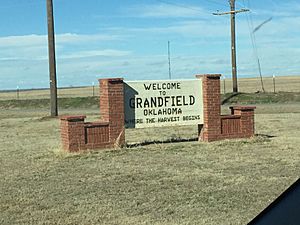
Where the Harvest Begins
|
|

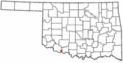
Location of Grandfield, Oklahoma
|
|
| Country | United States |
| State | Oklahoma |
| County | Tillman |
| Area | |
| • Total | 0.83 sq mi (2.16 km2) |
| • Land | 0.83 sq mi (2.16 km2) |
| • Water | 0.00 sq mi (0.00 km2) |
| Elevation | 1,122 ft (342 m) |
| Population
(2020)
|
|
| • Total | 919 |
| • Density | 1,101.92/sq mi (425.22/km2) |
| Time zone | UTC-6 (Central (CST)) |
| • Summer (DST) | UTC-5 (CDT) |
| ZIP codes |
73546, 73553
|
| Area code | 580 |
| FIPS code | 40-30850 |
| GNIS feature ID | 2410636 |
Grandfield is a city in Tillman County, Oklahoma, United States. In 2020, about 919 people lived there. It is located about 30 miles southeast of Frederick, which is the county seat. Grandfield is found where two main roads meet: US Route 70 and Oklahoma State Highway 36.
Contents
History of Grandfield
The Big Pasture: A New Beginning
The Big Pasture was a large area of land, about 480,000 acres, in Oklahoma. It was the last part of Oklahoma to be settled. Native American tribes like the Quapaw, Choctaw, Chickasaw, Kiowa, Comanche, and Apache lived on or controlled this land at different times.
In December 1906, the Big Pasture became part of Oklahoma Territory. Then, from December 3 to December 15, 1909, the United States offered parts of this land to people who wanted to build homes and farms. This was called "homesteading." Over 100,000 people wanted to buy one of the 1,830 available plots of land!
Before the land was opened, the U.S. government planned five official towns. Only one of them, Randlett, still exists today. Eschiti was the town closest to where Grandfield is now.
How Grandfield Was Founded
Things got tricky when the Wichita Falls and Northwestern Railroad decided to build its tracks two miles away from Eschiti. This led to a new town, Kell City, popping up along the railroad.
By 1907, Eschiti had a post office, but Kell City had the important railroad. Both towns wanted new settlers and businesses. To solve this, a Baptist minister named Reverend Andrew J. Tant teamed up with Frank Kell, who was involved with the railroad.
They offered free land lots to businesses, churches, and schools if they moved to Tant's farm. This farm was very close to Kell City, so many people and businesses moved there. People even saw houses being moved across the land! One early settler said she cooked breakfast in Eschiti and dinner in Grandfield without leaving her house.
The town needed a post office. A committee asked Assistant Postmaster General Charles P. Grandfield for help. He agreed, and the town was named in his honor. On January 16, 1909, Grandfield officially became a city. Its post office opened on January 21, 1909. By 1910, 830 people lived there.
The first residents of Grandfield came from many different places, including Kentucky, Tennessee, Kansas, Missouri, Arkansas, and Texas. Many new immigrants from Europe also made Grandfield their home.
Grandfield's Oil Boom
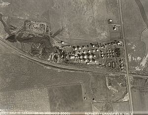
Two oil fields were found near Grandfield: the Northwest Oil Field and the Red River Oil Field. The oil industry became very important to Grandfield. When the Bell Oil and Refinery Company closed its refinery in the 1960s, it led to a decrease in the city's population.
Grandfield's Geography and Climate
Where Grandfield Is Located
According to the United States Census Bureau, Grandfield covers about 0.8 square miles (2.16 square kilometers) of land. There is no water area within the city limits.
Grandfield's Weather
| Climate data for Grandfield, Oklahoma | |||||||||||||
|---|---|---|---|---|---|---|---|---|---|---|---|---|---|
| Month | Jan | Feb | Mar | Apr | May | Jun | Jul | Aug | Sep | Oct | Nov | Dec | Year |
| Record high °F (°C) | 86 (30) |
92 (33) |
99 (37) |
103 (39) |
111 (44) |
116 (47) |
113 (45) |
115 (46) |
113 (45) |
105 (41) |
88 (31) |
85 (29) |
116 (47) |
| Mean daily maximum °F (°C) | 52 (11) |
56 (13) |
64 (18) |
74 (23) |
83 (28) |
92 (33) |
97 (36) |
97 (36) |
88 (31) |
77 (25) |
63 (17) |
52 (11) |
75 (24) |
| Daily mean °F (°C) | 39 (4) |
43 (6) |
51 (11) |
60 (16) |
70 (21) |
79 (26) |
84 (29) |
83 (28) |
75 (24) |
63 (17) |
50 (10) |
40 (4) |
61 (16) |
| Mean daily minimum °F (°C) | 25 (−4) |
29 (−2) |
37 (3) |
46 (8) |
57 (14) |
66 (19) |
70 (21) |
69 (21) |
61 (16) |
49 (9) |
37 (3) |
27 (−3) |
48 (9) |
| Record low °F (°C) | −9 (−23) |
−5 (−21) |
5 (−15) |
20 (−7) |
34 (1) |
46 (8) |
53 (12) |
50 (10) |
34 (1) |
16 (−9) |
12 (−11) |
−13 (−25) |
−13 (−25) |
Grandfield's Population
| Historical population | |||
|---|---|---|---|
| Census | Pop. | %± | |
| 1910 | 830 | — | |
| 1920 | 1,990 | 139.8% | |
| 1930 | 1,416 | −28.8% | |
| 1940 | 1,116 | −21.2% | |
| 1950 | 1,232 | 10.4% | |
| 1960 | 2,606 | 111.5% | |
| 1970 | 1,524 | −41.5% | |
| 1980 | 1,445 | −5.2% | |
| 1990 | 1,224 | −15.3% | |
| 2000 | 1,110 | −9.3% | |
| 2010 | 1,038 | −6.5% | |
| 2020 | 919 | −11.5% | |
| U.S. Decennial Census | |||
In 2000, there were 1,110 people living in Grandfield. These people lived in 434 households, and 295 of these were families. The city had about 1,388 people per square mile.
About 25.9% of the people in Grandfield were under 18 years old. About 19.5% were 65 years or older. The average age of people in the city was 38 years.
Grandfield High School Sports
Grandfield High School has a proud history in sports!
- The football team won the Oklahoma Class C Championship in 1948 and 1958.
- Later, playing 8-man football, they won two more Class C state championships in 1992 and 1993.
- The Girls Basketball team also won a state championship in 1968.
A famous player named Kenneth Johnson played for the Boys Basketball team. In 1979, he set an Oklahoma state record by scoring 105 points in one game! He also holds state records for the most points in a single season (1,280 points in 1978-79) and the most points in his entire high school career (3,191 points).
Historic Places in Grandfield
Several places in Grandfield are listed on the National Register of Historic Places. This means they are important historical sites. These include:
- The Grandfield Downtown Historic District
- The William and Mabel Donahoo Hubbard House
- The Humphreys Drugstore Building
- The Rock Island Depot
- The Tillman County Bank of Grandfield
See also
 In Spanish: Grandfield (Oklahoma) para niños


