Granite Peak (Montana) facts for kids
Quick facts for kids Granite Peak |
|
|---|---|
 |
|
| Highest point | |
| Elevation | 12,807 ft (3,904 m) NAVD 88 |
| Prominence | 4,759 ft (1,451 m) |
| Listing | U.S. state high point 10th |
| Geography | |
| Parent range | Beartooth Mountains |
| Topo map | USGS Granite Peak |
| Climbing | |
| First ascent | 1923 by Elers Koch |
| Easiest route | Southwest Couloir (class 3 scramble) |
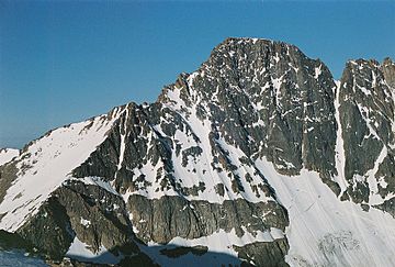
Granite Peak is the highest natural point in the state of Montana. It stands at an elevation of 12,807 feet (3,904 m) above sea level. This makes it the tenth-highest state high point in the United States.
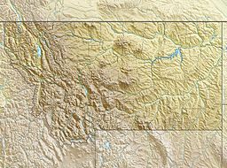
Granite Peak is located in the Absaroka-Beartooth Wilderness. This wilderness area is found in Park County. The peak is also very close to the borders of Stillwater County and Carbon County. It is about 10 miles (16 km) north of the Wyoming border. The city of Columbus, Montana is about 45 miles (72 km) southwest of the peak.
Contents
Climbing Granite Peak
Granite Peak is known for being a very challenging mountain to climb. Many people consider it the second most difficult state high point to climb in the U.S. Only Denali in Alaska is thought to be harder.
Why is it difficult?
Climbing Granite Peak is tough for a few reasons. It requires technical climbing skills, meaning you might need special gear. The weather can also be very bad and change quickly. Plus, finding the right path to the top can be tricky.
First successful climb
The first time anyone successfully climbed Granite Peak was on August 29, 1923. The climbers were Elers Koch, James C. Whitham, and R.T. Ferguson. Before them, many others had tried but failed. Granite Peak was the last of all the U.S. state high points to be climbed.
Popular climbing routes
Today, most climbers take two or three days to reach the top of Granite Peak. They often stop and camp overnight on the Froze-to-Death Plateau. Some very experienced climbers can even make it to the summit and back in just one day.
Another route that has become popular is the Southwest Couloir route. This path starts near Cooke City. It is considered a non-technical route, meaning it doesn't usually require special climbing equipment. Climbers using this route typically take two days to finish their trip.
See also
 In Spanish: Pico Granito para niños
 | Calvin Brent |
 | Walter T. Bailey |
 | Martha Cassell Thompson |
 | Alberta Jeannette Cassell |


