Gravale facts for kids
Quick facts for kids Gravale |
|
|---|---|
| Droibhéal | |

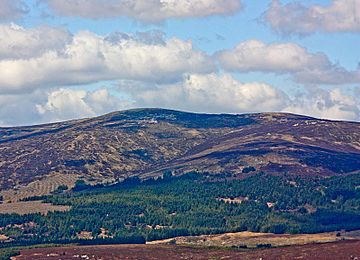
Gravale (highest) with Carrigvore (right) from SE
|
|
| Highest point | |
| Elevation | 718 m (2,356 ft) |
| Prominence | 123 m (404 ft) |
| Listing | 100 Highest Irish Mountains, Hewitt, Arderin, Simm, Vandeleur-Lynam |
| Naming | |
| English translation | difficult passage |
| Language of name | Irish |
| Geography | |
| Location | Wicklow, Republic of Ireland |
| Parent range | Wicklow Mountains |
| OSI/OSNI grid | O1049009420 |
| Topo map | OSi Discovery 56 |
| Geology | |
| Mountain type | Granite with microcline phenocrysts |
| Climbing | |
| Easiest route | from the Sally Gap, or along the R115 |
Gravale is a mountain in County Wicklow, Republic of Ireland. It stands at 718 metres (2,356 ft) tall. Its Irish name, Droibhéal, means "difficult passage". Gravale is one of the highest peaks in the Wicklow Mountains range.
This mountain is located in the middle part of the Wicklow Mountains. It sits on a long, wet ridge that runs from the Sally Gap. This ridge is like the "central spine" of the whole mountain range. Other mountains on this ridge include Carrigvore (682 metres (2,238 ft)) and Duff Hill (720 metres (2,360 ft)).
Gravale is ranked as the 79th highest mountain in Ireland on the Arderin scale. It is also the 98th highest on the Vandeleur-Lynam scale.
How High Does It Stand Out?
A mountain's 'prominence' is how much it rises above the land around it. Gravale has a prominence of 123 metres (404 ft). This means it stands out quite a bit from the surrounding hills.
Because of its prominence, Gravale is listed as the 45th highest mountain in Ireland. This ranking comes from a list called 100 Highest Irish Mountains. To be on this list, a mountain needs to have a prominence of at least 100 meters.
The Name of Gravale
The name "Gravale" has an interesting history. According to an expert named Paul Tempan, the Irish name "Drobeóil" is very old. It was mentioned in ancient Irish stories and poems called the Metrical Dinsenchas.
There's also a historical name for the dip between Gravale and Duff Hill. This area was known as "Lavarna" or "Lavarnia". This name comes from the Irish words "Leath-Bhearna", which means "half-gap". It was probably a tough path for people traveling between the Blessington lakes area and Lough Dan.
 | John T. Biggers |
 | Thomas Blackshear |
 | Mark Bradford |
 | Beverly Buchanan |


