Carrigvore facts for kids
Quick facts for kids Carrigvore |
|
|---|---|
| Carraig Mhór | |

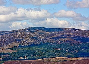
Gravale (highest) with Carrigvore (right) from SE
|
|
| Highest point | |
| Elevation | 682 m (2,238 ft) |
| Prominence | 67 m (220 ft) |
| Listing | Hewitt, Arderin, Simm, Vandeleur-Lynam |
| Naming | |
| English translation | big rock |
| Language of name | Irish |
| Geography | |
| Location | Wicklow, Republic of Ireland |
| Parent range | Wicklow Mountains |
| OSI/OSNI grid | O122101 |
| Topo map | OSi Discovery 56 |
| Geology | |
| Mountain type | Granite with microcline phenocrysts |
| Climbing | |
| Easiest route | from the Sally Gap, or along the R115 |
Carrigvore is a mountain in Ireland. Its name comes from the Irish language, Carraig Mhór, which means "big rock." This mountain stands at 682 meters (about 2,238 feet) tall.
Carrigvore is one of the highest peaks in Ireland. It is listed as the 111th highest on the Arderin scale. It is also the 134th highest on the Vandeleur-Lynam scale. These scales are ways to rank mountains by their height.
Contents
Exploring Carrigvore Mountain
Carrigvore is located in the middle part of the Wicklow Mountains. This mountain range is in County Wicklow, Republic of Ireland. It is a beautiful area, popular for hiking and exploring nature.
What is a Boggy Ridge?
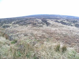
Carrigvore is part of a long, "boggy ridge." A ridge is a line of hills or mountains. This one runs from the Sally Gap towards Carrigvore. It then continues to other mountains like Gravale (718 meters) and Duff Hill (720 meters).
A "boggy" area means the ground is very wet and spongy. This is because it has a lot of peat. Peat is made from partly decayed plants. Walking on a boggy ridge can be a unique experience!
Nearby Mountains
After Carrigvore, the ridge connects to other tall peaks. These include Gravale and Duff Hill. These mountains are part of a larger group called a massif. A massif is a compact group of mountains.
The biggest mountain in this area is Mullaghcleevaun. It stands at 849 meters (about 2,785 feet). Carrigvore is a smaller part of this impressive mountain landscape.

How to Reach the Summit
One of the easiest ways to get to Carrigvore is from the Sally Gap. You can also start your hike from the R115 road. These routes offer great views of the surrounding Wicklow Mountains.
Hikers often enjoy the challenge of walking along the ridge. It connects several peaks, making for a long and rewarding journey. Always be prepared for wet conditions due to the boggy ground.
Geology of Carrigvore
Carrigvore is made of granite. Granite is a very hard type of rock. It forms deep underground from cooling magma. This granite also contains something called "microcline phenocrysts."
What are Microcline Phenocrysts?
Phenocrysts are large, noticeable crystals within a finer-grained rock. So, the granite of Carrigvore has bigger crystals of a mineral called microcline. These crystals make the rock look interesting. They show how the rock formed slowly over a long time.
The strong granite rock helps Carrigvore stand tall. It has resisted erosion for thousands of years. This is why it remains a prominent feature of the Wicklow Mountains.
 | Delilah Pierce |
 | Gordon Parks |
 | Augusta Savage |
 | Charles Ethan Porter |


