Greenhithe, New Zealand facts for kids
Quick facts for kids
Greenhithe
|
|
|---|---|
|
Suburb
|
|
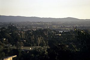
Greenhithe looking towards the Waitākere Ranges.
|
|
| Country | New Zealand |
| Local authority | Auckland |
| Electoral ward | Albany ward |
| Local board | Upper Harbour Local Board |
| Area | |
| • Land | 781 ha (1,930 acre) |
| Population
(June 2023)
|
|
| • Total | 8,860 |
| Postcode(s) |
0632
|
|
|
||
Greenhithe is a suburb in the northwest of Auckland, New Zealand. It is located on the North Shore. Long ago, Greenhithe was home to Tauhinu, a fortified pā (a Māori village with defenses). This pā belonged to the Te Kawerau ā Maki and Ngāti Whātua tribes. It was settled until the 1820s.
In the 1860s, the Forgham family started a community here. By the 1880s, Greenhithe became a major place for growing fruit for Auckland. Later, in the 1960s, building and repairing boats became important industries. Greenhithe grew into a suburb after the Auckland Harbour Bridge was built in 1959 and the Upper Harbour Bridge in 1975. The population of Greenhithe doubled between 2001 and 2018.
Contents
Why is it Called Greenhithe?
The name Greenhithe was given by an early settler, Henry James Blyth, in 1882. He named his house and orchards after Greenhithe, a village in Kent, England. This English village is on the River Thames, where Blyth used to keep his yacht before moving to New Zealand.
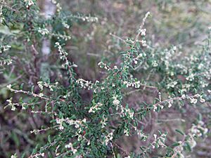
The Māori name for the area is Tauhinu. This name comes from the Tauhinu pā, which was named after a shrub called tauhinu. This plant was known for its special healing properties.
What is Greenhithe Like?
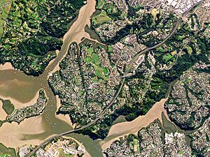
Greenhithe is a suburb on the North Shore of New Zealand. It's like a small land area surrounded by water on three sides. These waters are the Upper Waitematā Harbour, Lucas Creek, and Oruamo or Hellyers Creek. The highest part of Greenhithe is at the very south, where there are cliffs about 85 meters high.
A stream called Te Wharau Creek flows north through Greenhithe. It eventually becomes an estuary (where the river meets the sea) and flows into Lucas Creek. There's also a part of Greenhithe called Wainoni, which is around Wainoni Park. The suburb is divided by State Highway 18. This road, also known as the Upper Harbour Motorway, connects the North Shore to Hobsonville in West Auckland.
Long ago, the banks of Lucas Creek were covered in forests with many kauri trees. By the mid-1800s, the area had changed to scrubland, mostly with mānuka plants and ferns.
Greenhithe's Past
Māori History and Early Settlements
Most of what we know about Greenhithe's early Māori history comes from Whatarangi Ngati. She shared these stories in the early 1900s. Whatarangi knew a lot about the histories of the Ngāti Whanaunga, Ngāti Whātua, and Ngāti Pāoa tribes.
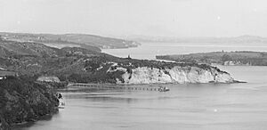
At Greenhithe, the Tauhinu pā was built on the southern cliffs of the area. This pā looked over the entrance to Oruamo or Hellyers Creek. There was also a village called Te Wharemoenanu (meaning "The House of Sleep Talking") to the west, near the entrance to Lucas Creek. Other important places had names too, like Te Wharauakae and Te Okoaratanga. There was also Ana Kororā, a place where kororā (little penguins) were caught. The water between Greenhithe and Herald Island was known as Wainoni.
Around the year 1700, the Tauhinu pā was attacked by Kapetaua from the Hauraki Gulf. Later, around 1740, the people of Tauhinu pā fought alongside Ngāti Whātua. The chief of Tauhinu, Pahauroa, was hurt and died during this time.
By the early 1800s, Greenhithe was one of the most populated areas on the North Shore by Tāmaki Māori people. However, in the 1820s, many Māori left the North Shore because of wars. A small group of Ngāti Whātua warriors stayed at Tauhinu pā. When people returned in the 1830s, Ngāti Whātua settled more in the Māngere-Onehunga area, and Te Kawerau ā Maki settled at Te Henga / Bethells Beach.
European Settlers Arrive
The Greenhithe area was part of a large piece of land bought by the New Zealand Government in the 1840s. Digging for kauri gum was a main way for European settlers to earn money in the late 1840s. The first land given to European settlers in Greenhithe was to the Gamble Brothers in 1854 and 1855.
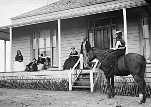
The first known person to live here permanently was George Deane. He bought land near Lucas Creek in 1858 and lived there with his wife. But it was hard to make a living, so they left in 1861. During this time, a part of Greenhithe was called Humbug Point by sailors. This was because of the many sand banks that made it difficult for ships to pass.
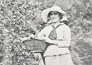
In the mid-1860s, Thomas and Mary Forgham came to Auckland. They started a self-sufficient community in Greenhithe. Their farmhouse was called Fern Bank. The Forghams grew fruit trees and raised animals. The name Greenhithe became popular in the 1880s. This was after Henry James Blyth took over the farm and renamed it. Fruit boxes sent to Auckland markets from the farm had "Greenhithe" written on them. By the late 1880s, growing apples, lemons, and pears was the main business.
Greenhithe started to grow as a rural community in the 1910s and 1920s. In 1908, Thomas Hunter started the first regular boat service to Auckland. The Greenhithe Hall was built in 1914, and the first store opened in 1917. By the 1920s, the Greenhithe Hall was the main place for social events. A fruit canning factory was also opened by the Jonkers family. In 1926, the population was 134, and it grew to 471 by 1951.
Greenhithe Becomes a Suburb
Greenhithe became much more connected to Auckland when the Auckland Harbour Bridge opened in 1959. Because of this, the Greenhithe ferry service stopped in 1960. In 1958, a boatyard opened, and boat repair became a big business. In the mid-1960s, Ferro Cement Ltd started making concrete boats. As other areas like Albany grew, most factories left Greenhithe.
Greenhithe saw another big growth in the 1970s after the Upper Harbour Bridge was built in 1975. In 1971, the population was 1,076, and by 1981, it had grown to 1,578. In 2002, the North Shore City Council decided Greenhithe should grow more. This led to a big increase in people living there. The population grew from 4,170 in 2001 to 7,613 in 2013.
In 2007, the Upper Harbour Motorway opened. This road created a direct link between West Auckland and the North Shore through Greenhithe.
Who Lives in Greenhithe?
Greenhithe covers about 7.81 square kilometers. As of 2023, about 8,907 people live here. The population has been growing steadily. In 2018, there were 8,592 people, and in 2013, there were 7,686.
The people living in Greenhithe come from many different backgrounds. About 63.6% are of European descent. There are also people of Māori (5.8%), Pasifika (2.1%), and Asian (33.5%) heritage. Many people in Greenhithe were born overseas, about 44.6% of the population. Most people speak English, but many other languages are also spoken.
Things to Do and See
- Greenhithe Community Hall: This is a community center that first opened in 1914. It's a place for local events.
- Greenhithe Village: This is the main shopping area in the suburb, located on Greenhithe Road.
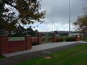
- Greenhithe War Memorial Park: A park created to remember those who served in World War II.
- North Shore Rowing Club: This club operates from Rame Road in Greenhithe, offering rowing activities.
- St Michael and All Angels Church: An Anglican church built in Greenhithe in 1956.
- Wainoni Park: A large park, about 40 hectares in size. It is home to Greenhithe FC (a football club), the Greenhithe Pony Club, and Greenhithe Riding for the Disabled.
Schools in Greenhithe
- Greenhithe School: This is a primary school for students in years 1–6. It opened as a small rural school in 1893. It has about 423 students.
- Upper Harbour Primary School: This is also a primary school for students in years 1–6. It opened more recently, in February 2006. It has about 334 students.
Famous People From Greenhithe
- Julie Chapman, who started the charity KidsCan.
- Olivia McTaggart, a talented pole vault athlete.
 | DeHart Hubbard |
 | Wilma Rudolph |
 | Jesse Owens |
 | Jackie Joyner-Kersee |
 | Major Taylor |


