Grove City, Minnesota facts for kids
Quick facts for kids
Grove City, Minnesota
|
|
|---|---|

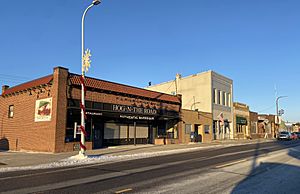
Atlantic Avenue businesses
|
|

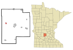
Location in Meeker County and the state of Minnesota
|
|
| Country | United States |
| State | Minnesota |
| County | Meeker |
| Area | |
| • Total | 0.66 sq mi (1.71 km2) |
| • Land | 0.61 sq mi (1.58 km2) |
| • Water | 0.05 sq mi (0.13 km2) |
| Elevation | 1,211 ft (369 m) |
| Population
(2020)
|
|
| • Total | 624 |
| • Density | 1,022.95/sq mi (394.95/km2) |
| Time zone | UTC-6 (CST) |
| • Summer (DST) | UTC-5 (CDT) |
| ZIP code |
56243
|
| Area code(s) | 320 |
| FIPS code | 27-26126 |
| GNIS feature ID | 0644499 |
Grove City is a small city in Meeker County, Minnesota, in the United States. In 2020, about 624 people lived there.
Contents
History of Grove City
Grove City started because of the railroad. In 1870, the St. Paul and Pacific Railway built a station near Acton Township. This was about two miles east of where Grove City is today.
There was also a post office called "Swede Grove" about one mile north. Having two different places caused confusion for people. So, the community asked the railroad to move the station to its current spot.
Grove City officially became a city in 1878. The name "Grove" came from the old "Swede Grove" post office. "City" was added to show the hopes people had for the town's future. The Grove City post office opened in 1879. It was one of the first businesses in the new town.
Many other businesses opened early on. These included grocery stores, hardware stores, and gas stations. There were also hotels, lumberyards, banks, and places like blacksmiths. The town even had a barrel factory and grain elevators. People could find restaurants, a shoe store, and a bakery too.
Geography of Grove City
Grove City is located in the western part of Meeker County, Minnesota. Two main roads pass through the northern side of the city. These are U.S. Highway 12 and Minnesota State Highway 4. They meet on Atlantic Avenue.
U.S. Highway 12 goes east about nine miles to Litchfield. Litchfield is the county seat of Meeker County. Highway 12 also goes west about 18 miles to Willmar. Minnesota State Highway 4 goes north about 17 miles to Paynesville. It also goes south about 15 miles to Cosmos.
The city covers about 0.66 square miles (1.71 square kilometers). Most of this area is land, about 0.61 square miles (1.58 square kilometers). A small part, about 0.05 square miles (0.13 square kilometers), is water. Grove City is part of the Grove Creek watershed. This creek flows northeast and joins the Middle Fork of the Crow River.
Education in Grove City
Grove City is home to ACGC High School. This school brings together students from three nearby cities. These cities are Atwater, Cosmos, and Grove City in Minnesota.
Population and People
Grove City's population has changed over the years. Here's how many people have lived there during different census counts:
| Historical population | |||
|---|---|---|---|
| Census | Pop. | %± | |
| 1880 | 230 | — | |
| 1890 | 349 | 51.7% | |
| 1900 | 316 | −9.5% | |
| 1910 | 351 | 11.1% | |
| 1920 | 388 | 10.5% | |
| 1930 | 372 | −4.1% | |
| 1940 | 447 | 20.2% | |
| 1950 | 481 | 7.6% | |
| 1960 | 466 | −3.1% | |
| 1970 | 531 | 13.9% | |
| 1980 | 596 | 12.2% | |
| 1990 | 547 | −8.2% | |
| 2000 | 608 | 11.2% | |
| 2010 | 635 | 4.4% | |
| 2020 | 624 | −1.7% | |
| U.S. Decennial Census 2020 Census |
|||
In 2010, the city had 635 people living in 268 households. Most residents were White, making up about 97% of the population. A small percentage of people were from other racial backgrounds. About 2.8% of the population identified as Hispanic or Latino.
The average age in Grove City in 2010 was about 35.6 years old. About 26.8% of the residents were under 18 years old. About 16.2% were 65 years or older. The city had slightly more females (52.4%) than males (47.6%).
See also
 In Spanish: Grove City (Minnesota) para niños
 | Ernest Everett Just |
 | Mary Jackson |
 | Emmett Chappelle |
 | Marie Maynard Daly |

