Guilford, Missouri facts for kids
Quick facts for kids
Guilford, Missouri
|
|
|---|---|

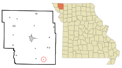
Location of Guilford, Missouri
|
|
| Country | United States |
| State | Missouri |
| County | Nodaway |
| Township | Washington |
| Area | |
| • Total | 0.07 sq mi (0.19 km2) |
| • Land | 0.07 sq mi (0.19 km2) |
| • Water | 0.00 sq mi (0.00 km2) |
| Elevation | 951 ft (290 m) |
| Population
(2020)
|
|
| • Total | 60 |
| • Density | 833.33/sq mi (323.67/km2) |
| Time zone | UTC-6 (Central (CST)) |
| • Summer (DST) | UTC-5 (CDT) |
| ZIP code |
64457
|
| Area code(s) | 660 |
| FIPS code | 29-29692 |
| GNIS feature ID | 2396980 |
Guilford is a small village located in the southeastern part of Nodaway County, Missouri, in the United States. It is situated near the Platte River. In 2020, the village had a population of 60 people, making it a very quiet and peaceful place to live.
Contents
A Look Back: Guilford's Story
Guilford was founded around the year 1856. The community got its name from a famous battle during the American Revolutionary War. This battle was called the Battle of Guilford Court House.
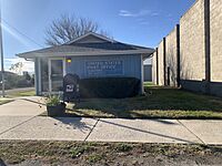
Before Guilford was officially named, there was a post office in the area called Carterville. It operated from 1853 to 1856. After that, the name changed to Guilford, and the post office has been open ever since.
Where is Guilford Located?
Guilford is found where two Missouri roads meet: Route M and Route AH. It's about half a mile east of the Platte River. The village is also about three miles north of the line that separates Nodaway County from Andrew County.
If you travel about 4.5 miles west on Route M, you will reach the community of Barnard. Another town, Whitesville, is about 7.5 miles south of Guilford.
According to the United States Census Bureau, Guilford covers a total area of about 0.19 square kilometers (or 0.07 square miles). All of this area is land, with no water.
Who Lives in Guilford?
| Historical population | |||
|---|---|---|---|
| Census | Pop. | %± | |
| 1880 | 67 | — | |
| 1900 | 235 | — | |
| 1910 | 207 | −11.9% | |
| 1920 | 273 | 31.9% | |
| 1930 | 201 | −26.4% | |
| 1940 | 227 | 12.9% | |
| 1950 | 164 | −27.8% | |
| 1960 | 125 | −23.8% | |
| 1970 | 105 | −16.0% | |
| 1980 | 87 | −17.1% | |
| 1990 | 93 | 6.9% | |
| 2000 | 87 | −6.5% | |
| 2010 | 85 | −2.3% | |
| 2020 | 60 | −29.4% | |
| U.S. Decennial Census | |||
In 2010, a count showed that 85 people lived in Guilford. These people lived in 36 different homes, and 23 of these were families. The village had 49 housing units in total.
All the people living in Guilford at that time were identified as White. About 25% of the homes had children under 18 living there. Many homes were married couples living together.
The average age of people in the village was about 38.5 years old. About 17.6% of residents were under 18. Also, 7.1% of the people were 65 years old or older. Slightly more males lived in Guilford (52.9%) than females (47.1%).
Learning in Guilford
For many years, Guilford was part of the South Nodaway R-IV School District. The village even had its own elementary school, which taught students from pre-kindergarten up to sixth grade. The older students, in grades 7 through 12, went to high school in Barnard, which is about five miles west of Guilford.
However, in May 2013, a change happened. All the students, from pre-kindergarten through 12th grade, began attending school in Barnard. This meant that the school building in Guilford was closed.
Famous Faces from Guilford
One notable person from Guilford is Jerry Wallace. He was a popular country and pop music singer. Some of his well-known songs include "Primrose Lane," "Shutters And Boards," "In The Misty Moonlight," and "If You Leave Me Tonight I'll Cry".
See also
 In Spanish: Guilford (Misuri) para niños
 | Precious Adams |
 | Lauren Anderson |
 | Janet Collins |


