Gumlog, Georgia facts for kids
Quick facts for kids
Gumlog, Georgia
G.M.D 213
|
|
|---|---|
 |
|
| Motto(s):
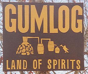
Land of Spirits
|
|

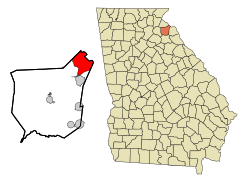
Location in Franklin County and the state of Georgia
|
|
| Country | United States |
| State | Georgia |
| County | Franklin |
| Area | |
| • Total | 16.11 sq mi (41.71 km2) |
| • Land | 13.49 sq mi (34.94 km2) |
| • Water | 2.62 sq mi (6.77 km2) |
| Elevation | 732 ft (223 m) |
| Population
(2020)
|
|
| • Total | 2,358 |
| • Density | 174.80/sq mi (67.49/km2) |
| Time zone | UTC-5 (Eastern (EST)) |
| • Summer (DST) | UTC-4 (EDT) |
| FIPS code | 13-35814 |
| GNIS feature ID | 1867242 |
Gumlog is a lovely lakeside community in Franklin County, Georgia, in the United States. It's called an "unincorporated area" because it doesn't have its own city government, but it's still a recognized place. It's also a "census-designated place," which means the government counts the people living there for official records. In 2020, about 2,358 people lived in Gumlog.
Contents
Where is Gumlog Located?
Gumlog is in the northeast part of Franklin County. It's right on the shores of Lake Hartwell, which is part of the Savannah River. The lake also forms the border between Georgia and South Carolina.
Gumlog is bordered by Stephens County to the northwest and Hart County to the southeast. The southern edge of Gumlog is close to Interstate 85. The city of Lavonia is right next to Gumlog's southwest corner. You can get to Gumlog from Interstate 85 by taking Exit 173.
Land and Water Areas
The Gumlog area covers about 41.6 square kilometers (16.1 square miles). Most of this area, about 34.8 square kilometers (13.5 square miles), is land. The rest, about 6.8 square kilometers (2.6 square miles), is water, mostly from Lake Hartwell.
Tugaloo State Park is a beautiful park located on a peninsula in Lake Hartwell, within the eastern part of Gumlog. It's a great place for outdoor activities!
Gumlog Road and Its History
Georgia Highway 328, also known as Gumlog Road, is the main road in and out of the community. It's about 10 miles long and crosses over a part of Lake Hartwell called Gumlog Cove.
Gumlog Road connects Highway 59 in Lavonia to Highway 17 in Avalon. Gumlog Creek also starts near Avalon. Interestingly, the town of Avalon was almost named "Gumlog" after Gumlog Creek, but the name was changed before it became official.
How Many People Live in Gumlog?
Gumlog first became a "census-designated place" in 1990. This means the government started counting its population separately then.
Here's how Gumlog's population has grown over the years:
- 1990: 1,436 people
- 2000: 2,025 people
- 2010: 2,146 people
- 2020: 2,358 people
Who Lives in Gumlog?
The United States Census Bureau collects information about the people living in different areas. Here's a look at the different groups of people who have lived in Gumlog over the years:
| Race / Ethnicity | Pop 2000 | Pop 2010 | Pop 2020 | % 2000 | % 2010 | 2020 |
|---|---|---|---|---|---|---|
| White (not Hispanic/Latino) | 1,872 | 1,951 | 2,106 | 92.44% | 90.91% | 89.31% |
| Black or African American (not Hispanic/Latino) | 89 | 113 | 83 | 4.40% | 5.27% | 3.52% |
| Native American or Alaska Native (not Hispanic/Latino) | 17 | 6 | 0 | 0.84% | 0.28% | 0.00% |
| Asian (not Hispanic/Latino) | 0 | 7 | 5 | 0.00% | 0.33% | 0.21% |
| Pacific Islander (not Hispanic/Latino) | 0 | 0 | 0 | 0.00% | 0.00% | 0.00% |
| Some Other Race (not Hispanic/Latino) | 3 | 0 | 10 | 0.15% | 0.00% | 0.42% |
| Mixed Race or Multi-Racial (not Hispanic/Latino) | 13 | 40 | 81 | 0.64% | 1.86% | 3.44% |
| Hispanic or Latino (any race) | 31 | 29 | 73 | 1.53% | 1.35% | 3.10% |
| Total | 2,025 | 2,146 | 2,358 | 100.00% | 100.00% | 100.00% |
See also
 In Spanish: Gumlog para niños
 | Selma Burke |
 | Pauline Powell Burns |
 | Frederick J. Brown |
 | Robert Blackburn |

