Gunter, Texas facts for kids
Quick facts for kids
Gunter, Texas
|
|
|---|---|
| Motto(s):
"Tough People Win"
|
|

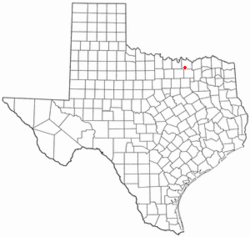
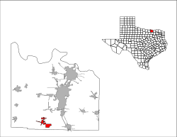
Location of Gunter, Texas
|
|
 |
|
| Country | United States |
| State | Texas |
| County | Grayson |
| Area | |
| • Total | 17.70 sq mi (45.85 km2) |
| • Land | 17.59 sq mi (45.56 km2) |
| • Water | 0.11 sq mi (0.29 km2) |
| Elevation | 676 ft (206 m) |
| Population
(2020)
|
|
| • Total | 2,060 |
| • Density | 95.22/sq mi (36.77/km2) |
| Time zone | UTC-6 (Central (CST)) |
| • Summer (DST) | UTC-5 (CDT) |
| ZIP code |
75058
|
| Area code(s) | 903, 430 |
| FIPS code | 48-31616 |
| GNIS feature ID | 2410676 |
Gunter is a small city in the southwestern part of Grayson County, Texas, United States. In 2020, about 2,060 people lived there. This was an increase from 1,498 people in 2010. Gunter is part of the larger Sherman–Denison metropolitan area.
Contents
History of Gunter
Gunter was started in 1902. The Gunter family gave 328 acres (about 1.3 square kilometers) of land for the town. This land was near where State Highway 289 and Farm to Market Road 121 are today.
The first house was built in 1903 by Albert Earthman. He later started the First National Bank in Gunter. Another bank, the First State Bank, also opened.
Early Challenges and Growth
Gunter grew steadily for a while. But in 1924, the First State Bank closed. This caused many businesses and farmers to lose their money. The Great Depression, a time of economic hardship in the 1930s, also hurt the town. Two big fires in 1930 and 1948 caused more damage.
Recent Growth and Development
Gunter's population started to grow again in the 1950s. It saw its biggest growth in the 1990s, increasing by 37 percent. More recently, people from the northern Dallas-Fort Worth area have started moving to Gunter. This is because Gunter is on State Highway 289. It is also close to Celina, Sherman, Denison, and Lake Texoma.
In 2002, a new bank, Landmark Bank, opened in Gunter. This was the first bank in the town in almost 90 years.
Geography and Location
Gunter is located in the southwestern part of Grayson County. State Highway 289 goes north from Gunter to Sherman. Sherman is about 18 miles (29 km) away and is the main city of the county. The highway also goes south about 10 miles (16 km) to Celina.
Land and Water Area
The city's size grew a lot between 2000 and 2010. In 2000, Gunter was about 1.5 square miles (3.9 square kilometers) of land. By 2010, it had grown to about 17.6 square miles (45.7 square kilometers). Most of this area is land, with a small part being water.
Climate in Gunter
Gunter has a type of weather called a humid subtropical climate. This means the summers are hot and humid. The winters are usually mild to cool.
Population and People
| Historical population | |||
|---|---|---|---|
| Census | Pop. | %± | |
| 1920 | 575 | — | |
| 1930 | 475 | −17.4% | |
| 1940 | 481 | 1.3% | |
| 1950 | 463 | −3.7% | |
| 1960 | 593 | 28.1% | |
| 1970 | 647 | 9.1% | |
| 1980 | 849 | 31.2% | |
| 1990 | 898 | 5.8% | |
| 2000 | 1,230 | 37.0% | |
| 2010 | 1,498 | 21.8% | |
| 2020 | 2,060 | 37.5% | |
| U.S. Decennial Census | |||
In 2020, Gunter had 2,060 people living there. There were 495 households and 413 families. Most people living in Gunter are White. About 22% of the population is of Hispanic or Latino background. There are also smaller groups of Black or African American, Native American, Asian, and people of mixed races.
Education
Students in Gunter attend schools that are part of the Gunter Independent School District.
See also
 In Spanish: Gunter (Texas) para niños
 | Audre Lorde |
 | John Berry Meachum |
 | Ferdinand Lee Barnett |

