Hackett River facts for kids
Quick facts for kids Hackett River |
|
|---|---|
|
Mouth of Hackett River
|
|
| Country | Canada |
| Province | British Columbia |
| District | Cassiar Land District |
| Physical characteristics | |
| Main source | Kennicott Lake Nahlin Plateau 620 m (2,030 ft) 58°10′26″N 131°33′8″W / 58.17389°N 131.55222°W |
| River mouth | Sheslay River 532 m (1,745 ft) 58°15′50″N 131°48′44″W / 58.26389°N 131.81222°W |
| Length | 33 km (21 mi) |
| Basin features | |
| Basin size | 528 km2 (204 sq mi), |
| Topo maps | NTS 104J4 Kennicott Lake NTS 104J5 Ketchum Lake |
The Hackett River is a river in the northwest part of British Columbia, Canada. It's like a smaller stream that flows into a bigger river, which is called a tributary. The Hackett River is a tributary of the Sheslay River.
This river flows for about 33 kilometers (20 miles) mainly towards the northwest. Along its journey, it passes through two lakes, a wet, marshy area called a wetland, and a narrow valley known as a gorge. Eventually, it joins the Sheslay River. The Sheslay River then flows into the Inklin River, which is part of the larger Taku River system.
The area of land where all the rain and melted snow drain into the Hackett River is called its drainage basin or watershed. This watershed covers about 528 square kilometers (204 square miles). The amount of water flowing in the river each year is about 7.28 cubic meters per second.
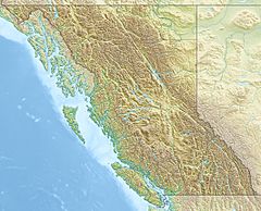
The mouth of the Hackett River is located about 55 kilometers (34 miles) northwest of a place called Telegraph Creek in British Columbia. It's also about 150 kilometers (93 miles) east of Juneau, Alaska, and about 330 kilometers (205 miles) southeast of Whitehorse, Yukon.
The land around the Hackett River's watershed is covered by different types of plants and features. About 35% is conifer forest (trees like pine and spruce), 30% is shrubland (areas with bushes and shrubs), and 11% is mixed forest (a mix of different trees). There are also areas of barren land (with very few plants) and herbaceous plants (non-woody plants like grasses).
The Hackett River is located in the traditional lands of the Tahltan people, who have lived in this area for a very long time.
River's Journey
The Hackett River begins with several small streams that flow into Kennicott Lake. This lake is on the south side of Level Mountain, in a region called the Nahlin Plateau. From its starting point near Hyland Ranch, the river travels northwest through the Tahltan Highland.
As it flows, the Hackett River first reaches Hatchau Lake. After that, it passes through the Salmon Creek 3 Indian reserve, which belongs to the Tahltan First Nation.
The river continues its journey northwest, flowing between Level Mountain and Kaketsa Mountain. It goes through a wetland area before entering a gorge. Along the way, other smaller streams join the Hackett River, including Stone Creek, Copper Creek, Pyrrhotite Creek, and Egnell Creek. The Egnell telegraph station, an old communication post, was once located near where Egnell Creek meets the Hackett River. The small community of Sheslay is found where the Hackett River joins the Sheslay River.
Historical Connections
The historic Yukon Telegraph Trail used to follow the Hackett River. This trail was an important route for telegraph lines, which were used to send messages across long distances. The trail ran northwest from a place called Saloon on the upper Little Tahltan River to Hyland Ranch, then continued to Egnell and Sheslay, which are both near the mouth of the Hackett River. This trail played a big role in connecting different parts of the region in the past.
See also
 | Claudette Colvin |
 | Myrlie Evers-Williams |
 | Alberta Odell Jones |


