Hannibal, New York facts for kids
Quick facts for kids
Hannibal
|
|
|---|---|

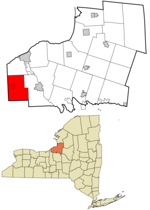
Location in Oswego County and the state of New York.
|
|

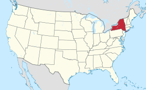
Location of New York in the United States
|
|
| Country | United States |
| State | New York |
| County | Oswego County |
| Incorporated | 1806 |
| Area | |
| • Total | 44.8 sq mi (116 km2) |
| • Land | 44.8 sq mi (116 km2) |
| • Water | 0.04 sq mi (0.1 km2) |
| Elevation | 328 ft (100 m) |
| Population
(2010)
|
|
| • Total | 4,854 |
| • Estimate
(2016)
|
4,631 |
| • Density | 103.37/sq mi (39.9/km2) |
| Time zone | UTC-5 (EST) |
| • Summer (DST) | UTC-4 (EDT) |
| ZIP code |
13074
|
| Area code(s) | 315 |
| FIPS code | 36-32028 |
| Website | https://hannibalny.org/ |
Hannibal is a small town located in Oswego County, New York, United States. In 2010, about 4,854 people lived there. The town gets its name from Hannibal, a famous leader from ancient Carthage.
The Town of Hannibal also includes a smaller area called the Village of Hannibal. The town is found on the western edge of Oswego County.
Contents
History of Hannibal Town
The first people settled in the Hannibal area around 1802. Much of this land was bought from the Onondaga and Oneida Native American tribes. This land was used to create the Central New York Military Tract, which helped pay soldiers who fought in wars.
The town of Hannibal was officially formed in 1806. It was created from a part of the Town of Lysander. At that time, it was still part of Onondaga County, New York. The name "Hannibal" was chosen by Robert Harpur. He worked for the New York survey and gave many "classical" names to places in central New York.
Geography of Hannibal
The town of Hannibal covers about 44.8 square miles (116.0 square kilometers). Almost all of this area is land, with only a tiny bit of water.
The western border of the town is also the border of Cayuga County.
Population Changes in Hannibal
| Historical population | |||
|---|---|---|---|
| Census | Pop. | %± | |
| 1820 | 935 | — | |
| 1830 | 1,794 | 91.9% | |
| 1840 | 2,269 | 26.5% | |
| 1850 | 3,368 | 48.4% | |
| 1860 | 3,246 | −3.6% | |
| 1870 | 3,234 | −0.4% | |
| 1880 | 3,173 | −1.9% | |
| 1890 | 2,688 | −15.3% | |
| 1900 | 2,473 | −8.0% | |
| 1910 | 2,148 | −13.1% | |
| 1920 | 1,834 | −14.6% | |
| 1930 | 1,855 | 1.1% | |
| 1940 | 2,010 | 8.4% | |
| 1950 | 2,230 | 10.9% | |
| 1960 | 2,673 | 19.9% | |
| 1970 | 3,165 | 18.4% | |
| 1980 | 4,027 | 27.2% | |
| 1990 | 4,616 | 14.6% | |
| 2000 | 4,957 | 7.4% | |
| 2010 | 4,854 | −2.1% | |
| 2016 (est.) | 4,631 | −4.6% | |
| U.S. Decennial Census | |||
In 2000, there were about 4,956 people living in Hannibal. These people lived in 1,760 households. Many households (41.1%) had children under 18 living with them. About 56.3% of households were married couples.
The population was spread out by age. About 30.5% of the people were under 18 years old. Another 30.5% were between 25 and 44 years old. The average age in the town was 34 years.
Communities and Places in Hannibal Town
The Town of Hannibal includes several smaller communities and specific locations:
- Bethel – A small community along Route 34, near the border with Ira.
- Cains Corners – A hamlet located southwest of the main Hannibal village.
- Dexterville – A place found at the eastern edge of the town.
- Fairdale – A hamlet situated east of the Hannibal village.
- Hannibal – This is the main village within the town, located in the western part on Route 104.
- Hannibal Center – A hamlet found southeast of the Hannibal village.
- Kinney Corners – A location near the northern border of the town, also on Route 104.
- Metcalf Siding – A place northwest of North Hannibal.
- North Hannibal – A hamlet northeast of Hannibal village, found on County Route 7.
- South Hannibal – A hamlet southeast of Hannibal Center, located on Route 176. This community was also known as "Hulls Corners."
See also
 In Spanish: Hannibal (Nueva York) para niños

