Hardscrabble River facts for kids
Quick facts for kids Hardscrabble River |
|
|---|---|

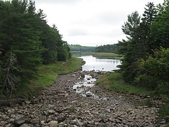
Hardscrabble River at head of tide, from U.S. Route 1
|
|
| Country | United States |
| Physical characteristics | |
| Main source | Maine |
| River mouth | Dennys Bay sea level 44°54′11″N 67°10′41″W / 44.903°N 67.178°W |
| Length | about 10 miles (16 km) |
The Hardscrabble River is a special kind of river mouth called an estuary. It's where the fresh water from Wilson Stream mixes with the salty water from the ocean. This small river is located in Washington County, Maine, in the United States.
Wilson Stream starts in a town called Charlotte. It flows for about 10 miles (16 kilometers) towards the southeast. Eventually, it reaches Dennys Bay, which is part of the Atlantic Ocean.
Contents
What is the Hardscrabble River?
The Hardscrabble River is actually the lower part of Wilson Stream. It gets its new name where it meets the ocean's tides. This area is very important for many plants and animals.
Where is it located?
The river is in a beautiful part of eastern Maine. It flows between several towns. On one side, you'll find Pembroke. On the other side are Dennysville and Edmunds. The river forms a natural border between these communities.
From Stream to Estuary
Wilson Stream is a freshwater stream for most of its journey. But when it reaches U.S. Route 1, something changes. This is roughly where the ocean's tide starts to affect the water. At this point, the stream becomes an estuary and is known as the Hardscrabble River. An estuary is a place where fresh river water and salty ocean water mix together.
Life in the Estuary
Estuaries like the Hardscrabble River are incredibly important. They are often called "nurseries of the sea." This is because many young fish and other sea creatures grow up here. The mix of fresh and salt water creates a unique environment.
A Special Habitat
The water in an estuary is called "brackish." It's not fully fresh, and it's not fully salty. This special water supports a wide variety of life. The mudflats and salt marshes along the riverbanks also provide homes. They offer shelter and food for many different species.
Animals of the Hardscrabble
You might find many interesting animals living in or near the Hardscrabble River.
- Fish: Many types of fish, like striped bass and herring, use estuaries. They come here to lay their eggs or to find food.
- Birds: Estuaries are popular spots for waterfowl and shorebirds. You might see ducks, geese, herons, and sandpipers. They feed on the small fish and insects in the water.
- Shellfish: Creatures like clams and mussels often live in the muddy bottoms.
- Mammals: Sometimes, you might even spot otters or mink along the riverbanks. They hunt for fish and other small prey.
Protecting the River
Rivers and estuaries are vital parts of our natural world. They provide clean water and support diverse ecosystems. Protecting places like the Hardscrabble River is very important.
Why Rivers are Important
Rivers are like the veins of the land. They carry water from mountains and forests to the oceans. They also help keep the environment healthy. Estuaries, in particular, filter pollutants and protect coastlines from storms. They are also important for the economy, supporting fishing and tourism.
How We Can Help
Everyone can help protect rivers and estuaries.
- Reduce pollution: Don't litter, and be careful with chemicals.
- Conserve water: Use less water at home to help keep rivers flowing.
- Learn more: Understanding how rivers work helps us protect them better.
 | Jackie Robinson |
 | Jack Johnson |
 | Althea Gibson |
 | Arthur Ashe |
 | Muhammad Ali |

