Harrisonburg, Louisiana facts for kids
Quick facts for kids
Harrisonburg, Louisiana
|
|
|---|---|
|
Village
|
|

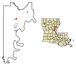
Location of Harrisonburg in Catahoula Parish, Louisiana.
|
|

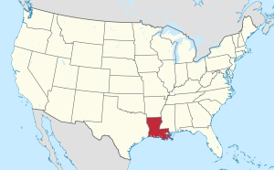
Location of Louisiana in the United States
|
|
| Country | United States |
| State | Louisiana |
| Parish | Catahoula |
| Area | |
| • Total | 1.05 sq mi (2.73 km2) |
| • Land | 0.97 sq mi (2.51 km2) |
| • Water | 0.09 sq mi (0.22 km2) |
| Elevation | 79 ft (24 m) |
| Population
(2020)
|
|
| • Total | 277 |
| • Density | 286.16/sq mi (110.44/km2) |
| Time zone | UTC-6 (CST) |
| • Summer (DST) | UTC-5 (CDT) |
| ZIP Code |
71340
|
| Area code(s) | 318 |
| FIPS code | 22-33210 |
Harrisonburg is a small village in Louisiana, United States. It is the main town, also called the parish seat, of Catahoula Parish. In 2020, about 277 people lived there.
A famous person named Riley J. Wilson once lived in Harrisonburg. He was a principal at the local high school and a lawyer before he became a judge. Later, he was elected to the United States Congress, serving from 1915 to 1937.
Contents
History of Harrisonburg
Harrisonburg got its name from the Harrison family of Virginia. They were an important family in the area's early days.
Fort Beauregard and the Civil War
Fort Beauregard is a historic fort located on a hill in Harrisonburg. It was a strong base for the Confederate army during the American Civil War.
In 1863, the fort helped protect Harrisonburg from an attack. Four Union gunboats tried to attack the village from the Black River. But after four days of fighting, the gunboats didn't cause much damage and had to leave.
Later, in September 1863, the Confederates left the fort before a large Union army arrived. They lost some cannons, but two big ones were saved. The town was attacked again in March 1864 by Union gunboats, but the river level was too low for them to advance further.
Past Events and Trade
For many years, Harrisonburg used to have special events at Fort Beauregard. These events were called reenactments, where people dressed up and acted out Civil War battles. These events stopped for a while but were brought back in 2015.
Harrisonburg was once a very important place for trade. This was because it was located on the Ouachita River. This river made it easy to travel to the Mississippi River and then to New Orleans. The Harrisonburg Road also passed through the area, connecting Mississippi to Texas.
After the Civil War, the state government thought about moving Louisiana's capital from New Orleans to Harrisonburg. However, this plan did not happen.
Geography of Harrisonburg
Harrisonburg is located in the northern part of Catahoula Parish. It sits on the west side of the Ouachita River.
Louisiana State Highway 8 goes through the village. This highway connects Harrisonburg to Sicily Island to the northeast. It also goes southwest for about 18 miles (29 km) to U.S. Route 84. Jonesville, which is the biggest town in Catahoula Parish, is about 10 miles (16 km) south of Harrisonburg. You can get there by taking Highway 124.
The village covers a total area of about 1.05 square miles (2.7 square kilometers). Most of this area, about 0.97 square miles (2.5 square kilometers), is land. The rest, about 0.09 square miles (0.2 square kilometers), is water.
Population in Harrisonburg
The number of people living in Harrisonburg has changed a lot over the years. Here's how the population has looked:
| Historical population | |||
|---|---|---|---|
| Census | Pop. | %± | |
| 1850 | 326 | — | |
| 1870 | 217 | — | |
| 1880 | 243 | 12.0% | |
| 1890 | 359 | 47.7% | |
| 1900 | 303 | −15.6% | |
| 1910 | 361 | 19.1% | |
| 1920 | 399 | 10.5% | |
| 1930 | 437 | 9.5% | |
| 1940 | 422 | −3.4% | |
| 1950 | 544 | 28.9% | |
| 1960 | 594 | 9.2% | |
| 1970 | 626 | 5.4% | |
| 1980 | 610 | −2.6% | |
| 1990 | 453 | −25.7% | |
| 2000 | 746 | 64.7% | |
| 2010 | 348 | −53.4% | |
| 2020 | 277 | −20.4% | |
| U.S. Decennial Census | |||
2020 Census Information
The most recent census in 2020 showed that 277 people lived in Harrisonburg. The table below shows the different groups of people living in the village.
| Race / Ethnicity (NH = Non-Hispanic) | Pop 2000 | Pop 2010 | Pop 2020 | % 2000 | % 2010 | % 2020 |
|---|---|---|---|---|---|---|
| White alone (NH) | 324 | 242 | 198 | 43.43% | 69.54% | 71.48% |
| Black or African American alone (NH) | 409 | 87 | 57 | 54.83% | 25.00% | 20.58% |
| Native American or Alaska Native alone (NH) | 0 | 2 | 0 | 0.00% | 0.57% | 0.00% |
| Asian alone (NH) | 11 | 0 | 1 | 1.47% | 0.00% | 0.36% |
| Pacific Islander alone (NH) | 0 | 0 | 0 | 0.00% | 0.00% | 0.00% |
| Other Race alone (NH) | 0 | 0 | 0 | 0.00% | 0.00% | 0.00% |
| Mixed race or Multiracial (NH) | 2 | 8 | 3 | 0.27% | 2.30% | 1.08% |
| Hispanic or Latino (any race) | 0 | 9 | 18 | 0.00% | 2.59% | 6.50% |
| Total | 746 | 348 | 277 | 100.00% | 100.00% | 100.00% |
More About the Population
In 2000, there were 746 people living in Harrisonburg. There were 142 households, and 91 of them were families. About 25% of households had children under 18 living with them. The average household had 2.5 people.
The population was quite varied in age. About 13% were under 18 years old, and 9.5% were 65 or older. The average age was 30 years.
The average income for a household in the village was $21,786. For families, the average income was $31,250. About 27.6% of the people in Harrisonburg lived below the poverty line. This included about 26% of those under 18 and 25% of those 65 or older.
The population in Harrisonburg has been getting smaller recently.
Education in Harrisonburg
- Harrisonburg High School
Climate in Harrisonburg
Harrisonburg has a type of weather called a humid subtropical climate. This means it has hot and humid summers. The winters are usually mild to cool.
See also
 In Spanish: Harrisonburg (Luisiana) para niños
 | Bayard Rustin |
 | Jeannette Carter |
 | Jeremiah A. Brown |

