Hartcliffe facts for kids
Quick facts for kids Hartcliffe |
|
|---|---|
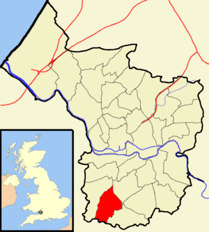
 Boundaries of the city council ward. |
|
| Population | 11,474 (2011.Ward) |
| OS grid reference | ST584679 |
| Unitary authority | |
| Ceremonial county | |
| Region | |
| Country | England |
| Sovereign state | United Kingdom |
| Post town | BRISTOL |
| Postcode district | BS13 |
| Dialling code | 0117 |
| Police | Avon and Somerset |
| Fire | Avon |
| Ambulance | Great Western |
| EU Parliament | South West England |
| UK Parliament |
|
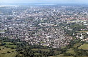
Hartcliffe is a lively area in the city of Bristol, located in the United Kingdom. It's known both as a council ward (a local government area) and as an outer part of the city. The Hartcliffe ward includes the areas of Hartcliffe itself, Headley Park, and small parts of Withywood and Bishopsworth.
Hartcliffe was mostly built after World War II. Many of its homes are council houses, which are homes provided by the local council. The area has seen many efforts to improve and update it, focusing on community growth and new opportunities.
Contents
Discovering Hartcliffe's Story
Hartcliffe is a district in Bristol, England. It's a large housing area built by the council, located on the southern edge of the city. It sits right next to Withywood, on the northern slopes of Dundry Hill.
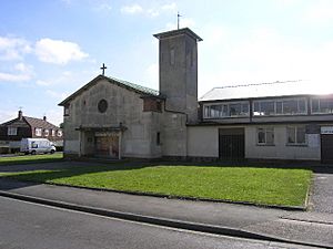
Building in Hartcliffe began in 1952. This happened after the council bought several farms in the area. A small shopping area called Symes Avenue was created. The first church, St Andrew, opened its doors in 1956.
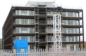
The company Imperial Tobacco once had offices and a factory in Hartcliffe. Today, part of that site is a shopping area called Imperial Retail Park. The old headquarters building, which is a listed building (meaning it's protected for its history), is now being turned into apartments called Lakeshore.
Community Spirit in Hartcliffe
The Hartcliffe and Withywood Community Partnership (HWCP) was started by local people in 1998. Their goal is to help improve and renew the area. This shows how much local residents care about their community.
Hartcliffe is home to several schools. These include Fair Furlong Primary School, Hareclive Academy, and Bridge Learning Campus. These schools help educate the young people of the area.
Hartcliffe Community Farm opened in 1979. It was founded by Doris Fiedor, a leader in the Hartcliffe Community Council. The farm has over 30 acres (about 120,000 square meters) of land. It's located at the top of Lampton Avenue. A very old barn, about 250 years old, was once at the farm. It was sadly burned down in a fire, but the farm continues to thrive. It is open every day for visitors and often hosts school groups.
Symes Avenue is the main shopping center for Hartcliffe and Withywood. It serves about 20,000 people living in these outer areas. On November 12, 2007, a new Morrisons supermarket opened there. This was part of a big redevelopment project. The project also included building a new library for the community.
Exploring Headley Park
Headley Park is another part of Bristol. The original homes in this area were built between 1934 and 1938. It is located in South Bristol. You can find it between Bedminster Down, Bishopsworth, Knowle West, and Hartcliffe. Headley Park is mostly a place where people live.
The area has one local pub called The Maytree. It is located on St Peters Rise. This is a common gathering spot for local residents.
The main Christian church in Headley Park is also on St Peters Rise. A church has been on this site for 60 years. It was first known as Crossways Tabernacle. In 2007, it was renamed Headley Park Church. This happened after a partnership with Kensington Baptist Church from north Bristol.
Nearby Areas: Bishopsworth and Withywood
The areas of Bishopsworth and Withywood are partly located within the Hartcliffe ward. However, most of these areas are found in the Bishopsworth ward.
 | Delilah Pierce |
 | Gordon Parks |
 | Augusta Savage |
 | Charles Ethan Porter |


