
Heerlen facts for kids
Quick facts for kids
Heerlen
Heële
|
|||
|---|---|---|---|
|
City and municipality
|
|||

View of the town hall
|
|||
|
|||
.svg)
Location in Limburg
|
|||
| Country | Netherlands | ||
| Province | Limburg | ||
| Government | |||
| • Body | Municipal council | ||
| Area | |||
| • Municipality | 45.53 km2 (17.58 sq mi) | ||
| • Land | 45.02 km2 (17.38 sq mi) | ||
| • Water | 0.51 km2 (0.20 sq mi) | ||
| Elevation | 113 m (371 ft) | ||
| Population
(Municipality, May 2014; Urban and Metro, May 2014)
|
|||
| • Municipality | 86,874 | ||
| • Density | 1,955/km2 (5,060/sq mi) | ||
| • Urban | 200,957 | ||
| • Metro | 247,731 | ||
| Demonym(s) | Heerlenaar | ||
| Time zone | UTC+1 (CET) | ||
| • Summer (DST) | UTC+2 (CEST) | ||
| Postcode |
6400–6433
|
||
| Area code | 045 | ||


Heerlen is a city and municipality in the southeast of the Netherlands. It's located in the province of Limburg. Heerlen is the third largest city in Limburg.
It's part of a bigger area called Parkstad Limburg. This area includes 8 municipalities and has about 250,000 people. Heerlen is east of Maastricht and north of Aachen in Germany.
Heerlen started as a Roman settlement. Later, in the late 1800s, it became a major center for coal mining. A famous architect named Frits Peutz helped shape the city in the 20th century. His most famous building is the Glaspaleis (Glass Palace). It's known worldwide for its important design.
Contents
History of Heerlen
Early Times and Roman Settlement
People lived near Heerlen a very long time ago, around 4400–3500 BC. In 1997, archaeologists found signs of an ancient settlement. This discovery was special because it showed early earth walls and ditches.
The real history of Heerlen began with the Romans. They built a military camp called Coriovallum. It was at a busy crossroads of two main Roman roads. Many Roman farms and buildings have been found in and around Heerlen.
The most exciting Roman discovery is the Thermae complex. These were Roman public baths found in 1940. Finding such baths means Coriovallum was an important Roman town. Today, a museum is built over the Thermae. It opened in 1977 and shows other Roman finds from the area.
Medieval Period and Changes
After the Romans left around the 3rd or 4th century, not much is known about Heerlen until the 10th century. At this time, farming grew again in Europe. New farms and mills were built along the local rivers. This is how medieval Heerlen slowly started to form.
The first time Heerlen was mentioned in writing was in 1065. A bishop named Udo of Toul wrote about gifts, including the land of Heerlen. Later, the counts of Ahr-Hochstaden owned Heerlen.
Heerlen gained special rights and freedoms. This made it more important than the nearby countryside. Areas like Voerendaal and Hoensbroek then fell under Heerlen's laws.
In 1244, Heerlen came under the rule of the dukes of Brabant. But in 1388, it became separate again. During the Eighty Years' War (1568–1648), Heerlen was fought over by Spain and the Dutch rebels. It changed hands many times.
In 1661, Heerlen became part of "Staat-Limburg," ruled by the new Dutch Republic. It was quite isolated until 1793, when the French took over. After Napoleon's defeat in 1814, Heerlen became part of the Dutch province of Limburg.
The Rise of Coal Mining
In the 19th century, Heerlen was mostly a farming area. But in 1874, coal was found nearby. Starting a coal mine was a big, risky project. Only a few private companies tried it at first.
In 1896, Heerlen got its first railway. This helped transport coal from the mines. The city grew slowly at first. In 1900, only 6,646 people lived there.
In 1901, the government stepped in and started its own mines. Soon, many large state-run coal mines began production. Heerlen's population grew very quickly. It went from 6,646 in 1900 to 32,263 in 1930. Many old buildings were taken down to make way for the growing city.
Coal mining was central to Heerlen's growth into a modern city. This continued until the early 1960s.
After the Mines Closed
The best years for coal mining ended in the late 1950s. Production slowly went down because of cheaper coal from other countries. Also, natural gas was found in the Netherlands.
Between 1965 and 1975, all the coal mines were closed. About 60,000 people in the Heerlen area lost their jobs. This was a very hard time for the city's economy. The Dutch government tried to help by moving some government offices to Heerlen. But even today, the city is still recovering from losing so many jobs.
Today, there are few signs of the mining industry in Heerlen. Most of the big piles of mining waste have been removed or turned into green hills. Even the tallest mine chimneys, 'Lange Lies' and 'Lange Jan', were taken down. One of the few remaining mining buildings now holds the Dutch Mine Museum.
Geography
Heerlen is located at 50°53′N 5°59′E / 50.883°N 5.983°E in the province of Limburg. It's in the southeast of the Netherlands, close to the border with Germany.
Heerlen is surrounded by other Dutch towns like Simpelveld, Voerendaal, and Brunssum. It also borders the German city of Aachen. Heerlen is one of the highest cities above sea level in the Netherlands.
Economy
Heerlen has the biggest furniture shopping area in Europe. It has 120,000 square meters of floor space. This includes a very large IKEA store that opened in 2008.
In 2008, the world's first minewater power station opened in Heerlen. This special station uses water from old mines to heat and cool buildings. It helps heat and cool 200 homes, shops, a supermarket, a library, and large office buildings.
Mines in Heerlen

Here are some of the important coal mines that were once in Heerlen:
- Oranje Nassau I: Operated from 1899 to 1974. Now used for the Minewater Project.
- Oranje Nassau III: Operated from 1917 to 1973. Also used for the Minewater Project.
- Oranje Nassau IV: Operated from 1927 to 1966.
- Staatsmijn Emma: Operated from 1911 to 1973.
Education
Heerlen has several educational places. One is Zuyd Hogeschool. This is a University of Applied Sciences. It has locations in Heerlen, Sittard, and Maastricht.
The main office of the Open University of the Netherlands is also in Heerlen. This university is for distance learning, meaning students learn from home. It has thousands of students across the Netherlands.
Architecture

The most famous architect in Heerlen was Frits Peutz. He designed at least 10 important buildings in the city. In 1935, Heerlen's most famous building, the Glaspaleis (Glass Palace), was built. It stands next to the old church in the city center.
The Glaspaleis was designed for a department store. It's a great example of early Modernism in architecture. In the 1990s, it was added to a list of the world's 1000 most important buildings of the 20th century. This encouraged the city to buy and fix up the building.
The Glaspaleis has been renovated and now holds several cultural places, including a modern art museum. It has become a symbol of Heerlen's new life after the mines closed.
Even though many old buildings were taken down around 1900, some older ones still stand. These include a 12th-century church (Pancratiuskerk) and an old prison tower (Schelmentoren) from around the same time.
Other interesting buildings include a Neoclassical chapel from 1848. You can also find old watermills and castles in other parts of Heerlen. Examples are the Weltermolen (14th century) and Hoensbroek Castle (oldest part from 1380).
Transport
Heerlen has three railway stations:
- Heerlen
- Heerlen Woonboulevard
- Hoensbroek
From Heerlen, you can travel by train to cities like Eindhoven, Utrecht, Amsterdam, Maastricht, and even to Aachen/Köln in Germany.
Sports
The GP Heerlen is a cyclo-cross race that takes place in Heerlen every February.
Images for kids
-
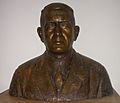
Bust of Frans de Wever, a general practitioner (2011)
-

Klaas de Vries, a retired politician (2008)
-

Gijs Tuinman, a Royal Netherlands Army officer (2014)
-
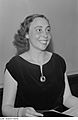
Agnes Giebel, a German classical soprano (1953)
-
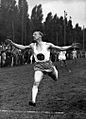
Tinus Osendarp, a Dutch sprinter and Olympic medalist (1936)


.jpg)

See also
 In Spanish: Heerlen para niños
