Hempstead Plains facts for kids
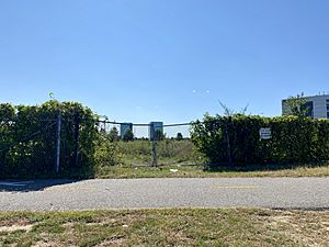
The Hempstead Plains is a special area in central Long Island, in a place called Nassau County. It was once a huge open space filled with native grasslands. Imagine a giant field, about 60,000 acres wide!
This big plain was separated from the North Shore of Long Island by a natural ridge called the Harbor Hill Moraine. Today, Route 25 is roughly along this line. The Hempstead Turnpike marks where the plain meets the South Shore of Long Island. The plains stretched from near Queens, New York City all the way to the Suffolk County border.
The town of Hempstead was first settled by Europeans around 1644. These settlers came from Connecticut. They bought land from the local Native Americans. The town might have been named after places in England or the Netherlands.
In early US history, the Hempstead Plains was one of the few natural prairies east of the Allegheny Mountains. Historians say it was formed over ten thousand years ago. Melted ice from glaciers left behind lots of sand and gravel. This created the large, flat open land we see today.
The Hempstead Plains is very important for nature and history. It is home to many rare plants, about 250 different kinds! Some of these plants are even endangered. Many birds, butterflies, and other animals also live here. This habitat is disappearing quickly, so protecting it is very important.
Contents
Horse Racing History
Horse racing in North America started right here on the Hempstead Plains! The first race meet was held in 1665. New York's colonial governor, Richard Nicolls, oversaw this event. This area is now part of Westbury and Garden City.
In 1905, Belmont Park opened on the western edge of the plains. Its main track is one and a half miles long. It is the biggest dirt Thoroughbred race course in the world. It also has the sport's largest grandstand.
A part of the plains is called Salisbury. Nassau County's largest park, Eisenhower Park, is located here. It covers more than 800 acres. It was first called Salisbury Park in the 1940s.
Even when planes were flying over the Hempstead Plains, part of Roosevelt Field became Roosevelt Raceway. This was first a popular place for auto racing. Then it became a famous track for standardbred horse racing. It operated from 1940 until 1988.
Aviation's Beginning
The Hempstead Plains was also a very important place for aviation. People even called it the "Cradle of Aviation." In July 1909, a pilot and builder named Glenn Curtiss moved his work to Mineola.
Curtiss flew his biplane, the Golden Flyer, over the plains. He circled for more than 52 minutes! This showed how well his aircraft could fly. He even won a prize for flying more than 25 kilometers.
About 15 years later, the Hempstead Plains was known as the "Cradle of Aviation." The Hempstead Plains Aerodrome changed its name to Hazelhurst Field in 1917. Then in 1918, it became Roosevelt Field on the east side and Curtiss Field on the west. These places, along with Mitchel Field, became a major center for private and military flights in the eastern United States.
The most famous flight from the Hempstead Plains was Charles Lindbergh's journey to France in 1927. On May 20-21, Lindbergh flew his plane, the Spirit of St. Louis, solo and nonstop across the Atlantic Ocean. He flew from Roosevelt Field to Le Bourget, Paris, in 33 and a half hours. His grandson, Erik Lindbergh, repeated this trip in 2002. It took him 17 hours and 17 minutes.
Plains Today: Development and Protection
In the middle of the 20th century, the Plains region started to change. More homes and businesses were built. The western part of Roosevelt Field closed in 1951. In 1956, the Roosevelt Field Mall opened there. It is one of the world's largest indoor shopping centers.
The old Roosevelt Raceway area now has a movie theater, a Target store, and fancy apartments. North of the raceway, The Source Mall was built. It has stores like Costco.
Mitchel Field was an Air Force base until 1961. Today, it has many different uses. You can find the Cradle of Aviation Museum there. Also, Nassau Community College, Nassau Veterans Memorial Coliseum, and parts of Hofstra University are on this land.
A few small areas of the original Hempstead Plains still exist today:
- The Hempstead Plains Preserve near Nassau Community College.
- Behind The Wheatley School in Old Westbury. This area is called the Wheatley Woods.
- Inside Eisenhower Park.
- Some areas stretching east to the Suffolk County border.
- Several acres in Plainview. This land was meant for a parkway that was never built, so it stayed undeveloped.
References
 | Calvin Brent |
 | Walter T. Bailey |
 | Martha Cassell Thompson |
 | Alberta Jeannette Cassell |


