Henmore Brook facts for kids
Quick facts for kids Henmore Brook |
|
|---|---|

|
|
|
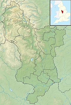
Mouth shown in Derbyshire
|
|
| Other name(s) | River Henmore |
| Country | England |
| Counties | Derbyshire |
| Physical characteristics | |
| Main source | Stainsborough Hall Hopton, Derbyshire |
| River mouth | Confluence with the River Dove Church Mayfield, Staffordshire 52°59′57″N 1°45′46″W / 52.99917°N 1.76278°W |
| Length | 20 km (12 mi) |
| Basin features | |
| Basin size | 46 km2 (18 sq mi) |
| Tributaries |
|
| Progression : Henmore - Dove - Trent - Humber | |
The Henmore Brook, also known as the River Henmore, is a small river in Derbyshire, England. It flows for about 20 kilometers (12 miles) before joining a bigger river called the River Dove.
Near its start, it was once called the Scow Brook. A large part of this area was covered by the Carsington Water reservoir in 1991. After the reservoir, it becomes the Henmore Brook. Three smaller streams, called Parkside, Kniveton, and Dayfield brooks, flow into it.
The Henmore Brook collects water from an area of 46 square kilometers (18 square miles). It flows through the town of Ashbourne. In the past, the brook has caused big floods in Ashbourne town center. The Environment Agency officially calls it a "Main river" from Carsington Water to where it meets the River Dove.
The River's Journey
The Henmore Brook begins near Soldiers Knoll, close to Stainsborough Hall. From there, it flows west into the upper part of Carsington Water, near Hopton.
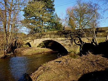
It comes out of the Carsington Water dam and flows southwest. It passes by the villages of Hognaston, Atlow, and Sturston. Then, it reaches the town of Ashbourne. After Ashbourne, it goes past Clifton village. Finally, it joins the River Dove at Church Mayfield.
A Look Back in Time
People have lived in the Henmore valley for a very long time. Many ancient sites from the Paleolithic (Stone Age) have been found here. These include burial mounds and standing stones near Carsington. Other mounds are in the hills south of Ashbourne. A rare Acheulean stone axe was also discovered near Hopton.
Lead mining was important in this area long ago. The Romans even set up a large settlement here because of it. Archaeologists found this Roman site near the Scow Brook before Carsington Water was built. In 1946, a Roman lead block weighing 69 kilograms (about 152 pounds) was found nearby.
The town of Ashbourne, originally called Essenburn (meaning "a brook where ash trees grow"), was mentioned in the Domesday Book. It became an important market town in the Middle Ages. The main road connecting Derby to Manchester crossed the brook in Ashbourne. Farmers in the Henmore valley provided food, like cheese, for these markets.
The brook also flows past Atlow moat. This is a well-preserved example of a medieval manor house moat. It was once the home of the Atlow family. There was also a large mill at Atlow, powered by the Henmore Brook. Unlike other mills along the brook, its buildings have been updated for modern use.
The Henmore Brook was not used for cotton spinning during the Industrial Revolution. This is unusual for a river in Derbyshire. However, some large cotton mills were built at Church Mayfield, where the Henmore meets the River Dove. There were at least two corn mills near Ashbourne that used the Henmore Brook for power. These were at Clifton and Sturston. Even though they are gone now, they are important places for the annual Royal Shrovetide Football game.
Royal Shrovetide Football
The Henmore Brook, often called the River Henmore during the game, is a key part of the Ashbourne Shrovetide game. This is a type of Mob football.
The river helps decide which team a player joins. If you were born north of the Henmore, you are an Up’Ard. If you were born south, you are a Down’Ard. The river connects the two goals at Sturston and Clifton. It often acts as the playing field itself. In 1996, the goals were moved to the riverbanks. This meant players had to be in the river to score a goal, making the game even harder!
In 2010, the game even went through the tunnel under the Civic Square. Once the game leaves the town, the riverbanks offer great spots to watch the match.
 | Bayard Rustin |
 | Jeannette Carter |
 | Jeremiah A. Brown |


