Holts Summit, Missouri facts for kids
Quick facts for kids
Holts Summit, Missouri
|
|
|---|---|
| City of Holts Summit | |

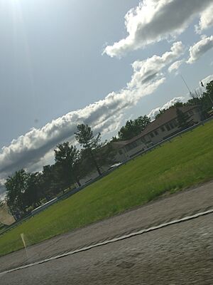
Holts Summit in May 2024
|
|

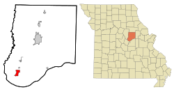
Location of Holts Summit, Missouri
|
|
| Country | United States |
| State | Missouri |
| County | Callaway |
| Incorporated | 1973 |
| Area | |
| • Total | 3.81 sq mi (9.86 km2) |
| • Land | 3.71 sq mi (9.60 km2) |
| • Water | 0.10 sq mi (0.26 km2) |
| Elevation | 804 ft (245 m) |
| Population
(2020)
|
|
| • Total | 4,458 |
| • Estimate
(2023)
|
4,677 |
| • Density | 1,203.24/sq mi (464.55/km2) |
| Time zone | UTC-6 (Central (CST)) |
| • Summer (DST) | UTC-5 (CDT) |
| ZIP code |
65043
|
| Area code(s) | 573 |
| FIPS code | 29-32770 |
| GNIS feature ID | 2394409 |
| U.S. Routes | |
Holts Summit is a small city in Callaway County, Missouri. It's home to about 4,458 people, based on the 2020 census. This city is located about 7 miles northeast of Jefferson City, which is the capital of Missouri. Holts Summit is also part of the larger Jefferson City Metropolitan Area.
Contents
Discovering Holts Summit's Past
Many of the first settlers in this area came from Virginia. One family, led by Abner Holt, arrived in Missouri in 1819. They spent a winter in Howard County. Then, in the spring, the men built a house in what would become Holts Summit. The family soon moved in.
Later, in 1870, Abner Holt's grandson, Timothy Holt, helped plan the town. He built it around a general store his father, James Holt, had started. They called the village "Holts Summit" because it was the highest spot between that location and the Missouri River.
Trains and Transportation History
A train station called "Hibernia Station" used to be near where North School is today. Trains carried people between Cedar City and Holts Summit. But as cars became more popular, fewer people rode the train. So, the train station was taken down in 1934. Holts Summit officially became a city in 1973.
Holts Summit and Missouri Wine
In the 1960s and 1970s, people started to rebuild the wine industry in Missouri. Summit Lake Winery was founded in Holts Summit in 2002. This connects the town to an area known as the Missouri Rhineland. This special area has many vineyards along the Missouri River, stretching from Callaway County to the western part of St. Charles County.
Exploring Holts Summit's Location
Holts Summit is located at 38°38′55″N 92°7′1″W / 38.64861°N 92.11694°W.
The United States Census Bureau says the city covers a total area of about 3.49 square miles (9.04 square kilometers). Most of this area, about 3.44 square miles (8.91 square kilometers), is land. A small part, about 0.05 square miles (0.13 square kilometers), is water.
People of Holts Summit
| Historical population | |||
|---|---|---|---|
| Census | Pop. | %± | |
| 1880 | 23 | — | |
| 1980 | 2,540 | — | |
| 1990 | 2,292 | −9.8% | |
| 2000 | 2,935 | 28.1% | |
| 2010 | 3,247 | 10.6% | |
| 2020 | 4,458 | 37.3% | |
| U.S. Decennial Census | |||
Population Details from 2010
According to the census from 2010, there were 3,247 people living in Holts Summit. These people lived in 1,377 households, and 896 of these were families. The city had about 943.9 people per square mile (364.4 people per square kilometer). There were 1,572 homes in total.
The people living in the city were mostly White (92.1%). There were also African American (3.9%), Native American (0.3%), and Asian (0.5%) residents. Some people were from other races (1.0%), and 2.1% were from two or more races. About 2.2% of the population identified as Hispanic or Latino.
In terms of households, 30.8% had children under 18 living with them. About 46.1% were married couples. Some households (13.9%) had a female head with no husband present. About 5.1% had a male head with no wife present. The average household had 2.35 people, and the average family had 2.83 people.
The average age of people in the city was 37.7 years old. About 22.7% of residents were under 18. About 12.8% were 65 years old or older. The city's population was 48.0% male and 52.0% female.
See also
 In Spanish: Holts Summit (Misuri) para niños
 | Sharif Bey |
 | Hale Woodruff |
 | Richmond Barthé |
 | Purvis Young |

