Hope Valley (California) facts for kids
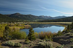
Hope Valley is a beautiful mountain valley located in Alpine County, California. It sits on the eastern side of the Sierra Nevada mountains, not far from Carson Pass and south of Lake Tahoe. Long ago, during the California Gold Rush, this valley was a very important path for settlers and people moving to and from California.
Hope Valley is about 7,000 feet high, and it's surrounded by tall mountains over 10,000 feet. People love Hope Valley for its amazing views, great places to fish, colorful trees in the fall, and fun winter activities like skiing.
Contents
Exploring Hope Valley's Geography

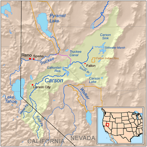
Hope Valley is found on the eastern slopes of the Sierra Nevada mountains. The top part of the valley starts about 4 miles northeast of Carson Pass. This is where Red Lake Creek flows into the West Fork of the Carson River.
From there, the valley follows the river north for several miles. Then, it makes a big turn to the east. About a mile and a half after this turn, the wide valley suddenly becomes very narrow. The river then flows through a deep, V-shaped canyon towards the deserts of Nevada.
How High is Hope Valley?
The valley floor is about 7,160 feet high at its upper end. It drops to about 7,000 feet where it narrows into Woodfords Canyon. Tall mountains surround the valley on all sides. Some of these peaks are over 10,000 feet tall! This means the valley has more than 3,000 feet of height difference from its lowest to highest points.
The tallest mountains around Hope Valley include Freel Peak (10,881 feet), Job's Sister (10,823 feet), and Job's Peak (10,633 feet). These three are on the same ridge to the northeast. Other peaks watching over the valley are Hawkins Peak (10,024 feet) and Pickett Peak (9,118 feet) to the southeast. Red Lake Peak (10,063 feet) and Stevens Peak (10,059 feet) are to the southwest, near Carson Pass. Waterhouse Peak (9,497 feet) and Thompson Peak (9,340 feet) are on either side of Luther Pass to the northwest.
Getting Around Hope Valley
Hope Valley is easy to reach by road. California State Route 88 runs through the valley from southwest to northeast. This highway goes over Carson Pass to the west and down Woodfords Canyon to the Carson Valley in the east.
State Route 89 also enters the valley from Luther Pass in the north. It meets SR 88 at a place called Pickett's Junction. Snowplows usually keep both highways open all year. They only close if there's a really big snowstorm.
Hope Valley's Past: A Look Back in Time
The Washoe People's Journey
Long ago, the Northern Washoe people lived in Hope Valley. Their main home was around Lake Tahoe, and their lands stretched into the mountains and deserts nearby. Every winter, a group of Northern Washoes would travel through the valley on snowshoes. They called their trail Pewećeli Yeweš.
They would cross the Sierra Nevada mountains to the west. There, they would catch salmon from the American River. After smoking the salmon to keep it fresh, they would travel back east. They brought the salmon to their people who were spending the winter in the desert east of Hope Valley.
How Hope Valley Got Its Name
In the summer of 1848, a group of soldiers from a Mormon Battalion gave the valley its English name. These Mormons were returning to Utah after fighting in the Mexican–American War. They were feeling sad because three of their men had died about a month earlier at Tragedy Spring.
But when they saw the valley, their spirits lifted. They felt a new sense of "hope." So, they named the valley "Hope Valley." Henry W. Bigler, one of the soldiers, wrote that they "campt [sic] at the head of what we called Hope Valley as we began to have hope." Later, in 1855, other valleys to the south were named "Faith Valley" and "Charity Valley." These names also came from Christian ideas of hope, faith, and charity.
A Key Route for Pioneers
During California's California Gold Rush, Hope Valley was a super important route across the Sierra Nevada. It was part of the first California Trail route through the eastern Sierras. The famous Pony Express also used this route. Even the legendary mail carrier Snowshoe Thompson traveled through Hope Valley.
In the early 1900s, there was an idea to build a reservoir by damming the valley. However, this plan was never carried out.
Protecting Hope Valley's Nature
Hope Valley is mostly part of the Carson Ranger District of Humboldt–Toiyabe National Forest. This means most of the valley is protected national forest land. Only a few small private areas are not part of it. The valley also touches Eldorado National Forest at Carson Pass. It also borders the Lake Tahoe Basin Management Unit, which is a special part of the U.S. Forest Service, at Luther Pass.
In 1989, the California Department of Fish and Wildlife set aside 2,900 acres of the valley floor. This area is now called the Hope Valley Wildlife Area. It helps protect the plants and animals that live there.
 | Aurelia Browder |
 | Nannie Helen Burroughs |
 | Michelle Alexander |


