Housay facts for kids
| Norse name | Húsey |
|---|---|
| Meaning of name | House Island |
| OS grid reference | HU680717 |
| Coordinates | 60°25′26″N 0°45′50″W / 60.424°N 0.764°W |
| Physical geography | |
| Island group | Shetland |
| Area | 163 hectares (0.63 sq mi) |
| Area rank | 119 |
| Highest elevation | 53 metres (174 ft) |
| Administration | |
| Sovereign state | United Kingdom |
| Country | Scotland |
| Council area | Shetland Islands |
| Demographics | |
| Population | 50 |
| Population density | 23 people/km2 |
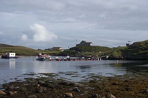
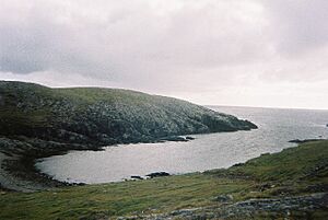
Housay (Scots: Housay), also known as West Isle, is one of the three islands that form the Out Skerries island group. This group is the most easterly part of the Shetland Isles in Scotland. Housay is a small island with a unique history and interesting natural features.
Contents
Exploring Housay's Landscape

Housay has the most varied types of rocks among the Out Skerries. You can find granite in the southwest area called Mio Ness. There is also limestone along the south coast. The island also has a lot of gneiss and schist, which are types of metamorphic rocks.
Island Shape and Features
The island of Housay has several thin pieces of land that stick out, called headlands. The longest one points to the southwest and is over 1.6 kilometers (1 mile) long. Another headland stretches north, then turns southwest, running next to the biggest one. These two headlands are separated by a bay called West Voe.
The island is surrounded by many tall, thin rock formations called stacks. These include the Hevda Stacks in the north. In the south, you can see the Stack a Mooth and Stack a Pillar. There are also some sea caves along the south coast. Da Steig is a collapsed sea cave that now connects the island to Mio Ness.
Housay is separated from the nearby island of Bruray by two narrow channels. These channels are known as North Mouth and South Mouth.
Water and Resources
Sometimes, Housay faces challenges with water supply. There isn't much peat (a type of fuel made from decayed plants) on the Out Skerries. Because of this, the people living on Housay have special permission to collect peat from the island of Whalsay.
Housay Through Time
The many old Norse names for places on Housay suggest that people have lived here for a very long time. They might have settled here during the Viking Age or even earlier.
Population Changes
The number of people living on Housay reached its highest point in 1891, with almost ninety residents. Today, the population is about half that. In 1991, 45 people lived on the island. By 2001, the population had grown slightly to 50 people.
Island Ownership
In 2010, the islands of Housay and Bruray were put up for sale. The main parts of these islands are held under a special type of land ownership called crofting tenure. The local crofting community was given the chance to buy the property, but they decided not to.
Island Connections and Services
Housay is an important hub for the Out Skerries community. It is home to the post office, which helps people send and receive mail. The island also has one of the two shops in the Skerries, where residents can buy supplies. The local church and the public hall are also located here.
The Skerries Bridge
A special bridge, called the Skerries Bridge, was built in 1957. This bridge created a permanent link between Housay and its neighboring island, Bruray. It makes it easier for people to travel between the two islands.
 | Frances Mary Albrier |
 | Whitney Young |
 | Muhammad Ali |


