Huamachuco facts for kids
Quick facts for kids
Huamachuco
|
|||
|---|---|---|---|
|
Town
|
|||
 |
|||
|
|||
| Country | |||
| Region | La Libertad | ||
| Province | Sánchez Carrión | ||
| District | Huamachuco | ||
| Elevation | 3,169 m (10,397 ft) | ||
| Population | |||
| • Estimate
(2015)
|
39,806 | ||
| Time zone | UTC-5 (PET) | ||
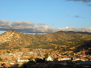
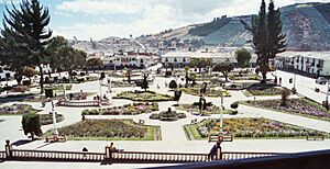
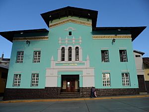
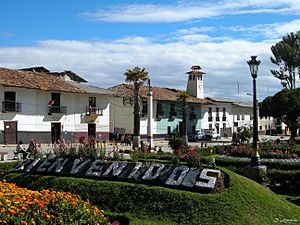
Huamachuco is a town in northern Peru. It is the capital of the Sánchez Carrión Province in the La Libertad Region. The town is also the main center for the Territorial Prelature of Huamachuco, which is a type of church district. Nearby, to the northeast, is Lake Sausacocha.
About 30 miles from Huamachuco is an important old site called Marcahuamachuco. This place has many ancient buildings. It was a major political and religious center for a culture that lived there between 350 CE and 1100 CE. The ruins of an old city from the Wari Empire, called Viracochapampa, are also very close, about 3.5 km north of Huamachuco. There are many other old ruins from before the time of Columbus around the town.
Huamachuco's History
The area around Huamachuco has been home to ancient Andean civilizations for a very long time. Before the Inca Empire grew powerful, this area was part of a single group called the "Señorio de Huamachuco." People there spoke the Kulyi language. Their main god was Catequil, a thunder god.
Catequil was a very important oracle, a place where people went to get answers or advice. His special shrine was in the middle of the Huamachuco territory. Archaeologists believe the mountain Cerro Icchal was Catequil's home. The ruins of Namanchugo, Catequil's main temple, are at the foot of Cerro Icchal.
Even though Atawallpa (an Inca ruler) and later Spanish priests destroyed much of it, old writings tell us how grand and important Catequil's shrine was. Catequil was famous across the northern Peruvian highlands. People traveled from far away to visit his shrine, which brought a lot of money to the Huamachucos. This wealth might be why the area around Huamachuco did not suffer as much as other parts of Peru when many people died after the Wari state fell. In fact, the population here seemed to keep growing.
Scientists have divided the history of human settlements in the Huamachuco area into 8 periods:
- Colpa phase (before 900 BC)
- Sausagocha phase (900 - 200 BC)
- Purpucala phase (200 BC - AD 300)
- Early-Huamachuco phase (AD 300 - 600)
- Amaru phase (AD 600 - 800?)
- Late-Huamachuco phase (AD 800? - 1000)
- Tuscan phase (AD 1000 - 1470)
- Santa Bárbara phase (AD 1470 - 1532)
The Tuscan phase was when the Huamachuco kingdom was independent. The Santa Barbara phase was when the Inca took control of Huamachuco. The capital of the Huamachuco kingdom was probably at Marcahuamachuco. Evidence shows people lived at Marcahuamachuco from the Early-Huamachuco phase until the Tuscan phase. After the Inca conquered the area, the people from Marcahuamachuco likely moved to where the modern town of Huamachuco is today.
The Inca built the town of Huamachuco as their main center in the area. It became the capital of an Inca province, also called Huamachuco. The Inca town did not seem to be built on top of an older settlement. However, the old hill fort of Cerro Tuscán, which overlooks the town, was made stronger to protect the Inca settlement.
The Inca also brought groups of settlers called mitmaqkuna to the area. They built many rest stops called tambos along their roads. This has been confirmed by archaeological findings. The Inca center of Huamachuco was a stop on the main Inca highway, the "Qhapaq Ñan" or "Royal Road," which went from Cusco to Quito. The Inca also built at least 215 storage buildings, called colca, on the hills around the town. Many of these had raised floors or special canals to keep food, like potatoes, fresh.
Spanish missionaries from the Augustinians founded the modern town of Huamachuco in 1553. They built it on top of the Inca town. During the Peruvian War of Independence, General José de San Martín called Huamachuco a "very illustrious and faithful city." Later, during the War of the Pacific, a big battle happened here on July 10, 1883. This was the Battle of Huamachuco, the last major fight of that war. Peruvian troops led by Andrés Avelino Cáceres were defeated by Chilean troops.
What Huamachuco Means
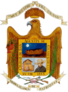
It is not fully clear where the name "Huamachuco" comes from. It might be from the Kulyi language, which was spoken in the area, or from Quechua, a language that became important during the Inca Empire. Most experts think the name is a mix of both languages. It likely means "land of falcons" or "country of falcons."
The name "Huamachuco" can be split into "huama" and "chuco." "Huama" probably comes from the Quechua word waman, meaning falcon, because it does not have a known meaning in Kulyi. "Chuco" is likely from Kulyi, meaning earth, land, region, or country. This word is often seen in place names in the region. Some people thought "chuco" might mean helmet in Quechua, making the name "falcon hat," but modern language experts say this is not correct.
Huamachuco's Geography
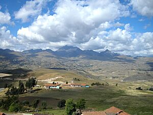
Huamachuco is located in the Andes Mountains. It sits between the eastern and western mountain ranges. It is about 100 km south of Cajamarca.
The area has high lands that are between 2,500 and 4,500 meters (about 8,200 to 14,760 feet) above sea level. Because it is so high, most of Huamachuco's land does not have trees. This high-altitude grassland is known as puna. The puna grasslands were perfect places for deer and wild camelids (like llamas and alpacas). They also supported domesticated camelids, such as alpacas and llamas, which are important animals for the people living there.
The deep valleys around Huamachuco show signs that people used to farm native Andean trees and shrubs there. It seems that in ancient times, the weather was a bit warmer than it is today. This allowed farming to happen at elevations 100–300 meters (about 330–980 feet) higher than is possible now.
Climate
Huamachuco has a subtropical highland climate. This means it has cool temperatures all year round. Huamachuco also has a dry season from June to August.
| Climate data for Huamachuco, elevation 3,186 m (10,453 ft), (1991–2020) | |||||||||||||
|---|---|---|---|---|---|---|---|---|---|---|---|---|---|
| Month | Jan | Feb | Mar | Apr | May | Jun | Jul | Aug | Sep | Oct | Nov | Dec | Year |
| Mean daily maximum °C (°F) | 18.3 (64.9) |
18.0 (64.4) |
17.6 (63.7) |
18.3 (64.9) |
18.7 (65.7) |
18.6 (65.5) |
18.7 (65.7) |
19.2 (66.6) |
19.5 (67.1) |
19.1 (66.4) |
19.0 (66.2) |
18.4 (65.1) |
18.6 (65.5) |
| Mean daily minimum °C (°F) | 7.6 (45.7) |
8.0 (46.4) |
8.0 (46.4) |
7.6 (45.7) |
6.8 (44.2) |
5.8 (42.4) |
5.4 (41.7) |
5.7 (42.3) |
6.8 (44.2) |
7.1 (44.8) |
6.5 (43.7) |
7.3 (45.1) |
6.9 (44.4) |
| Average precipitation mm (inches) | 118.2 (4.65) |
145.0 (5.71) |
176.4 (6.94) |
97.1 (3.82) |
50.3 (1.98) |
16.6 (0.65) |
10.0 (0.39) |
11.5 (0.45) |
38.8 (1.53) |
102.9 (4.05) |
96.4 (3.80) |
135.6 (5.34) |
998.8 (39.31) |
| Source: National Meteorology and Hydrology Service of Peru | |||||||||||||
See also
 In Spanish: Huamachuco para niños
 | Isaac Myers |
 | D. Hamilton Jackson |
 | A. Philip Randolph |


