Hundred of Blackheath, Kent facts for kids
| Blackheath | |
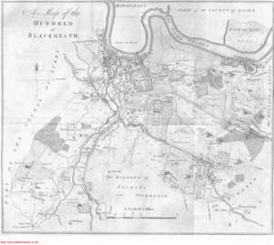
 Map of the Hundred of Blackheath, published in 1797 |
|
| Geography | |
| Status | hundred |
| 1831 area | 12,650 acres (51 km2) |
| 1887 area | 17,316 acres (70 km2) |
| HQ | Blackheath |
| History | |
| Created | in antiquity |
| Abolished | 1889 |
| Succeeded by | various, see text |
Quick facts for kids Demography |
|
|---|---|
| 1851 population | 121,753 |
| 1887 population | 234,987 |
Blackheath was an old "hundred" in the north-west part of Kent, England. A hundred was a type of local area used for government and law in England for many centuries. By the early 1900s, this system was no longer used.
Today, the name "Blackheath" refers to a specific area in south-east London. Most of the land that was once the Blackheath hundred is now part of the Royal Borough of Greenwich.
Contents
What was the Blackheath Hundred?
The name "Blackheath" first appeared in records in 1166. It meant "dark-coloured heathland," which describes an open, uncultivated area. The open space we know as Blackheath was where important meetings for the hundred took place.
In the Domesday Book of 1086, this area was called the hundred of "Grenviz" (Greenwich). It was part of a larger region called the "lathe" of Sutton at Hone.
Parishes in the Hundred
The Blackheath hundred included several smaller areas called parishes. These were:
- Charlton
- Chislehurst
- St Paul and St Nicholas Deptford
- Eltham
- Greenwich
- Kidbrooke
- Lee
- Lewisham
- Woolwich
- Mottingham
Where was Blackheath Located?
The northern edge of the Blackheath hundred was mostly the River Thames. Across the river was the Becontree hundred in Essex. A small part of Woolwich parish was actually north of the river, covering about 1.6 square kilometers.
To the north-west, Blackheath also touched the Isle of Dogs and the Tower division of the Ossulstone hundred in Middlesex. To the west, it bordered the Brixton hundred in Surrey.
Within Kent, Blackheath was next to the hundreds of Bromley and Beckenham to the south, Ruxley to the south-east, and Lesnes to the east.
How Big was Blackheath?
In 1831, the Blackheath hundred covered about 51.2 square kilometers. By 1887, its area had grown to about 70.1 square kilometers.
The population also grew a lot. In 1851, about 121,753 people lived there. By 1887, the population had increased to 234,987 people.
How the Hundred System Changed
Over time, the old hundred system became less important. New groups and councils took over many of the jobs that hundreds used to do.
In 1855, most of the Blackheath hundred became part of the Metropolitan Board of Works. This board was in charge of public works in London. The areas of Chislehurst and Mottingham were not included in this change.
By 1889, the hundred system was no longer used. Most of the Blackheath area (except Chislehurst and Mottingham) became part of the new County of London. Since 1965, the entire area has been part of Greater London.
Modern Local Government
In 1894 and 1900, new local government areas called districts replaced the old systems. These districts were later combined and, in 1965, were replaced by the London boroughs we have today.
Here's how the old parishes of Blackheath hundred fit into today's London boroughs:
| Parish | District (around 1900) | Today's London Borough |
|---|---|---|
| Charlton | Metropolitan Borough of Greenwich | Greenwich |
| Chislehurst | Bromley Rural District | Bromley |
| Deptford St Nicholas | Metropolitan Borough of Greenwich | Greenwich |
| Deptford St Paul | Metropolitan Borough of Deptford | Lewisham |
| Eltham | Metropolitan Borough of Woolwich | Greenwich |
| Greenwich | Metropolitan Borough of Greenwich | Greenwich |
| Kidbrooke | Metropolitan Borough of Greenwich | Greenwich |
| Lee | Metropolitan Borough of Lewisham | Lewisham |
| Lewisham | Metropolitan Borough of Lewisham | Lewisham |
| Mottingham | Bromley Rural District | Bromley |
| Woolwich | Metropolitan Borough of Woolwich | Greenwich |
 | William Lucy |
 | Charles Hayes |
 | Cleveland Robinson |

