
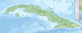
Image: Cuba physical map

Size of this PNG preview of this SVG file: 800 × 323 pixels. Other resolution: 320 × 129 pixels.
Original image (SVG file, nominally 851 × 344 pixels, file size: 592 KB)
Description: Cuba physical map, parameters equal to File:Cuba location map.svg
Title: Cuba physical map
Credit: Own work
Author: Urutseg
Usage Terms: Creative Commons Zero, Public Domain Dedication
License: CC0
License Link: http://creativecommons.org/publicdomain/zero/1.0/deed.en
Attribution Required?: No
Image usage
The following 38 pages link to this image:
- Bay of Buena Vista
- Bay of Cárdenas
- Bay of Pigs
- Bay of Santa Clara
- Canarreos Archipelago
- Cauto River
- Cayo Coco
- Cayo Guajaba
- Cayo Guillermo
- Cayo Largo del Sur
- Cayo Romano
- Cayo Sabinal
- Cayo Saetía
- Cienfuegos Bay
- Colorados Archipelago
- Escambray Mountains
- Guanabo
- Guaniguanico
- Guayos
- Gulf of Batabanó
- Gulf of Guacanayabo
- Jardines del Rey
- Jatibonico del Sur River
- Mantua River
- Mogotes de Jumagua
- Nipe-Sagua-Baracoa
- Omaja
- Pan de Guajaibón
- Pico San Juan
- Pico Turquino
- Río de la Palma
- Sabana-Camagüey Archipelago
- San Pedro River (Cuba)
- Santa Fe, Isle of Youth
- Santiago de las Vegas
- Sierra Maestra
- Sierra de los Órganos
- Windward Passage

All content from Kiddle encyclopedia articles (including the article images and facts) can be freely used under Attribution-ShareAlike license, unless stated otherwise.