
Image: Location map Southern San Diego

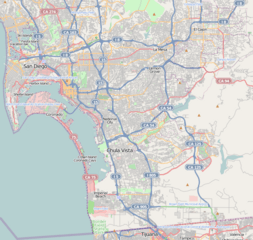
Description: This map of Southern San Diego was created from OpenStreetMap project data, collected by the community. This map may be incomplete, and may contain errors. Don't rely solely on it for navigation.
Title: Location map Southern San Diego
Credit: openstreetmap.org
Author: OpenStreetMap contributors
Permission: OpenStreetMap data and maps are licensed under the Creative Commons Attribution-ShareAlike 2.0 license (CC-BY-SA 2.0). This file is licensed under the Creative Commons Attribution-Share Alike 2.0 Generic license. You are free: to share – to copy, distribute and transmit the work to remix – to adapt the work Under the following conditions: attribution – You must give appropriate credit, provide a link to the license, and indicate if changes were made. You may do so in any reasonable manner, but not in any way that suggests the licensor endorses you or your use. share alike – If you remix, transform, or build upon the material, you must distribute your contributions under the same or compatible license as the original. https://creativecommons.org/licenses/by-sa/2.0 CC BY-SA 2.0 Creative Commons Attribution-Share Alike 2.0 truetrue
Usage Terms: Creative Commons Attribution-Share Alike 2.0
License: CC BY-SA 2.0
License Link: https://creativecommons.org/licenses/by-sa/2.0
Attribution Required?: Yes
Image usage
The following 21 pages link to this image:
- Allied Gardens, San Diego
- Alta Vista, San Diego
- Bay Terraces, San Diego
- Broadway Heights, San Diego
- College Area, San Diego
- Del Cerro, San Diego
- Encanto, San Diego
- Grant Hill, San Diego
- Grantville, San Diego
- Logan Heights, San Diego
- Mount Hope, San Diego
- National City, California
- Otay Mesa, San Diego
- Paradise Hills, San Diego
- Redwood Village, San Diego
- San Carlos, San Diego
- San Ysidro, San Diego
- Sherman Heights, San Diego
- Stockton, San Diego
- Tierrasanta, San Diego
- United States Custom House (San Ysidro, California)
